Muscat · Muttrah, Port Sultan Qaboos, Seeb airport and Madinat Al Irfan

Venue mapping in Muscat, from the Muttrah souq to the airport terminal

Spatial Map is browser-based indoor mapping software: it turns the floor plan of a building into a 3D map of every floor, with rooms, doors, lifts and stairs, and puts live data on top. Venue mapping in Muscat means mapping a strip of coast rather than one centre: an old harbour district at Muttrah that is being redeveloped, a cruise terminal that fills each winter, a very large airport terminal about 32 km away in Seeb, and a set of exhibition halls in between. Each is its own facility, and one workspace can hold all of them.

No credit card. Runs in the browser. Pro is $60/month for up to 4 facilities. Book a demo

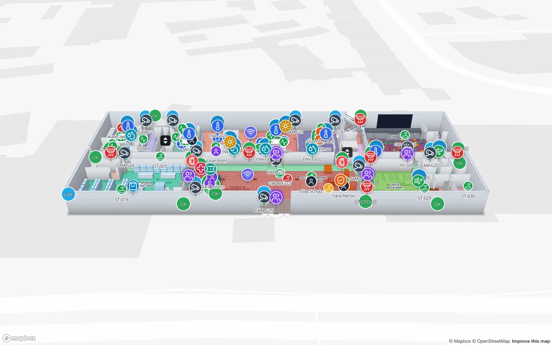
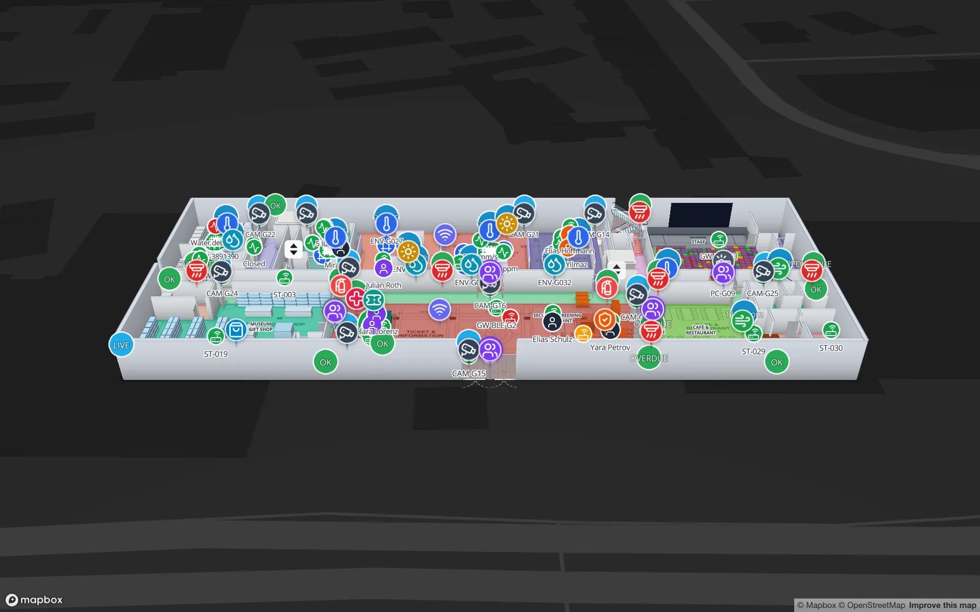
Silverbay International Airport — Terminal 2, a airport terminal demo, in the Spatial Map 3D viewer with live device markers
Silverbay International Airport — Terminal 2
Silverbay Airport, a two-floor demo terminal: check-in islands, security lanes, immigration, gates and baggage reclaim with live crowding.
Floors in the Silverbay terminal demo
2
Reports in the Lakeside convention demo
21
App languages, including Arabic with right-to-left layout
6
Free trial, up to 5 facilities, no card
7 days

Muttrah: a harbour district with a souq at its heart

Muttrah is one of the wilayats of Muscat Governorate and looks out on the Sea of Oman. Its natural harbour gave the area its name, its souq is described as one of the oldest markets in Oman, and above the harbour stands Muttrah Fort, which has six towers and was built under Portuguese rule after 1578. Buildings like these were not drawn on a CAD system. The plan you can get is a survey sheet, a scan of a ministry drawing or a photograph, and walls that are not square.

That is a normal starting point. Upload the scan or photo, align it at real size, and let AI Map draft walls, doors and areas for a person to correct; the post on digitising a paper floor plan shows the steps. Covered lanes of a souq can be drawn as corridors with each stall as an area, so a unit can carry its trader, its opening hours and its maintenance jobs. Spatial Map maps the buildings you give it. It is not a street map of Muttrah, and it makes no claim about the Corniche outside.


Port Sultan Qaboos: a waterfront being planned before it is built

The Ministry of Heritage and Tourism has signed an agreement with the state tourism developer for the Port Sultan Qaboos waterfront: about 1 million square metres in total, more than 400,000 of them developable, in three phases. The scheme names four districts: Port Souq for retail and leisure, Port Gateway with a hotel and public spaces, Al Shatifi with residential and hotel use and a promenade, and Al Shatifi Hills, a mountain resort.

For anyone who will operate one of those districts, the useful moment is early. Each building can be traced from its design drawings as it is issued, given its rooms and service areas, and replaced with a revised plan when the design changes. Operations teams then plan opening-day routes, signage and cleaning zones on the map before the first visitor arrives, and a read-only share link lets a contractor or tenant fit-out team see the floors and layers you choose, with an expiry date, without an account.

The cruise terminal: a building that fills and empties with the season

Port Sultan Qaboos is where cruise passengers reach Muscat. The cruise season generally runs from October to the end of April; in 2023 Oman’s three cruise ports, Muscat, Salalah and Khasab, received 321,012 tourists on 202 ship visits, and a tender to renovate the terminal building and its control tower closed in October 2024. A terminal like this can be quiet for days and then very full for a morning.

On a map, that is a crowding problem with a calendar. Passenger counters or a people-counting camera post rows to a table, the arrivals hall and the coach bays are tinted by how full they are, and a heatmap of the day’s readings shows where queues form on a busy ship call; see occupancy heatmaps on a floor plan. The Silverbay terminal demo shows the same idea on two floors. Spatial Map does not receive ship schedules or manifests; a table of expected calls from your own system can be shown as a layer.

Seeb: a terminal you map zone by zone

Muscat International Airport is in Seeb, about 32 km from the old city. Its terminal, opened in March 2018, covers 580,000 square metres with 118 check-in counters and 45 gates and was designed for up to 20 million passengers a year after the first phase. Nobody maps a building that size in one afternoon, and nobody needs to. A concession holder maps its units, a cargo agent its shed, a lounge operator its floor, an engineering team the plant rooms, each as a facility with the same coordinates so that they sit together in one workspace.

Routes between floors work inside each facility: Navigate builds a walking route through doors, stairs, lifts and escalators with Fastest, Step-free and other options, shown with the walking minutes. There is no blue dot; the visitor opens a link that starts at a known spot. Spatial Map is not connected to any airport’s flight, baggage or security systems.

Madinat Al Irfan: five halls that change every week

The Oman Convention and Exhibition Centre has five column-free exhibition halls with about 22,000 square metres between them, in the Madinat Al Irfan development about 4 km from the airport, plus a convention block with two ballrooms and a theatre. An exhibition hall is a building whose floor plan is different each week: partitions open and close, stands go up in a day and come down in another.

Keep the fixed things as one facility, the hall shells, foyers, lifts, loading doors and services, and draw each show’s stand blocks as areas you can switch off after the show. Exhibitor freight and badge scans go in tables, and the hall’s live occupancy is tinted on the plan, as in the Lakeside demo with its halls, booth blocks, registration and loading docks.

Services for teams in Muscat

Where Muscat teams usually start depends on the building:

Also served nearby

The same approach covers Ruwi, Al Khuwair, Qurum, Bawshar, Al Amerat and the buildings along the road to Seeb. Nothing needs to be installed in any of them: the map opens in a browser, in Arabic or English.

How Spatial Map does it

From a scanned drawing to a Muscat map people can use

  1. 01

    Pick one building

    A terminal, a hall block, a historic building or one wing of a waterfront scheme, whichever has visitors who get lost.

  2. 02

    Place the plan

    Upload the PDF, DWG (AutoCAD R2004–R2018, placed as a picture), photo or scan, align it at real size and let AI Map draft the walls for review.

  3. 03

    Name it in two languages

    Give units, halls, counters and gates Arabic and English names, and draw stairs, lifts and escalators so routes cross floors.

  4. 04

    Publish a link

    A read-only share link with Navigate behind a QR code at the entrance, with live crowding and bookings as layers for your own team.

What Muscat operators map

Cruise terminal arrivals

Arrivals hall and coach bays tinted by how full they are on each ship call.

Airport units and concessions

Each operator’s floor as a facility, with routes and crowding in one workspace.

Exhibition hall changeovers

Fixed hall shells with each show’s stands, freight and badge scans on top.

Heritage and museum buildings

Galleries with occupancy, climate and tagged objects, plus a visitor layer.

See it on real demo facilities

Fictional names, real floor plans, live sensors, RFID, BLE tags and gateways — open any of them in the browser.

All 13 demo facilities

Indoor mapping in Muscat — questions we get

Yes. Upload the scan or photo, align it at real size, and let AI Map draft walls and doors for a person to correct. Where nothing exists, sketch the outer walls and photograph the sketch. Thick or irregular walls are drawn as they are; the map does not need right angles.

A share page follows the visitor’s browser language, so Arabic phones get the right-to-left interface and English phones an English one. The names you give units and counters are your own text and can carry both languages. The app’s interface languages are English, Arabic, Chinese, French, German and Spanish, so other languages appear only in the names you type.

No. Spatial Map is not connected to port, airport or venue systems. It shows what you send it: your own people counters, bookings or schedules posted to a table through the write API (HTTPS, bearer key, bulk upsert, 60 requests per minute per key), polled from a REST endpoint, or uploaded as CSV or Excel.

Yes. Each operator’s area is its own facility with its own roles, and a read-only share link shows only the floors and layers you choose, with an expiry date, a view cap and the option to revoke it. Workspaces are isolated from one another.

No. Spatial Map does not position visitors. A visitor opens a link that starts at a known point, such as a QR code at a gate or a desk, and Navigate draws the route and walking minutes from there, between floors if needed.

No. Spatial Map is sold online and our team works with customers in Oman remotely, by video call and through the contact form, in Arabic or English. There are no local resellers or partners.

In US dollars, the same worldwide: a 7-day free trial for up to 5 facilities with no card, then Pro at $60 a month or $600 a year for up to 4 facilities. Larger estates are quoted as custom services.

Map one Muscat building before the next season.

Start the free trial and open the Silverbay and Lakeside demos, or send us the plan of a terminal, hall or historic building through the contact form.