Indoor mapping · Museums & galleries

A museum indoor map for galleries, collections and conditions

Spatial Map is a museum indoor map for the people who run the building: every gallery across every floor on a 3D map, with step-free routes between them, the location of exhibits and objects, temperature and humidity per room, and visitor counts as heatmaps. Visitors and partners see it through read-only share links.

Last updated:

No credit card. Runs in the browser. Pro is $60/month for up to 4 facilities. Book a demo

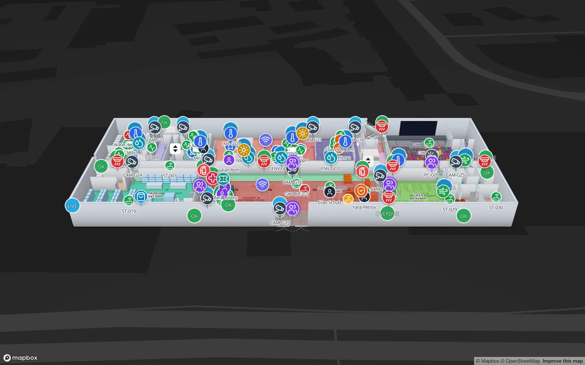
Production Museum, a three-floor museum demo, in the Spatial Map 3D viewer with live device markers
Production Museum
The Production Museum demo: galleries, exhibits and classrooms on three floors with visitor, climate, camera and staff markers.
Floors in the Production Museum demo
3
Reports in the Production Museum demo
19
Mapped assets and devices in the demo
187
Free trial, no credit card
7 days

Galleries across floors, with step-free routes

A museum is a sequence of rooms, usually on several levels, joined by stairs, lifts and the odd awkward ramp. In Spatial Map each gallery, classroom, shop, café and plant room is a named area on a scaled floor plan, and the stairs, lifts and doors between them are drawn as such. Floors stack in 3D, so a visitor-services team sees the whole building at once.

That structure drives wayfinding. The viewer’s Navigate button routes between two galleries on a floor or across floors, with Fastest, Step-free and Other route options, turn-by-turn steps and walking minutes. The step-free route keeps wheelchair users and pushchairs on the lifts, and tells staff how long the walk really takes. It suits a welcome-desk tablet, a gallery kiosk or a staff screen. A blue dot that follows a visitor around on their own phone is not built in; that would be a custom project. Read more on gallery wayfinding and in the wayfinding docs.

Production Museum, a three-floor museum demo, in the Spatial Map 3D viewer with live device markers
Production Museum
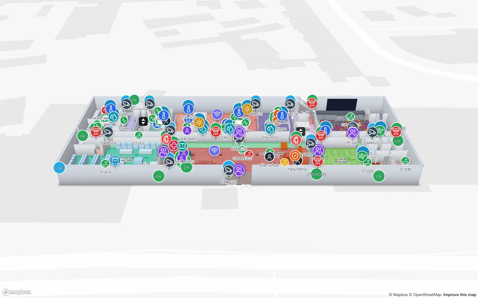
Production Museum (demo): galleries, exhibits and classrooms across three floors, with the routes between them.

Where is it? A museum collection location map

Collections move: from store to gallery, to the conservation studio, out on loan and back. A museum collection location map puts each object or exhibit at its current room, case or shelf, so curators, registrars and technicians stop hunting through spreadsheets. In the demo, an Artworks & Exhibits table places every piece on its floor, and RFID object tags show when a tagged piece moves between rooms.

Your collection management system stays the record of provenance, condition reports and loans. Spatial Map holds none of that. It receives the location rows your system or your readers send (through a table’s write API, REST polling or a CSV or Excel upload) and draws them in place, with a side drawer for the fields you choose. Colour by status — on display, in storage, on loan, in conservation — with style rules and the History player replays where a piece has been.

  • On display — exhibits as markers inside their gallery, with title, maker and case number in the drawer.
  • In storage — store rooms and racks shown as areas with the objects shelved in them.
  • Moving — RFID reads at doors and gallery thresholds record a tagged piece crossing from room to room.
  • Audit — the object list for a room exports to PDF or Excel for a gallery check.

Temperature and humidity, gallery by gallery

Light, temperature and relative humidity decide how long a collection lasts. Each environmental sensor is a marker inside the room it measures, coloured by the range you set: in band, drifting, out of band, silent. A curator sees the south gallery drifting before the gallery closes for the day, and a technician walks to the right room.

Readings come from your sensors or building-management gateway, written to a table or polled over REST. Alert rules run every 15 seconds on that table: “humidity above 60 percent for 30 minutes” or “sensor not updated for 15 minutes”, with a severity and a message that names the gallery. Alerts appear in the app (bell, pop-up and Alerts page) with Show on map, and clear when the room recovers. There is no email or SMS, so out-of-hours cover stays with your own process. The limits are yours; Spatial Map does not decide what a conservation standard requires, and the history is a readable trail rather than a certified record.

Visitor heatmaps and share links

Door counters, gallery sensors and ticket scans become rows per room and time. The heatmap layer weights those rows by their count, so the busy rooms glow and the quiet ones fade. Heat stops at walls and closed doors, and you read one floor at a time. Next to it, a Room Occupancy report and a Visitor Counters report give operations the figures behind the picture. Spatial Map does not count people itself; it draws what your counters send. See how occupancy heatmaps work.

For visitors and partners, a read-only share link opens the map in a phone browser with no account. Lock it to the ground floor, choose which layers are visible (the galleries and wayfinding without the staff markers), and set an expiry and a view cap. Loan partners and school groups can each have their own. Hide anything sensitive, like camera and security layers, before sharing.

Production Museum, a three-floor museum demo, in the Spatial Map 3D viewer with live device markers
Production Museum
Production Museum (demo): visitor, climate, camera and staff layers on the same galleries.

Museum questions and the layer that answers them

QuestionLayer on the mapData comes from
Which rooms are busiest now?Visitor heatmap and occupancy coloursDoor counters, ticket scans
Is each gallery within its range?Temperature and humidity markersEnvironmental sensors or building gateway
Where is object X today?Exhibit and storage markersCollection system export or table write
Did a tagged piece leave its room?RFID reader readsReaders at doors and thresholds
How does a visitor reach the lift?Navigate, Step-free routeDoors, stairs, lifts drawn on the plan
Where are guards and equipment?Staff and safety markersYour staff and equipment systems
How Spatial Map does it

A museum map in four steps

  1. 01

    Import the floor plans

    Upload a PDF or AutoCAD DWG per floor, set the drawing scale and pin it to the building’s location. How import works.

  2. 02

    Trace the galleries

    Draw galleries, stores, doors, stairs and lifts, and name each room as your systems do. AI Map can draft the first pass for review.

  3. 03

    Connect objects and sensors

    Tables for exhibits, climate and visitor counts are fed through the write API, REST polling or uploads, then drawn with data links.

  4. 04

    Share and navigate

    Staff open the viewer; visitors and partners get read-only links locked to a floor, with the Navigate button on.

Museum and gallery maps in the demo workspace

Gallery operations

Occupancy, visitor counters, climate sensors, cameras and staff on three floors.

Collection and object tracking

Artworks and exhibits with RFID object tags, placed by room.

Events and exhibition halls

Rooms and sessions live, crates tracked dock to booth.

See it on real demo facilities

Fictional names, real floor plans, live sensors, RFID, BLE tags and gateways — open any of them in the browser.

All 13 demo facilities

Museum indoor map — frequently asked questions

Not with a live blue dot. Spatial Map gives turn-by-turn routes between any two points, step-free if needed, from a share link, a kiosk or a staff tablet. A visitor app with positioning is a custom project.

No. Records of provenance, condition and loans stay there. Spatial Map shows where objects are, from the location rows your system or readers send, and has no write-back to other systems.

Fixed RFID readers at doors and thresholds write reads to a table, and the map shows the last room each tag was read in. Tag choice matters for metal frames, glass and wet materials; see RFID tags for metal, liquids and apparel.

Alert rules notify chosen roles or members in the app, with Show on map. There is no email, SMS or push, so keep your own on-call routine for nights and weekends.

Yes, through read-only share links with a floor lock, chosen layers, an expiry and a view cap. Leave security and staff layers out of public links.

Yes. Spatial Map reads DWG files (R2004 to R2018) itself and places them as a floor-plan picture at the right scale; PDFs work the same way. DXF is not read directly. AI Map reads the placed picture and drafts walls, rooms and doors for you to review, and you draw the rest on top. See CAD and PDF import.

A 7-day free trial covers up to 5 facilities with no credit card. Pro is $60 a month or $600 a year for up to 4 facilities. Done-for-you mapping and integrations are quoted as custom services.

Map your galleries for the people who care for them.

Start a free trial and open the Production Museum demo, or send us your floor plans and a sensor export and we will map the building for you.




