Sohar · Port, freezone, storage yards and the rail line

RFID tracking in Sohar, where one freezone holds many kinds of warehouse

Spatial Map puts RFID reads on a live 3D map of the building where they happen, so a tag at a dock door becomes a pallet in a lane, a carton in a container or a roll at a despatch bay. RFID tracking in Sohar is shaped by one fact: the port and freezone are a single place with nearly two thousand companies in it, so the warehouse next door may be a food store, a ceramics plant or a data hall. Each building can carry its own map, and your readers and middleware do the reading.

No credit card. Runs in the browser. Pro is $60/month for up to 4 facilities. Book a demo

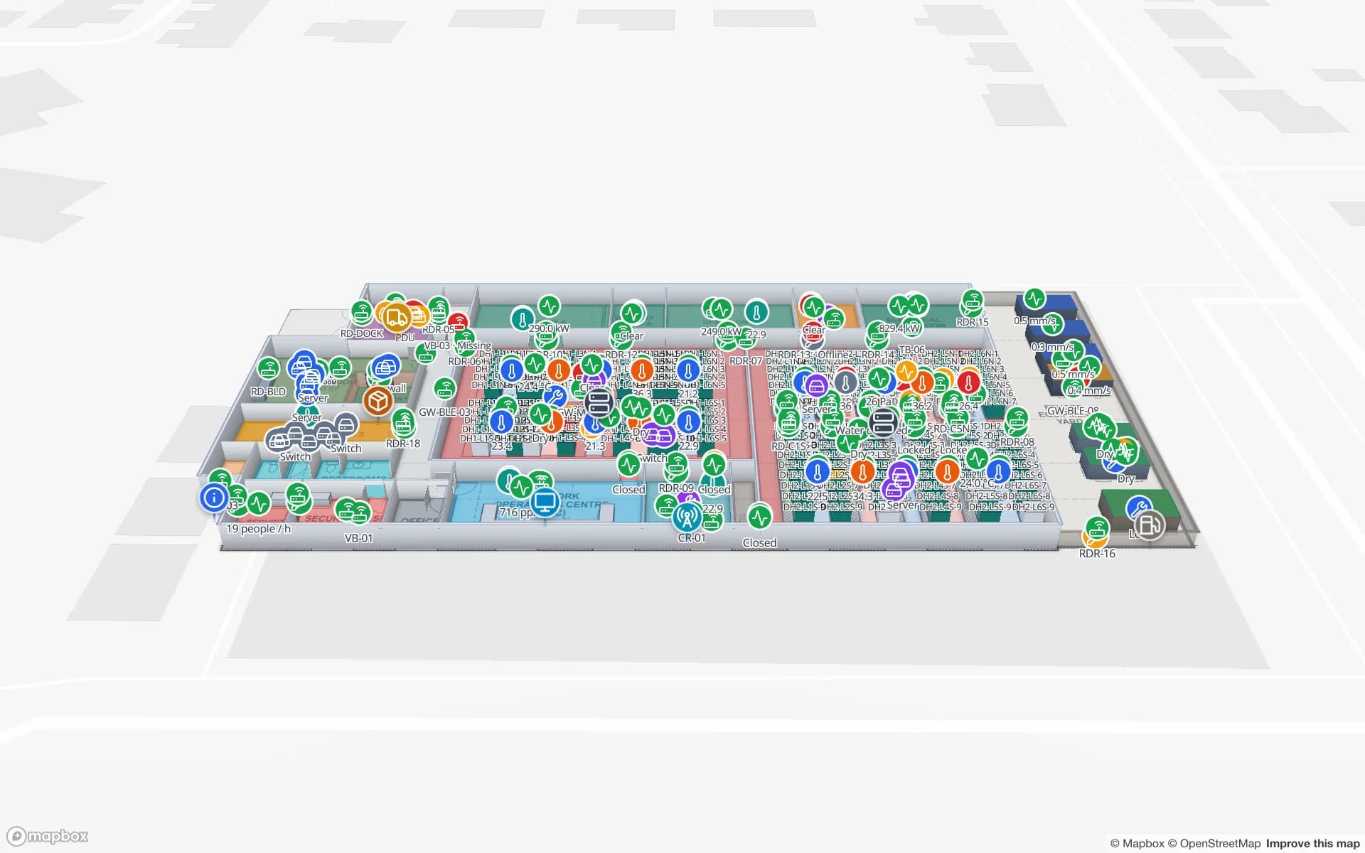
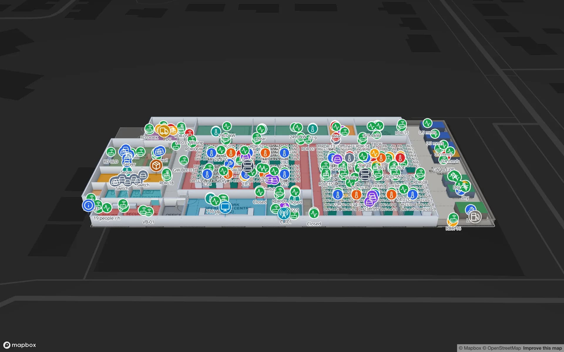
Eastport Cross-Dock Freight Hub, a cross-dock & trailer yard demo, in the Spatial Map 3D viewer with live device markers
Eastport Cross-Dock Freight Hub
Eastport Cross-Dock, a demo freight hub: 50 dock doors, 44 yard slots and 1,180 RFID pallets, with the gate and weighbridge.
Dock doors in the Eastport cross-dock demo
50
Yard slots in that demo
44
RFID pallets moving through Eastport
1,180
Free trial, up to 5 facilities, no card
7 days

A port town between Muscat and Dubai, with a zone of its own

Sohar sits on the Batinah coast, about 200 km north-west of Muscat and roughly the same distance from Dubai. The freezone beside the port lists metals, petrochemicals, food processing and logistics among its sectors. In 2026 the port and freezone were reported to be tied to 1,924 companies, accounting for 2.6 % of Oman’s GDP, so the zone is less one industry than a small town of tenants.

That mix is the reason to map building by building. A tenant who stores food needs lanes and cold rooms; one who packs gloves needs cartons by order; one who runs a data hall needs cabinets. The Oman page already walks through Sohar next to Duqm, Salalah and Khazaen; this page is only about what an RFID reader sees inside the Sohar gate.


The container freight station: one shed, many consignees

A 26,000 square metre container freight station and logistics complex is being built at the port. A freight station is where one container’s worth of goods for many consignees is unpacked, sorted and re-stuffed, and its question is always the same: which carton belongs to which consignee, and has it left? RFID tags on cartons or pallets, read at the dock doors and again at the stuffing lane, answer it, and the map shows each consignee’s cartons by lane rather than as a list.

The Eastport demo shows the pattern with 50 dock doors, 44 yard slots and 1,180 RFID pallets. How to place readers at a door is covered in the post on handheld readers, fixed readers and gates. Spatial Map does not connect to port community, customs or terminal systems; it shows what your own reads say.

Storage on 27 more hectares: yards, crates and what RFID cannot see

A storage company at the port is adding 27 hectares. Large open yards hold project cargo, steel and other loads where a tag sits on the crate, the bundle or the pallet, not the thing itself, and where a yard slot is a patch of ground rather than a rack. Draw each slot or bay as an area, name it as your yard system does, and post the pallet’s last read there.

Be straight about the limits. RFID tags do not suit every surface, and metal and wet loads need on-metal tags and a test; see tags for metal, liquids and apparel. Bulk heaps are counted by a weighbridge or survey, and those results can be rows in a table that colours the area. Readers and tags are a decision for your hardware vendor and integrator; Spatial Map only receives the reads.

A zone of mixed tenants: gloves, ceramics, a data hall, pharmaceutical materials

Recent announcements at the freezone include a glove-packing plant on 5,000 square metres, a ceramics expansion of about 15,000 square metres on top of an existing 20,000, a cloud data centre on 25,000 and a plant for pharmaceutical starting materials. Each wants a different map from the same product. Cartons by order for the glove packer, pallets by kiln batch for the ceramics plant, cabinets and spares for the data hall as in the Ridgeline demo, and quarantine areas for the pharmaceutical materials as in the Polar Pharma demo. Spatial Map makes no compliance claim for any of them.

A freezone landlord, a logistics provider or a group with several tenants can hold each building as its own facility in one workspace, with roles to separate who sees which, and a read-only share link for a tenant’s own manager. About 6 million square metres have also been set aside for renewable energy projects, with green-hydrogen studies; as those sites are built, contractors’ stores can be mapped as they open and closed when they finish.

The rail line and what it changes inside the sheds

A 238 km railway is being built from Sohar through Al Buraimi and Al Ain to the UAE national rail network. Freight is a core purpose, and Oman’s transport minister has said trials are expected to begin in the fourth quarter of 2027. Nothing runs yet, so there is nothing to claim. What a rail link does change is inside the buildings: wagons arrive on a timetable rather than trucks at random, and a freight station or warehouse near the line needs an area for rail-side loading and a rule for how long a wagon’s goods may wait.

That can be drawn today as a siding area on the plan with a staging lane and a count rule that raises an in-app alert when goods in it are older than a limit. Spatial Map does not receive rail timetables or wagon data; those would arrive as rows your own system posts.

Services for teams in Sohar

Where Sohar teams usually begin:

  • Freight stations and forwarders start with inventory tracking at dock doors, because a misplaced carton costs a vessel cut-off.
  • Plants in the zone usually begin with asset tracking for pallets, crates and forklifts, then add stock by rack.
  • RTLS and UWB matters for big, busy yards where trucks and tractors must be located continuously; most buildings do not need it first.
  • If you have no readers or tags yet, our team can source RFID readers, antennas and tags on request, quoted per project, with warranty from the manufacturer: see hardware and demo kits on request.
  • Your own developers can use the table write API; where they cannot, our team builds Android RFID handheld apps, ERP and WMS integrations and other custom software as client projects. The product runs as cloud or on-premises.

Also served nearby

The same approach covers Liwa, Shinas, Saham and Al Khaburah along the Batinah coast, and Al Buraimi inland. Nothing needs to be installed at any of them: the map opens in a browser, in Arabic or English.

How Spatial Map does it

From the Sohar gate to the despatch door

  1. 01

    Pick one building

    A freight station shed, a tenant’s warehouse or a yard bay, wherever a misplaced load costs most.

  2. 02

    Map doors, lanes and slots

    Upload the plan or sketch, let AI Map draft the floor, and name read points the way your middleware names them.

  3. 03

    Connect reads and stock

    RFID middleware and your ERP post rows through the write API, a polled REST endpoint or CSV and Excel uploads.

  4. 04

    Add door and silence rules

    In-app alerts for goods staged too long, short loads before cut-off and readers that stopped reporting.

What Sohar teams track

Freight station cartons by consignee

Dock doors, stuffing lanes and cartons by consignee before cut-off.

Yard bays and project cargo

Pallets and crates by yard slot, with the last read kept in the row history.

Plant stores and raw materials

Raw-material and finished-goods racks next to the lines and docks.

Data-hall assets and spares

Cabinets, IT equipment and spares by hall.

See it on real demo facilities

Fictional names, real floor plans, live sensors, RFID, BLE tags and gateways — open any of them in the browser.

All 13 demo facilities

RFID tracking in Sohar — questions we get

No. It has no link to port community, customs or terminal systems. It shows what happens inside your own building or yard, from your own RFID reads, WMS or ERP, so it complements the port-level systems rather than replacing them.

Yes. Put the customer in a column of the table and colour or filter by it, then give each customer a read-only share link limited to the floors and layers you choose, with an expiry date and a view cap. Roles control who in your own team sees which facility.

Not by RFID. A tag goes on a crate, bundle or pallet. For bulk heaps, a weighbridge ticket or survey figure can be a row in a table that colours the yard area; the map shows the number, it does not measure it.

Only a new area on the plan. Draw the rail-side loading area and staging lane, and post wagon or consignment rows from your own system. Spatial Map does not receive rail timetables, and nothing here depends on the line opening.

Yes, with a full right-to-left layout, alongside English, Chinese, French, German and Spanish; each user picks their own. Names you give lanes, bays and racks are your own text and can be in Arabic or English.

No. Spatial Map is sold online and our team works with customers in Oman remotely, by video call and through the contact form. There are no local resellers or partners.

In US dollars, the same worldwide: a 7-day free trial for up to 5 facilities with no card, then Pro at $60 a month or $600 a year for up to 4 facilities. RFID hardware, if you ask us to source it, is quoted per project and is not part of the subscription.

Map one Sohar shed before the next vessel.

Start the free trial and open the Eastport demo, or send us the plan of a freight station, tenant warehouse or yard and a sample of your reads through the contact form.