
Indoor maps and digital twins, wired to every device in every facility.
Spatial Map is the indoor mapping platform for the teams who run buildings. Turn floor plans into 3D maps, then bind sensors, RFID, BLE tags and gateways to the rooms, racks and seats they belong to. Reports and read-only links follow — for stadiums, terminals, cold stores, plants and warehouses, in the browser.
Already have an account? Sign in
- 7-day free trial, no card
- PDF & DWG floor-plan import
- Live data without refresh
- Reports with PDF & Excel export
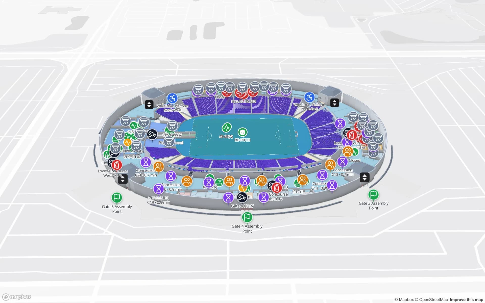
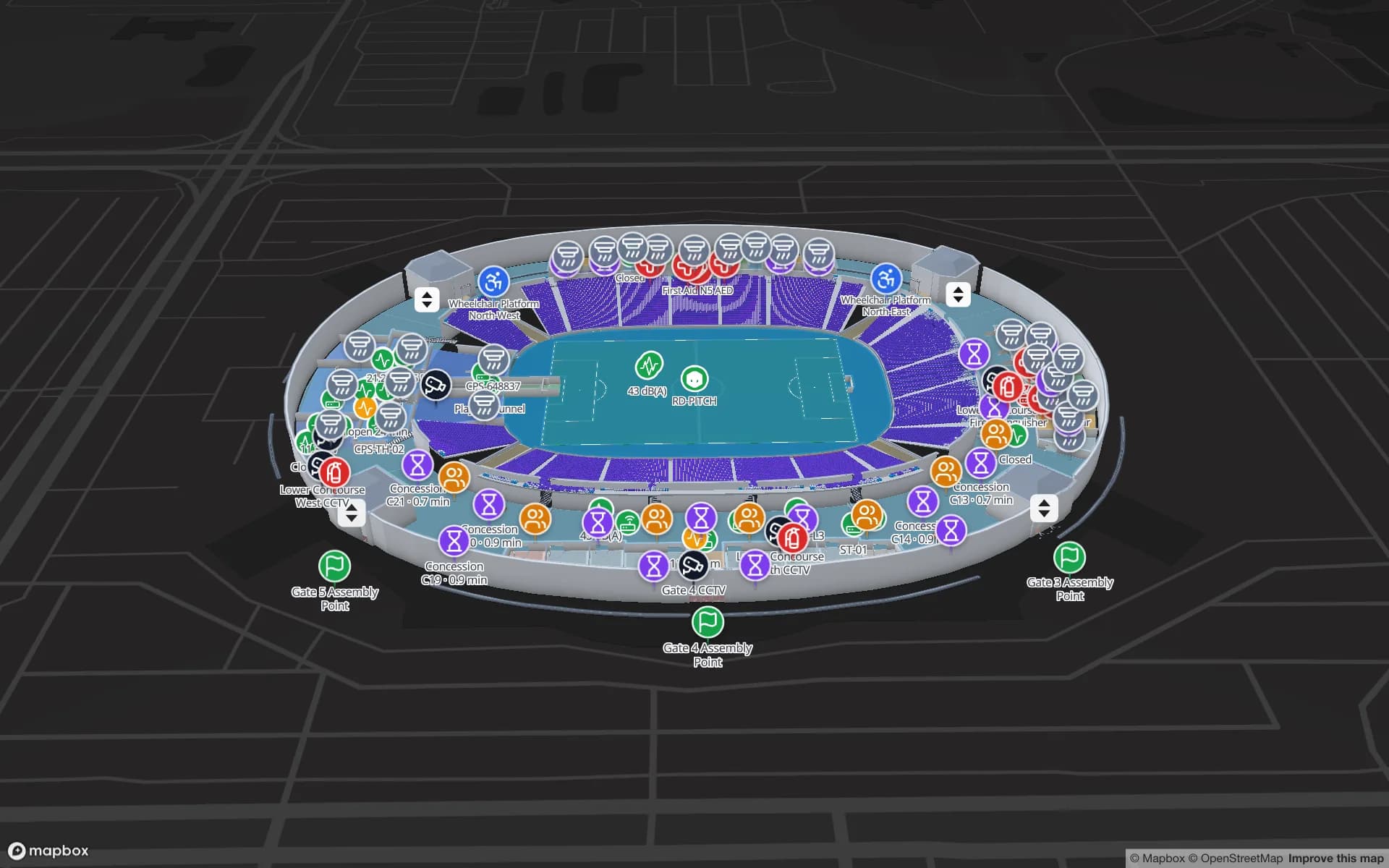
Stadium
A stadium with 30,000+ seats drawn as rack cells: gates and turnstiles, crowd flow, seating, match operations, F&B and hospitality suites.
- floors
- 2
- tables
- 26
- reports
- 21
- tracked assets
- 194
The whole platform in 1:34.
The 13 demo facilities, every device on one map, live playback reader by reader, reports and the seven solutions — one film, with music, made from the product's own 3D.
One platform, shaped to your industry.
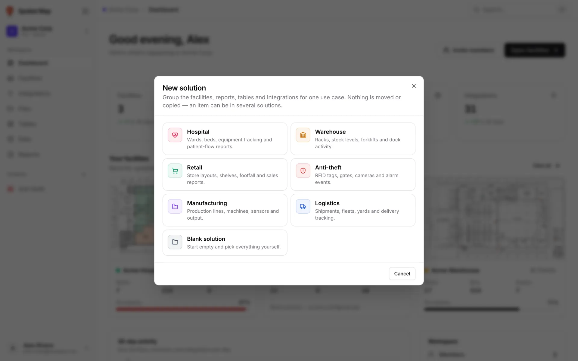
Every card below opens a solution and its one-minute film, made from the product's demo facilities. In the app, a Solution groups the facilities, reports and data for one use case — start from a template and you're organised on day one.
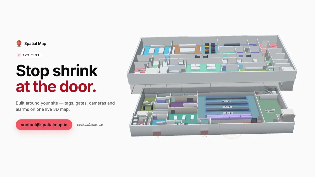 Film, 0:58
Anti-theft
See theft signals where they happen — RFID, access and cameras on one map.
Explore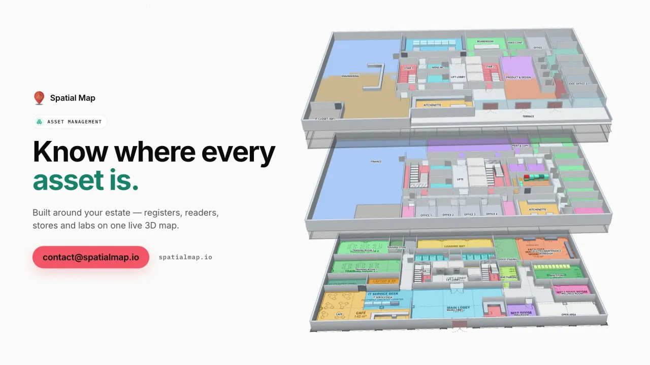 Film, 1:03
Asset Management
Every asset, where it is — tracked, checked out and maintained on one map.
Explore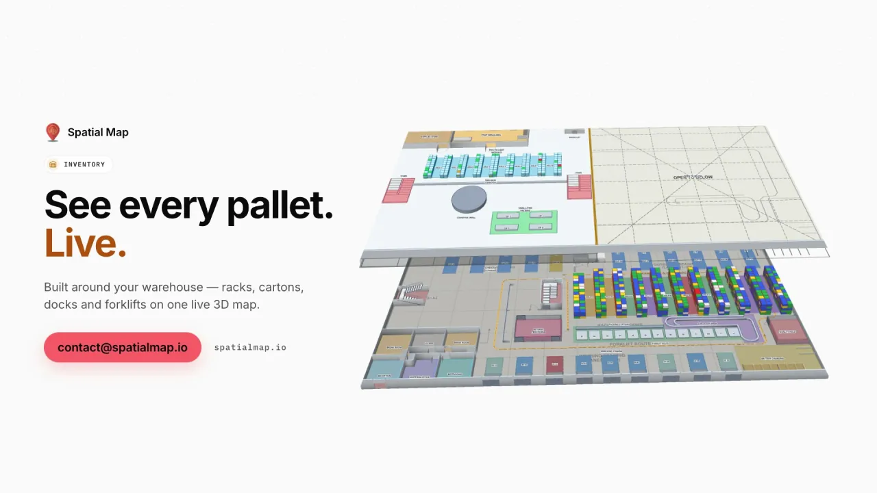 Film, 1:00
Inventory
The live 3D map of your stock — racks, bins, shelves and the people moving them.
Explore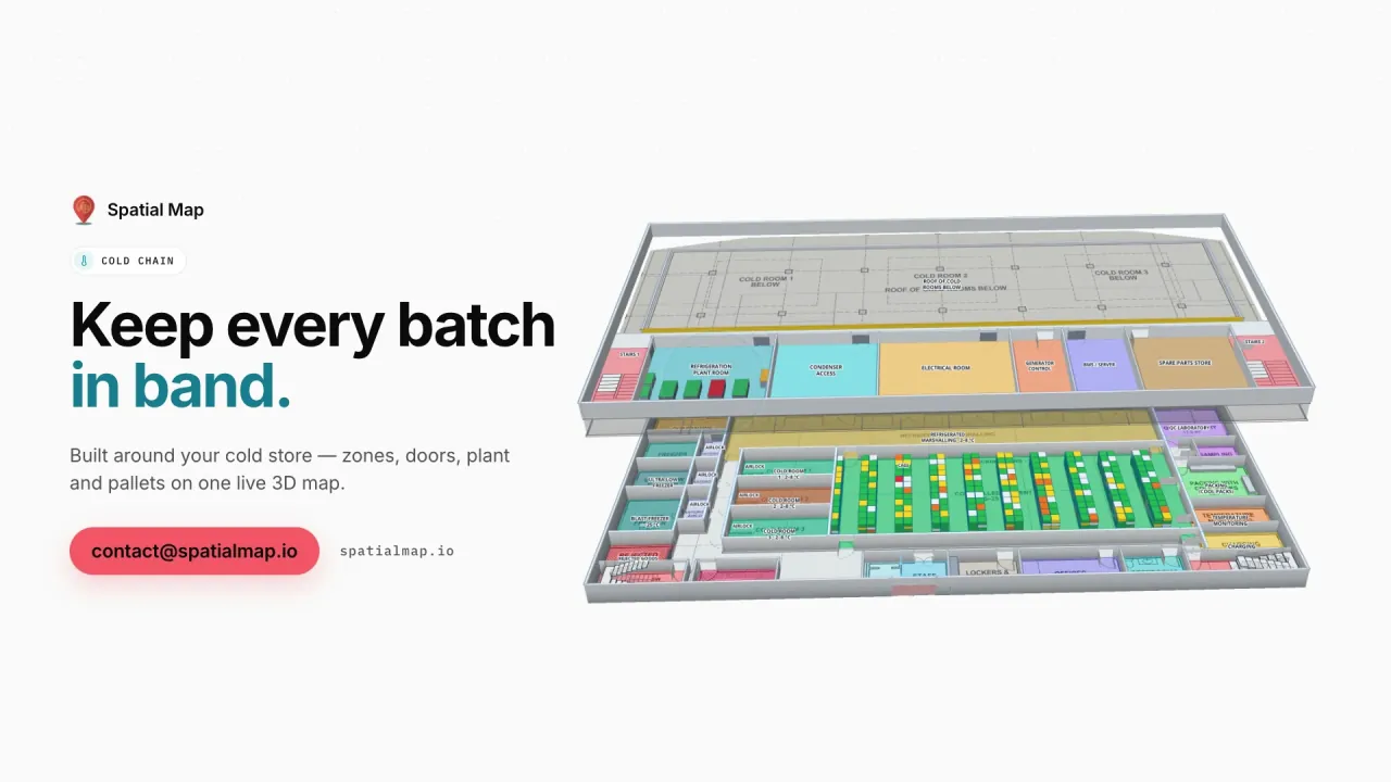 Film, 1:02
Cold Chain
Every cold room at a glance — temperatures, doors and excursions on one live map.
Explore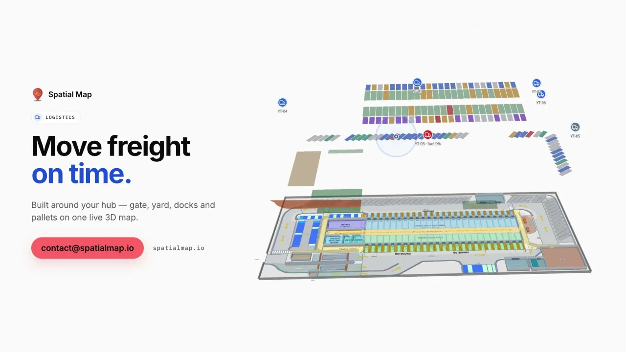 Film, 1:01
Logistics
Docks, yard and freight flow — your logistics site, live in 3D.
Explore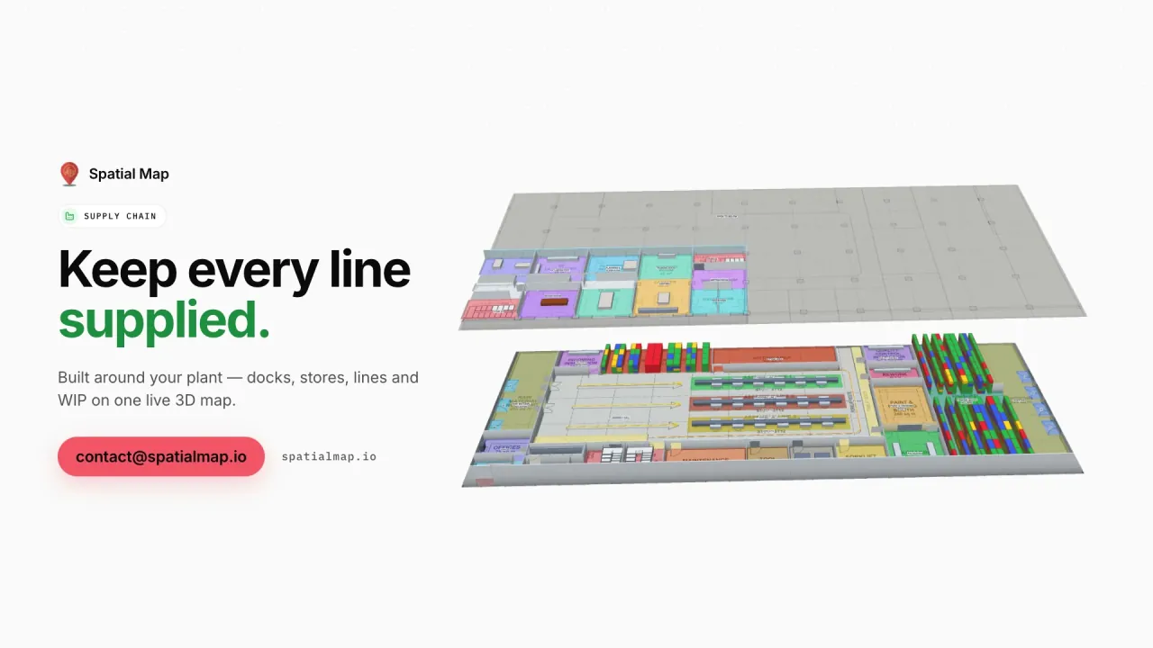 Film, 1:02
Supply Chain
From inbound materials to outbound shipments — your plant, live on one map.
Explore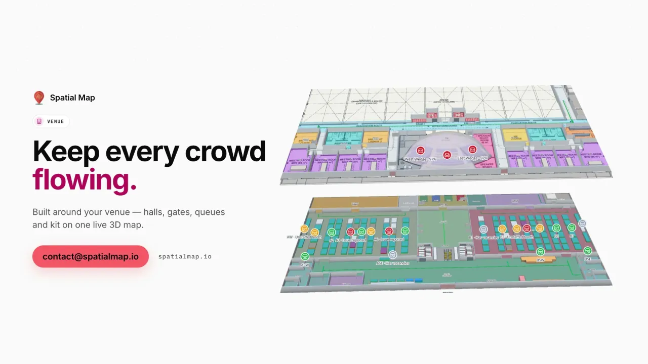 Film, 1:06
Venue
Crowds, queues and services — every level of your venue on one live map.
Explore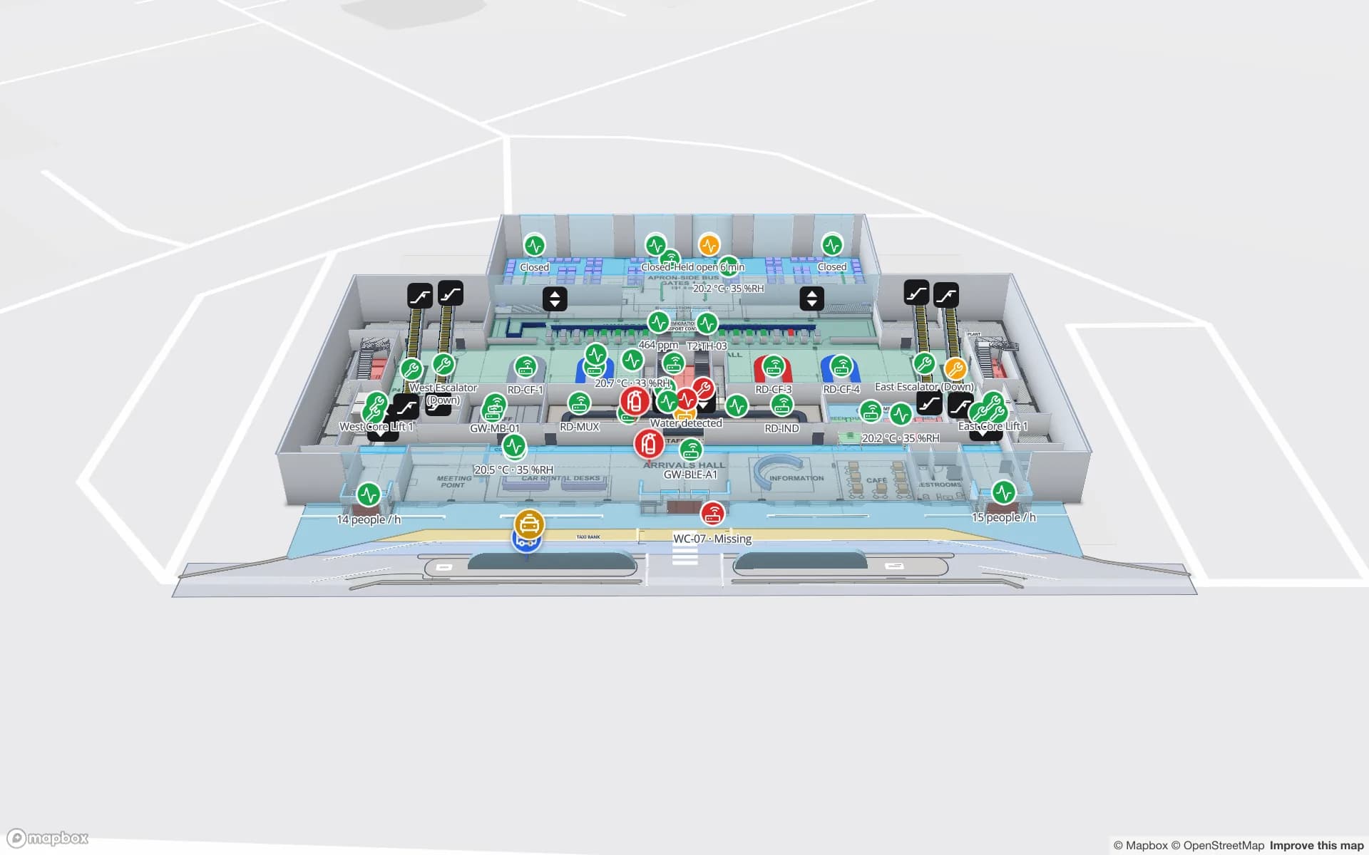
Showcase · 13 demo facilities
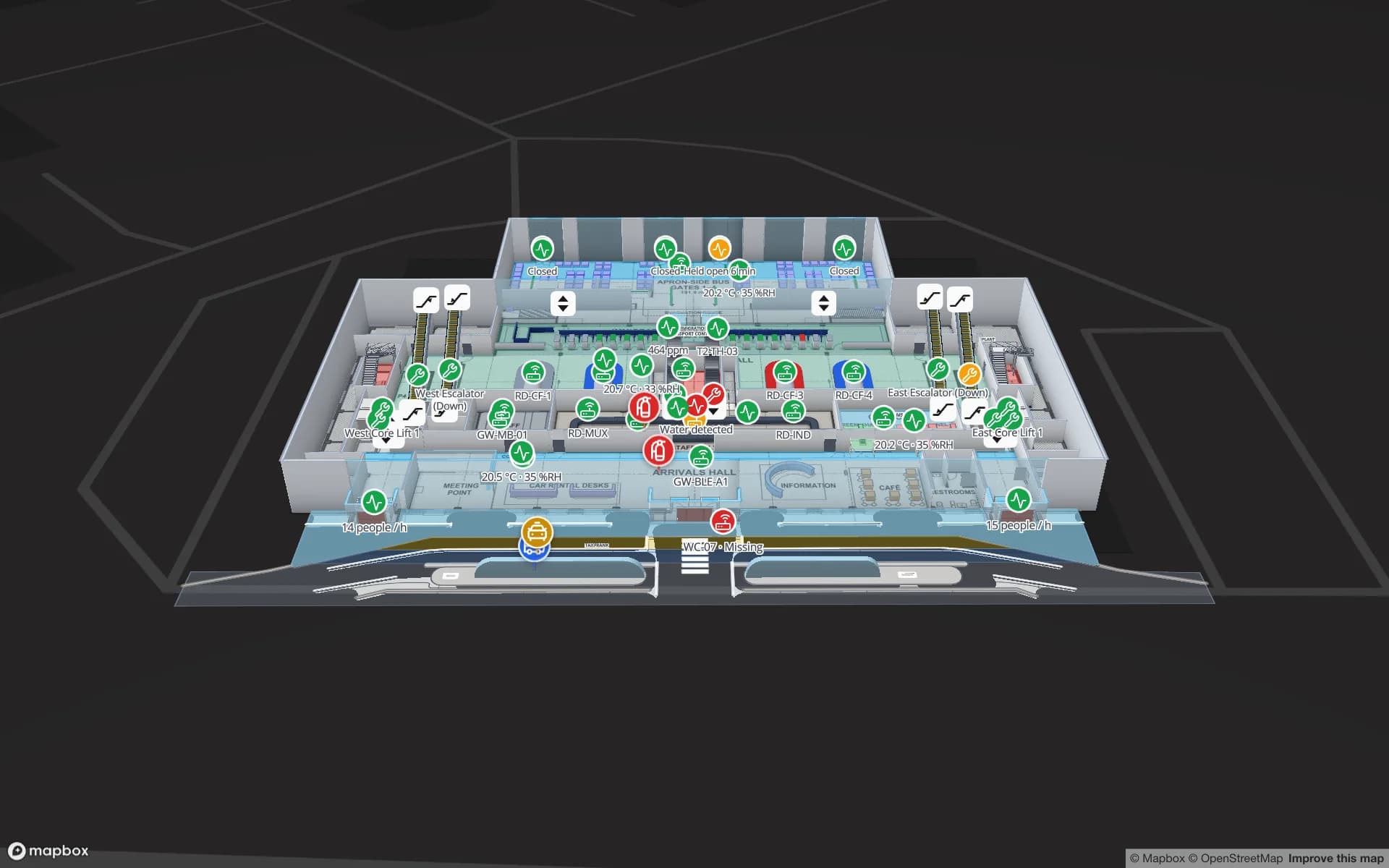
A stadium, an airport terminal, a data center, a cold store, plants, warehouses and more — each with live device data.
Browse the showcaseA home page for every solution.
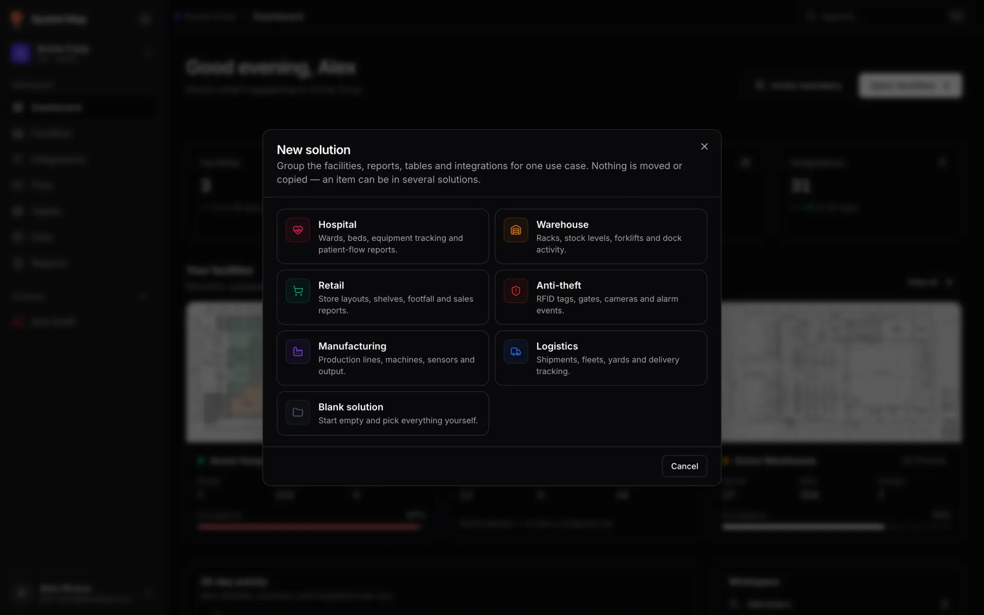
Facilities, reports, tables and integrations for one use case on one screen — with live record counts and integration health (Healthy, Partial, Failing). Every list in the app can be scoped to the solution.
- •Templates: Warehouse, Retail, Anti-theft, Manufacturing, Logistics and more
- •One item can belong to several solutions
- •Deleting a solution never deletes data
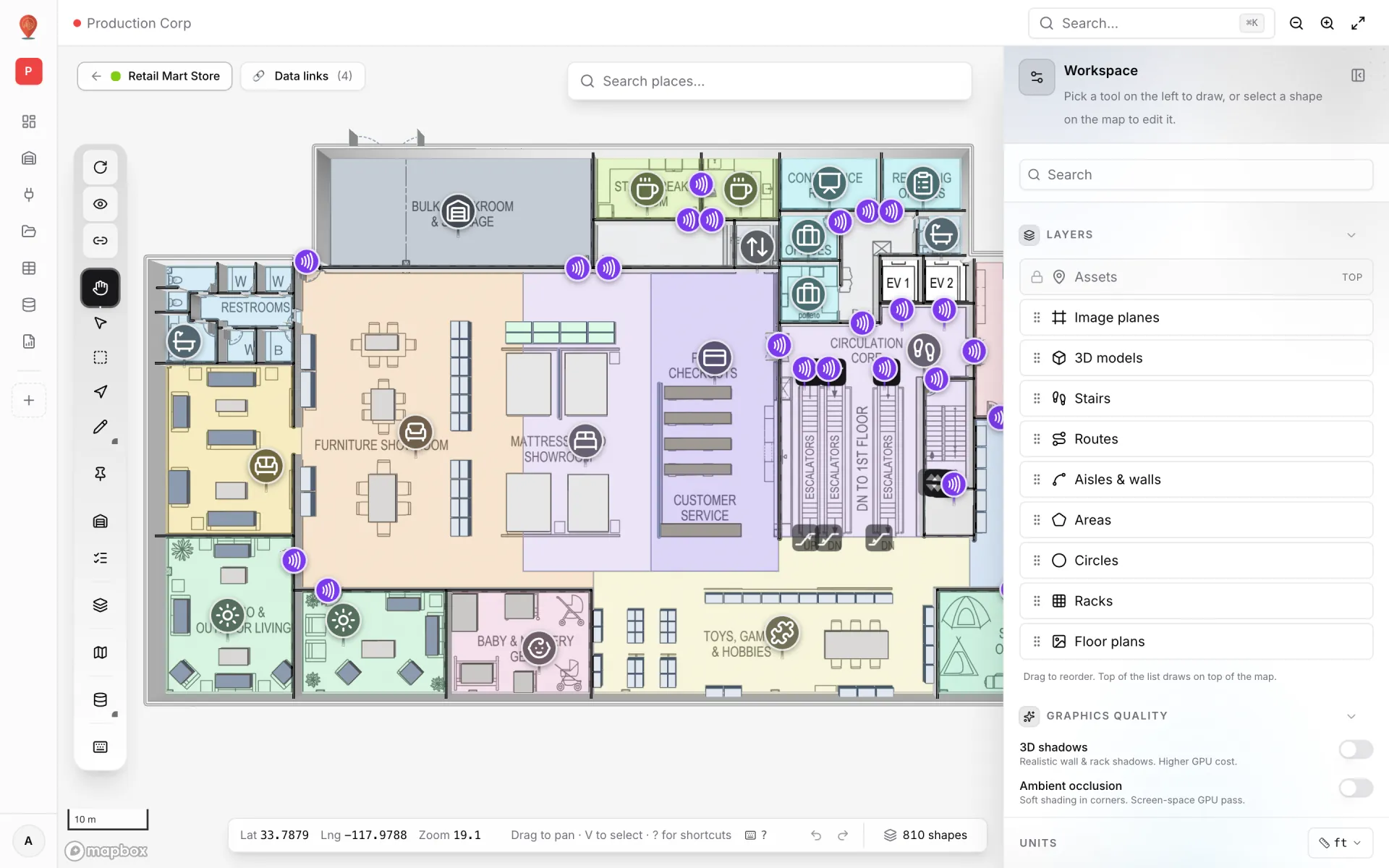
Draw it. Bind it. Visualize it. Share it.
One workspace replaces the spreadsheet of bins, the CAD drawing of the floor plan, and the dashboard nobody opens.
From floor plan to 3D in an afternoon.
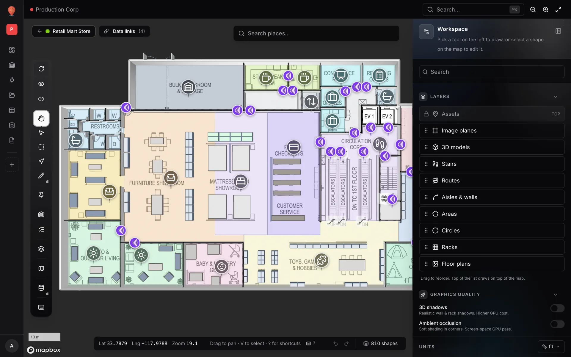
Import the architect's PDF or DWG — Spatial Map reads its scale — pin it to the site, and trace on top. Every tool has a single-letter shortcut, shapes extrude into real 3D as you draw, and you can stack as many floors as the building has.
PDF import
Pick a page; the plan’s real size comes from 16 standard ISO, ANSI and ARCH sheet sizes.
DWG import
AutoCAD R2004–R2018 read natively: pick the layers, and the drawing is placed as a picture at real-world units.
AI Map
Press A: walls, doors, racks, labels, areas, stairs, lifts and escalators drafted from your plan — the whole floor or one part — for you to review and add.
Draw rack
Two clicks make a rack of bins — square, triangle or hex cells, stacked into multi-level racks in 3D.
Add asset
Pin anything that has a place — a pump, a fire extinguisher, a consulting room — with one of 1,700+ icons.
Add circle
One drag for a single circle, or two clicks for a regular grid of circles.
Add area
Click out a room, zone or department and press Enter. Fill it, label it, extrude it into 3D.
Add aisle
Polylines that become 3D walls or flat lanes — height, thickness, dash and border per line.
Add route
A fixed path — evacuation route, forklift lane, pick path — with per-segment lengths and a total.
Add floor plan
Upload a PDF, DWG or image and place it on the map at real-world scale, one per floor.
Add 3D model
Drop a model from the built-in library or upload your own. Tint, scale and rotate each one.
Add image plane
An image as a textured plane — flat on the floor, tilted like a billboard or standing as a sign.
Add text
Room and department names on the map, with presets for glow, outline and signage.
Add stairs & lifts
Straight, L and U stairs with real treads and railings, plus elevators and escalators between floors.
Add door
Single, double, sliding or revolving doors with frame, leaf and swing arc.
Magic walls
Turn every area into a walled room in one action — the fastest way from a flat plan to 3D.
Route from A to B
Click a start and a destination to preview the walking route before you share wayfinding.
Marquee select
Drag a box to select every shape inside — then change floor, hide, show or delete them together.
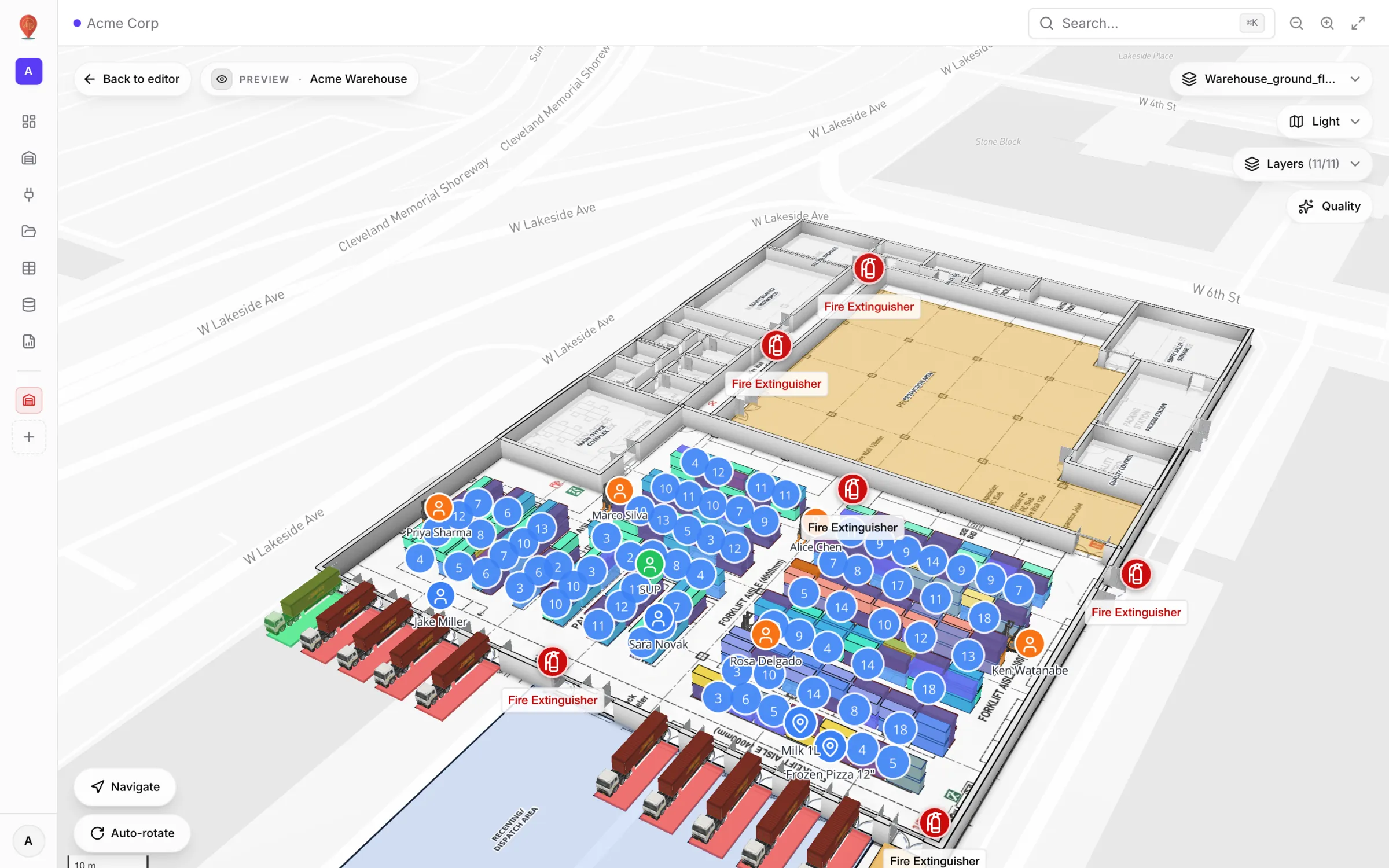
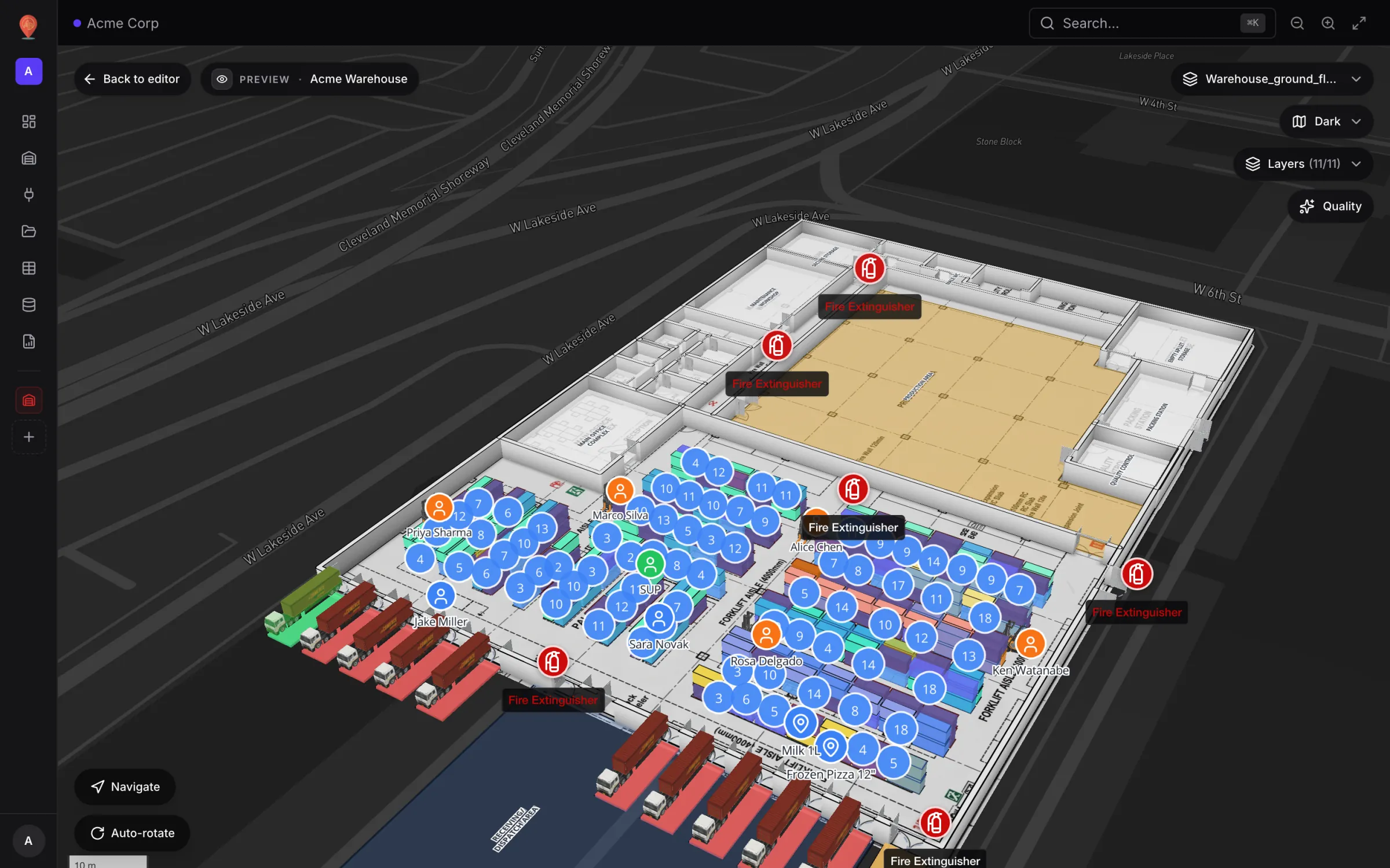
Trace on the blueprint. Extrude in place.
Upload your architect's PDF or DWG at its real scale, drag and rotate it into place on the map, and every shape you draw on top sits at its real-world coordinate. Stack Ground → Second → Third and each floor lands exactly above the last — joined by stairs, lifts and escalators.
Georeferenced
Plans sit on a real basemap at true scale, so every shape has a real-world coordinate.
Multi-floor stack
One floor plan per level, each at its own elevation. Mark a default for shared views.
Per-shape elevation
Slider on every shape — sit it on the floor, or 3.2 m above it.
3D shadows + AO
Toggle real-time shadows and ambient occlusion when your GPU can handle it.
Turn-by-turn directions from the map you already drew.
Click a start and a destination: Spatial Map finds the walking route through your rooms, corridors and doors — around racks and walls, up stairs and lifts to other floors — and lists every turn with distance and walking time. It works in the editor and the viewer.
- •Routes avoid walls and racks, pass through doors
- •Distance, walking time and turn count
- •Across floors, with Fastest, Step-free and Other route
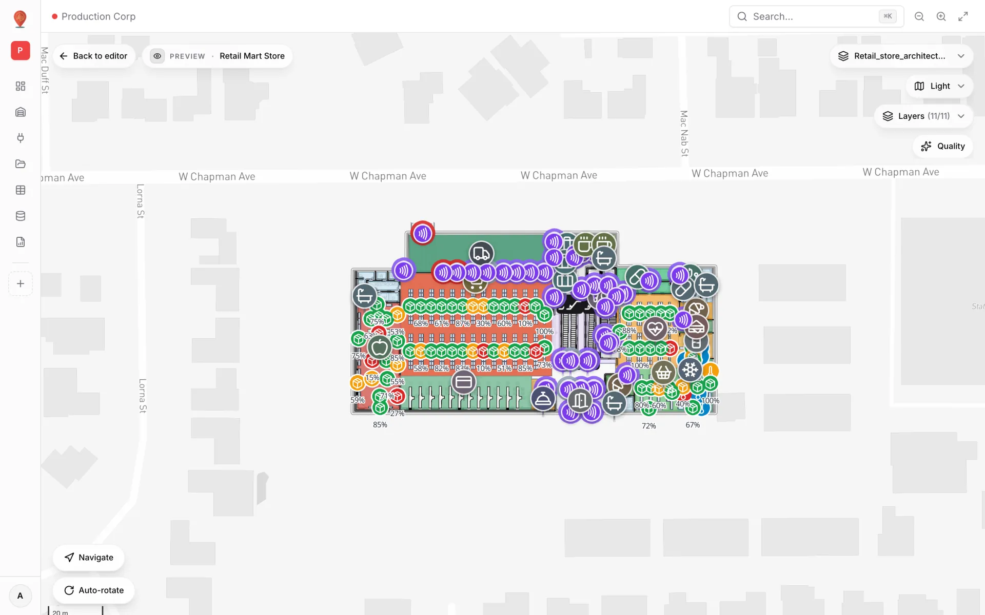
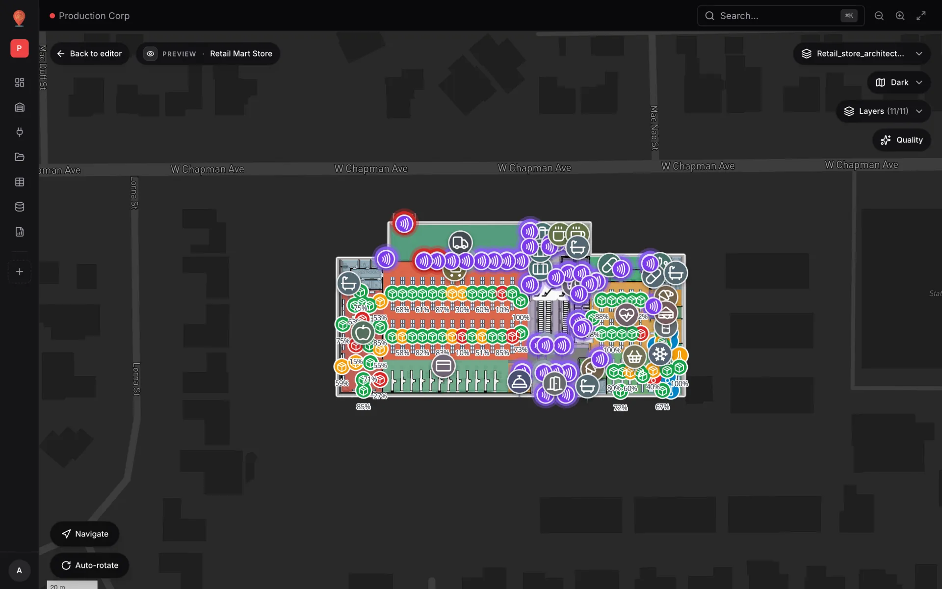
Reports that keep the map in the picture.
Every facility starts with eight reports. Build your own in a guided wizard — KPIs, charts, tables and a live facility map — and export to PDF, Excel, CSV or JSON.
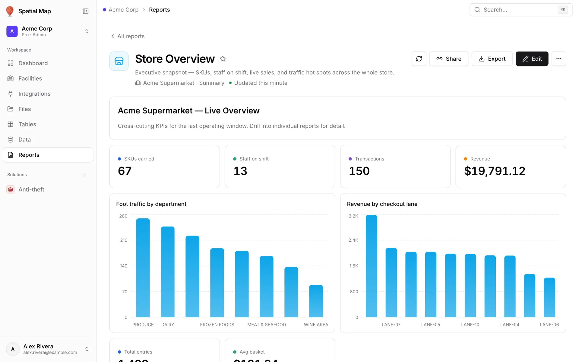
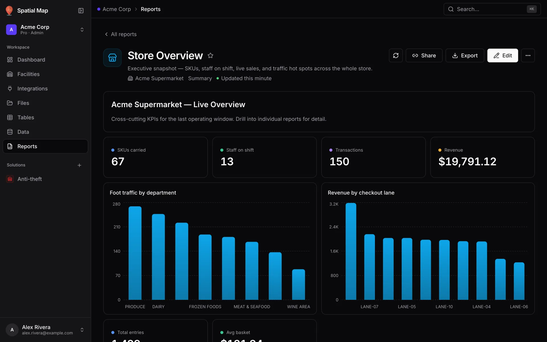
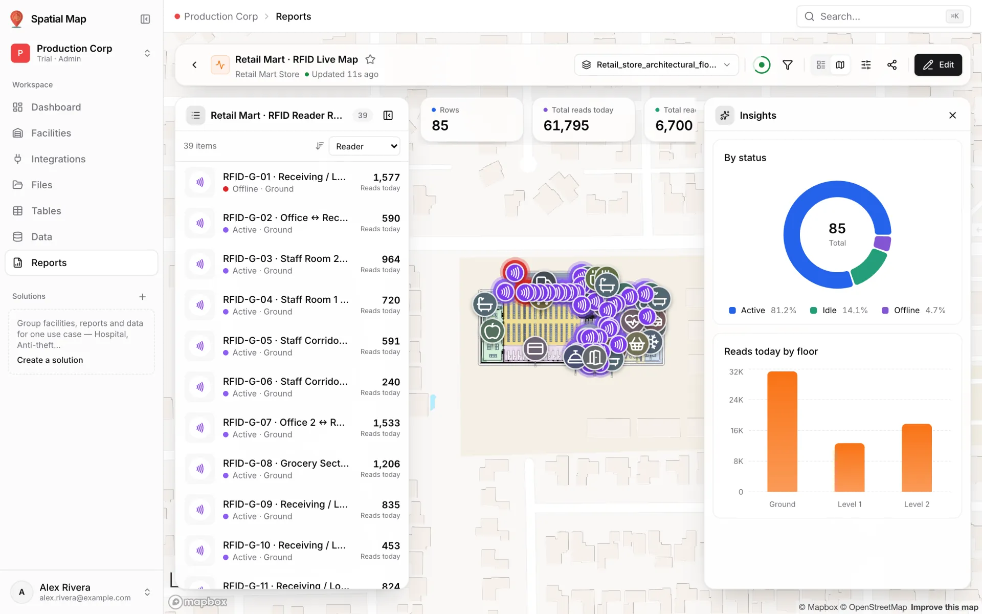
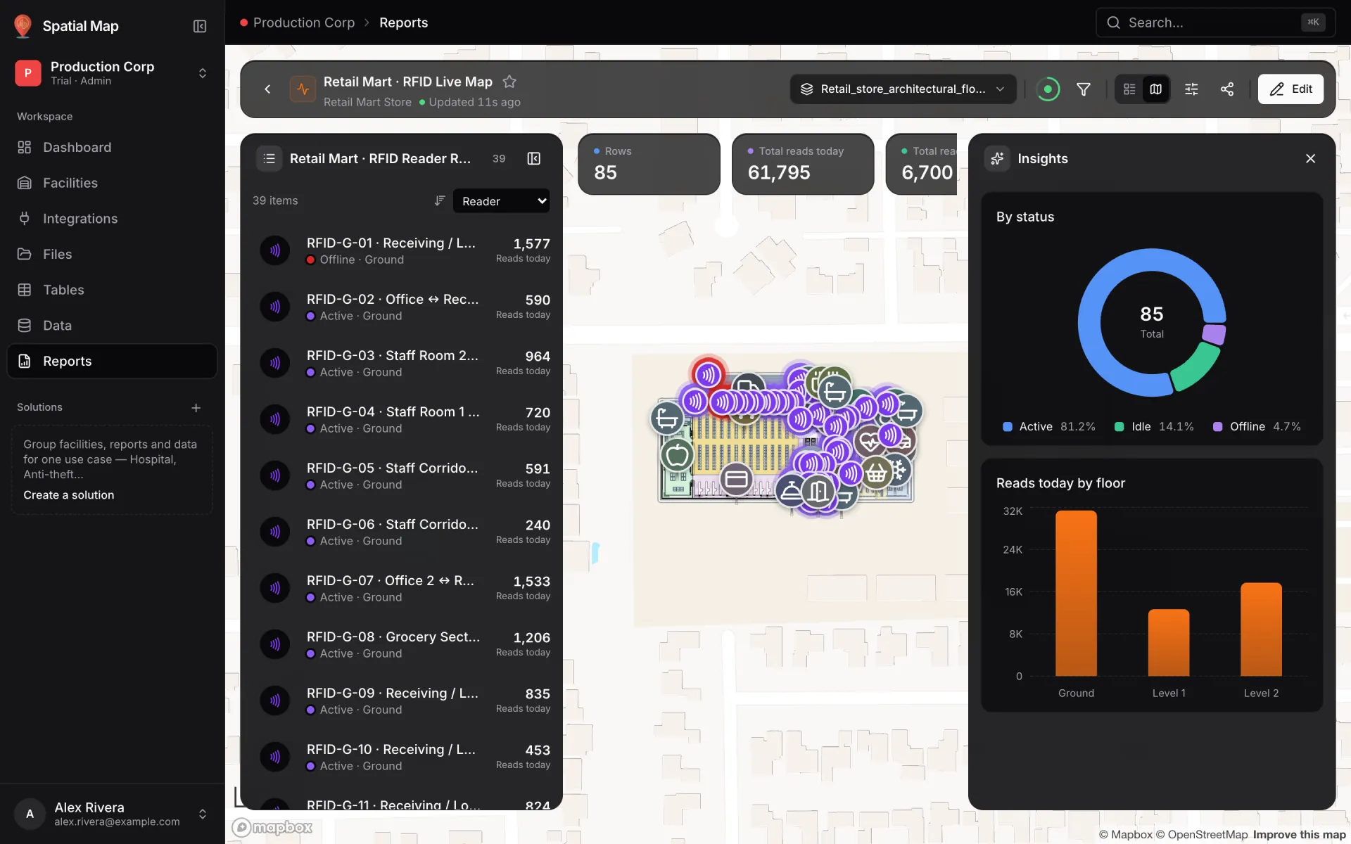
Guided wizard
Data source, columns, filters, conditional formatting, grouping, parameters, widgets and layout — step by step.
KPIs, charts, map
Big numbers with a delta, line, bar, area, pie and donut charts, tables, notes and the live facility map.
Three layouts
Document, grid, or full map with the KPIs and insights around it.
Export and share
PDF, Excel with conditional colours, CSV, JSON, any chart as a PNG — or a public read-only report link.
Learn more in the reports docs or the reports and dashboards tutorial.
Connect the systems you already run.
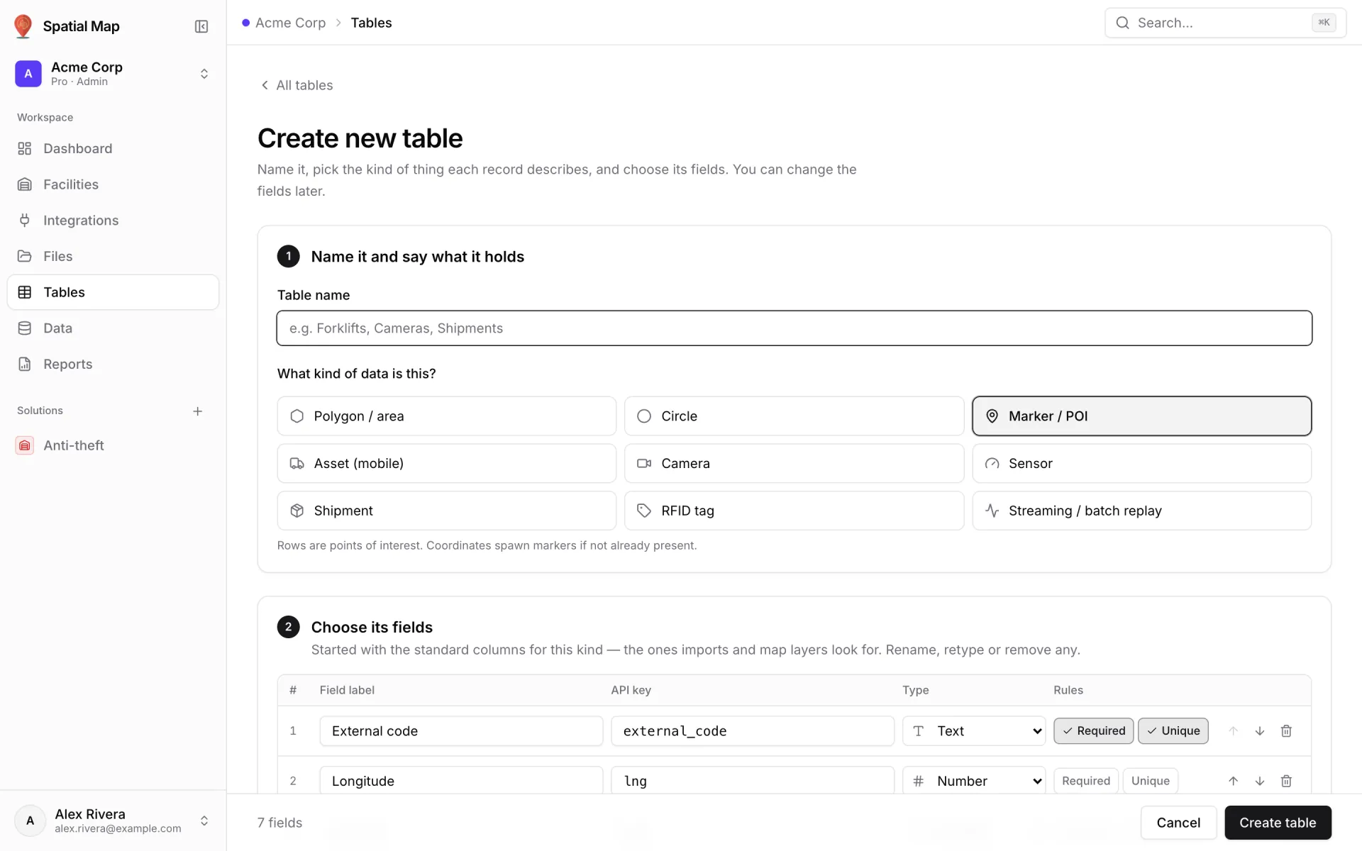
WMS, ERP, RTLS, RFID middleware, cameras or IoT gateways — if it speaks JSON, it lands on the map. No proprietary connectors to wait for: REST sources, file uploads and your own tables with a write API.
REST API sources
Point at any JSON endpoint, add an API key, bearer token or custom headers, and pull on a schedule.
File uploads
CSV, Excel, JSON and GeoJSON — bin rosters, asset lists, sensor inventories or shape geometry.
Tables + write API
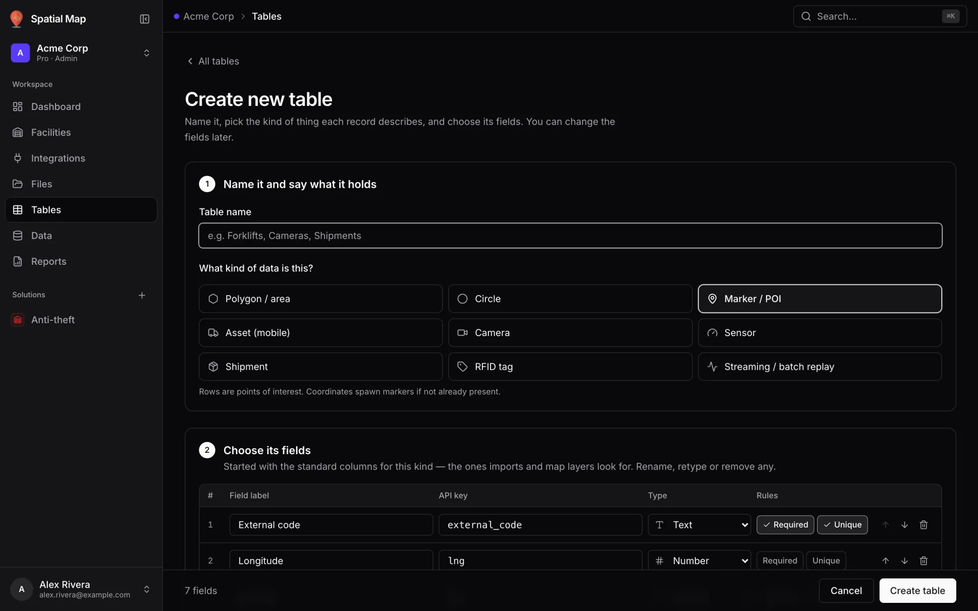
Define your own schema, then post rows from any system with a per-table API key. Every row keeps its history.
Pull into a table
Let a table fetch its own rows from your URL on a schedule — no middleware to run.
References
Typed lookups like SKU → supplier, so codes in your feeds become names on the map.
Style rules
Colour shapes from their data — “red when out of stock”, “amber when cleaning” — first match wins.
Health & audit log
Every source shows whether data is arriving, with run history and an audit log of every write.
Data screen
Every record your sources have ingested, searchable, with run history and export.
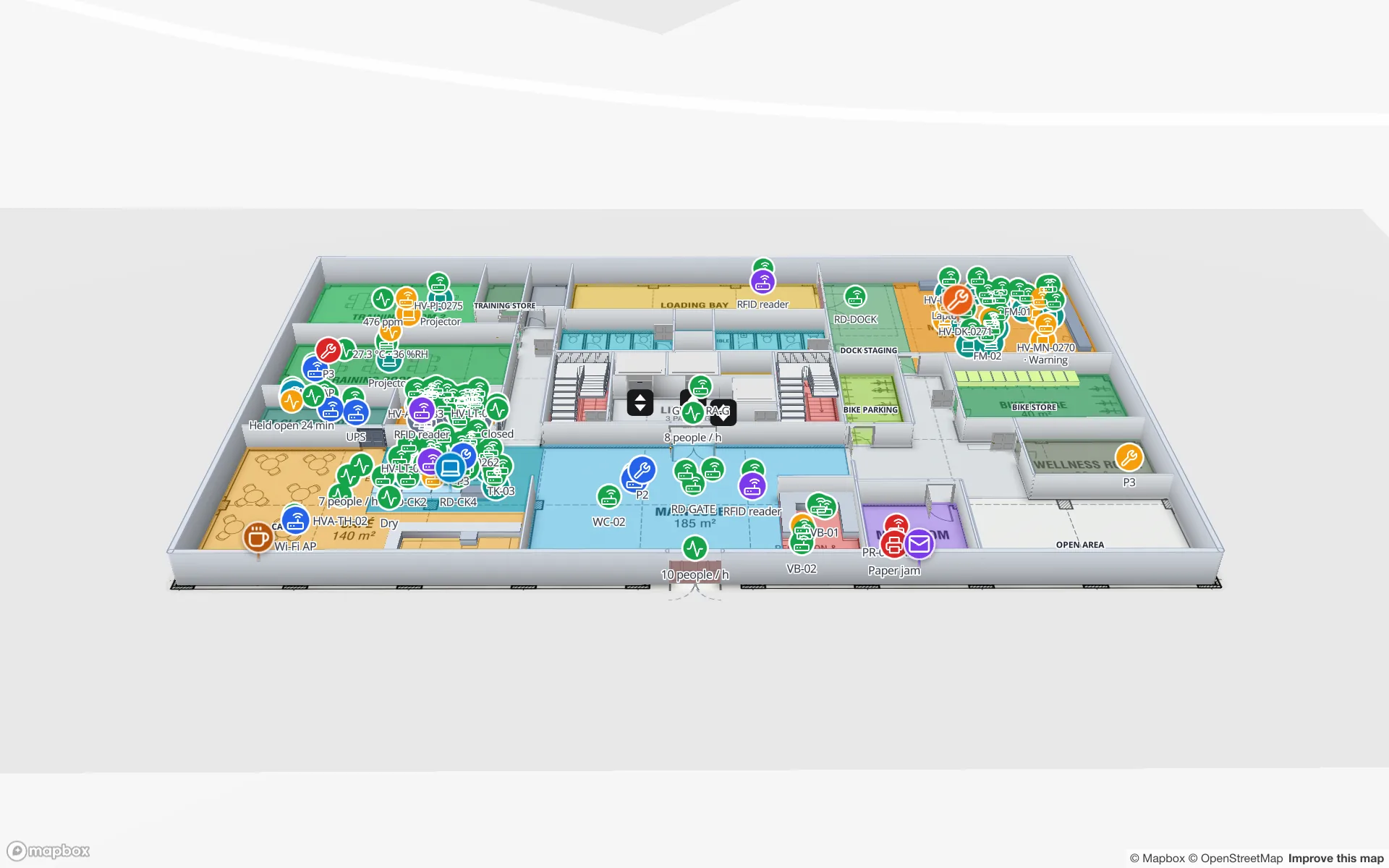
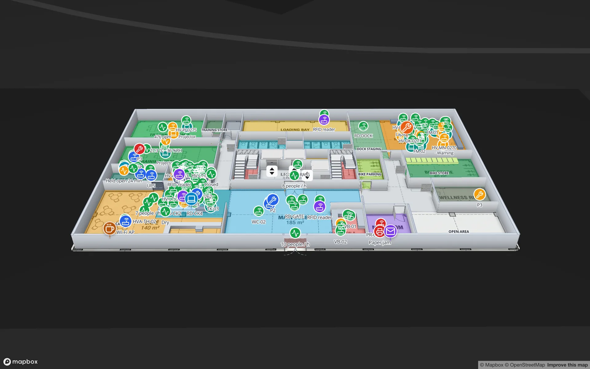
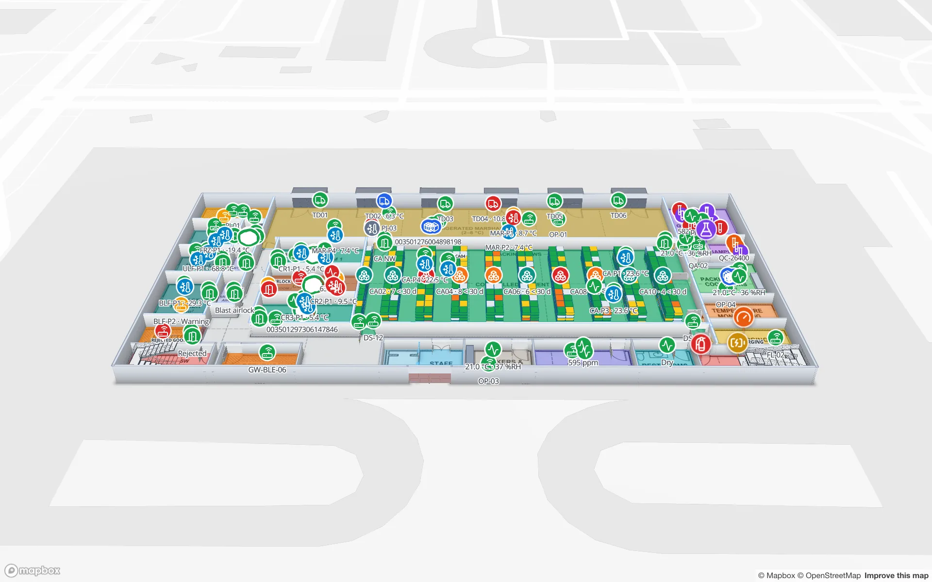
See what's happening, the moment it happens.
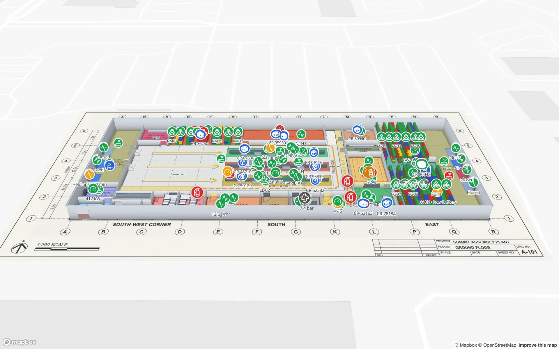
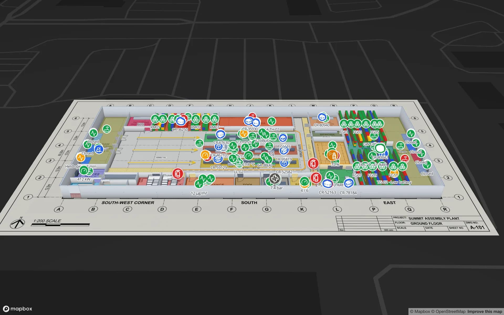
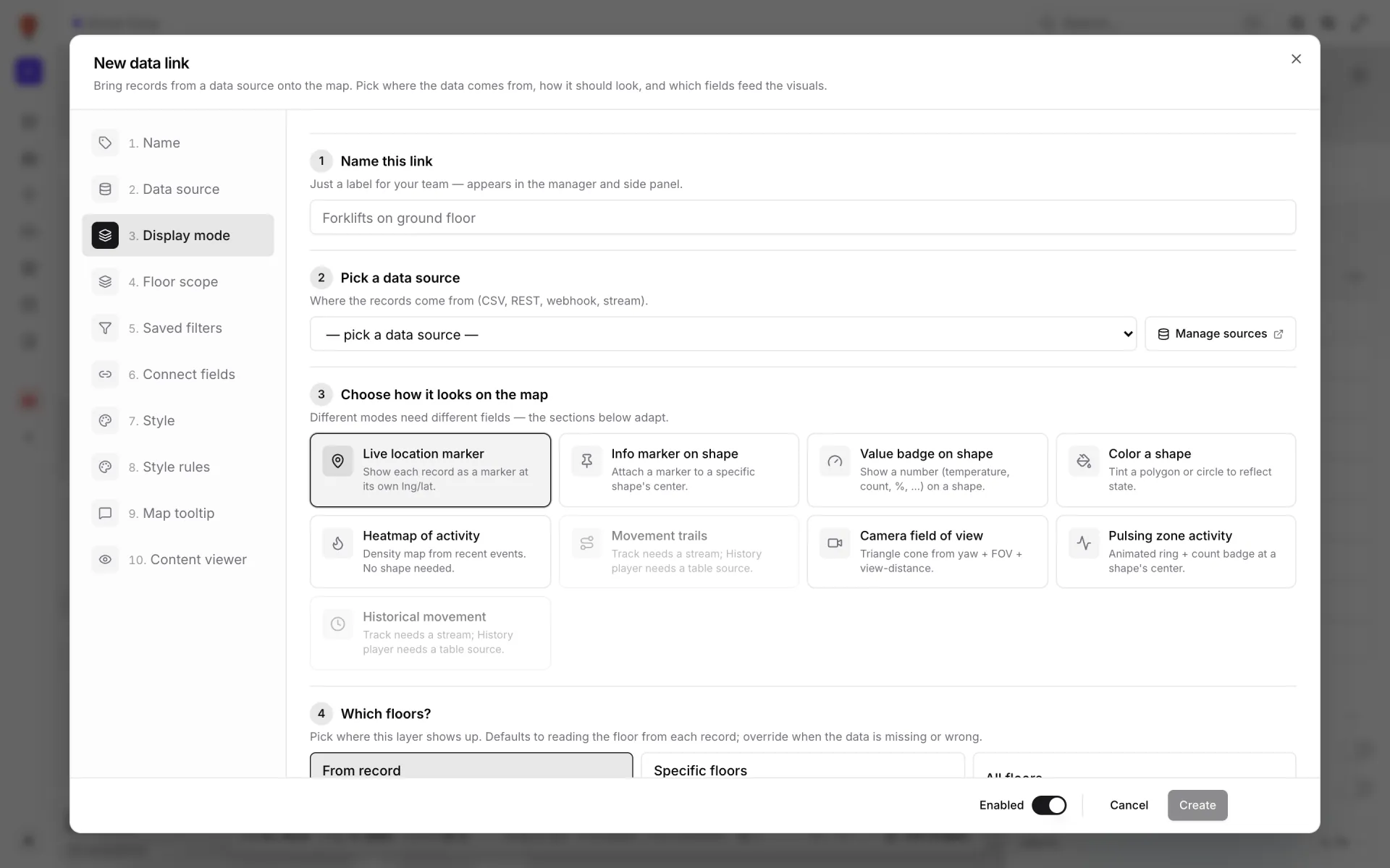
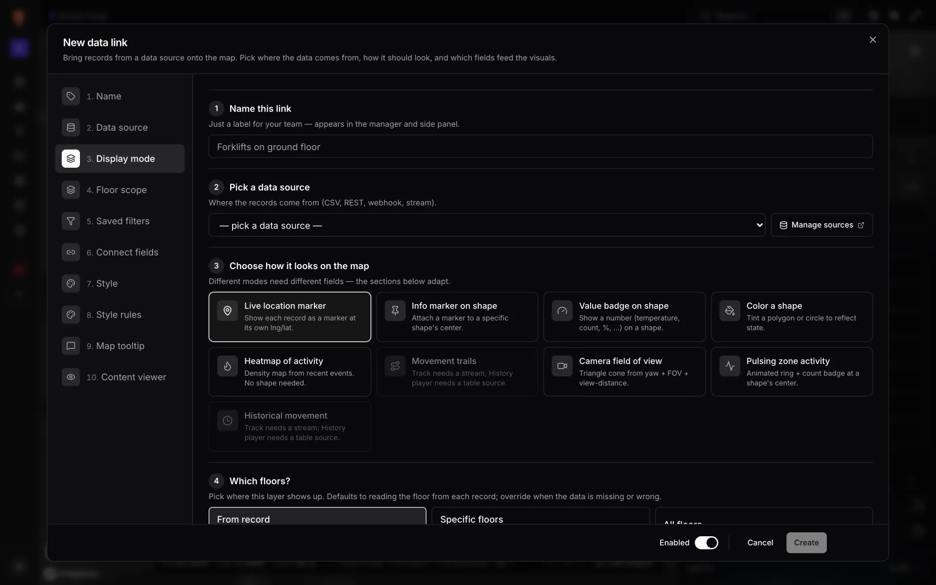
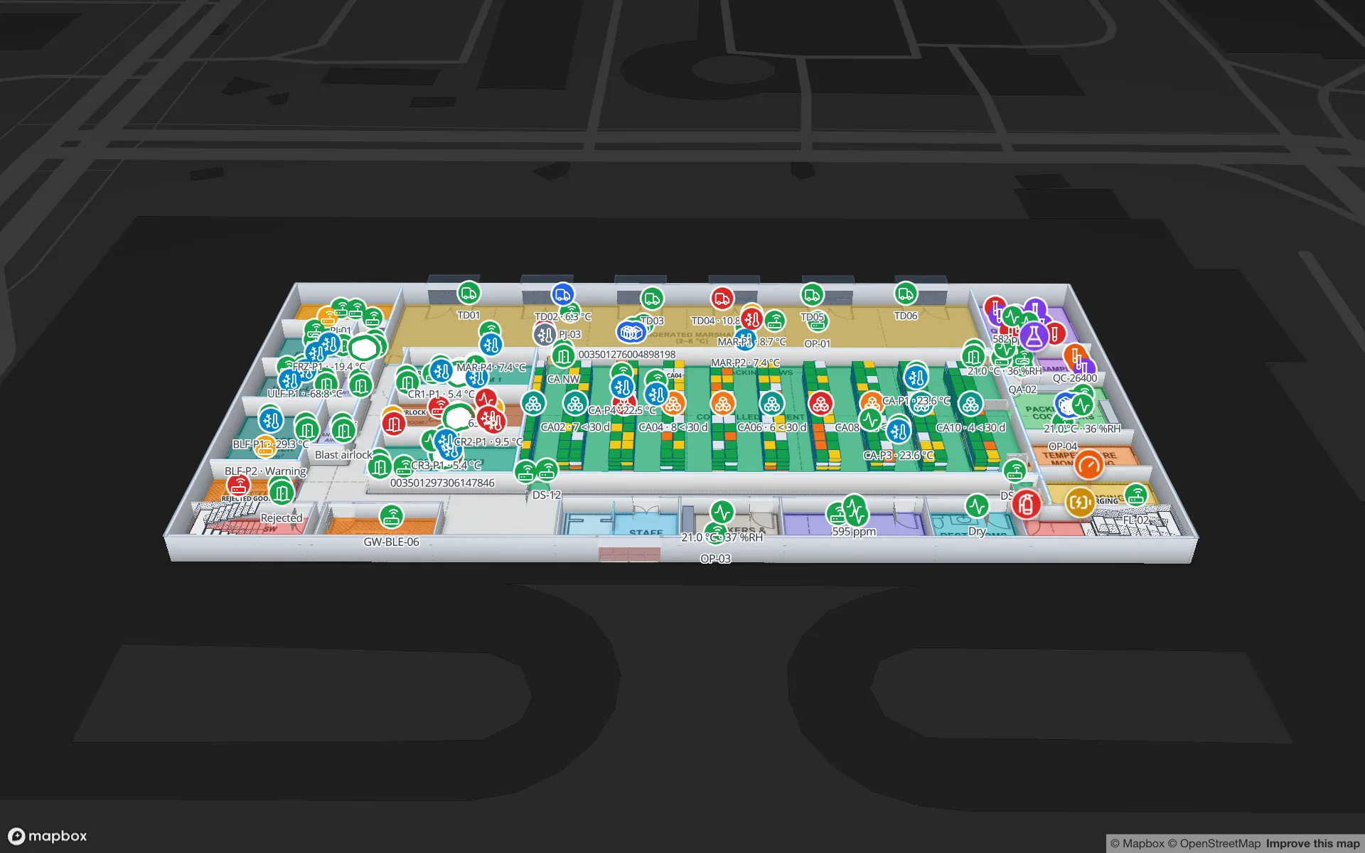
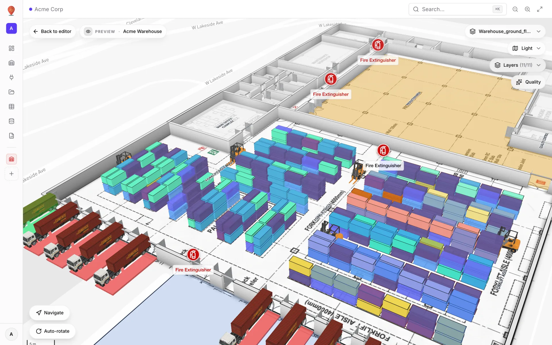
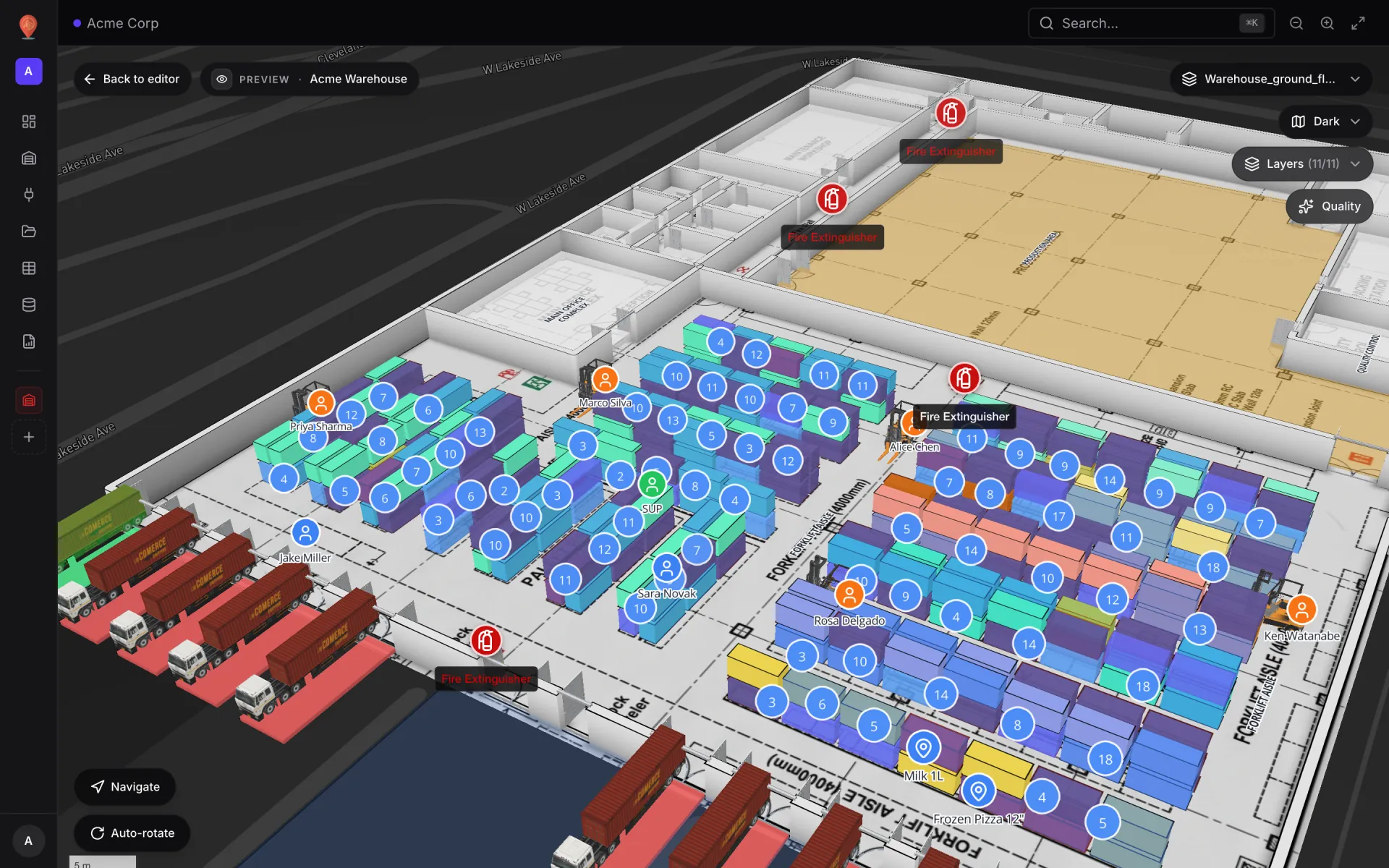
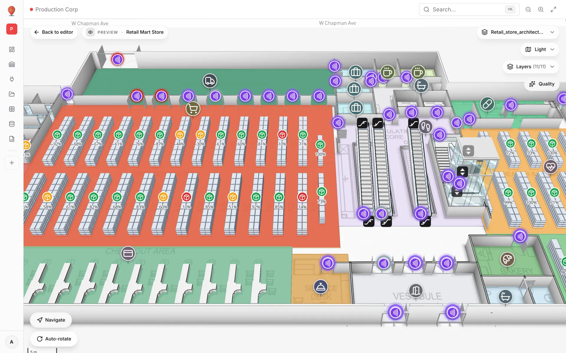
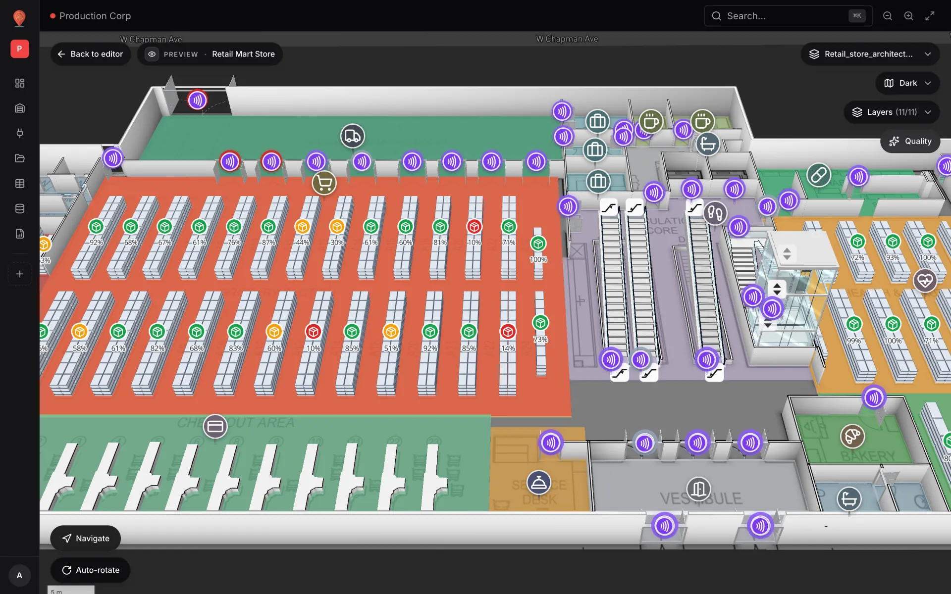
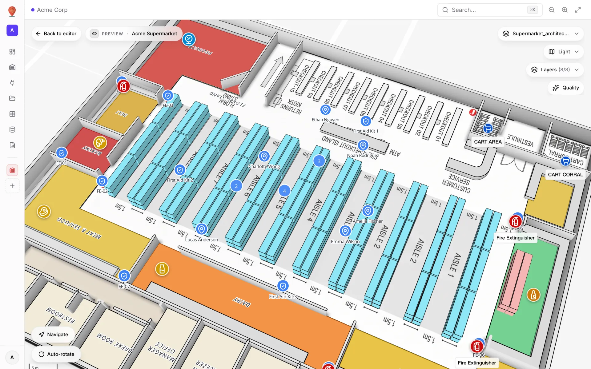
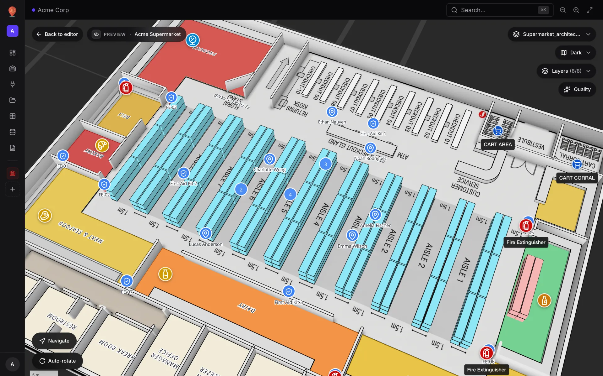
Pick a render mode per data link — live location markers, value badges, coloured areas, heatmaps, camera cones, pulsing zones — and the map updates the moment your data does. Editor, viewer and read-only share links all render them in real time.
Your team inside, your guests read-only.
Every signup gets its own workspace, and every query is scoped to it on the server. Bring your team in with a role, or hand external guests a branded read-only link — expiring, view-capped, revocable anytime.
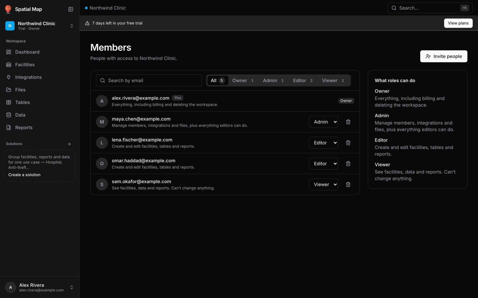
Invite by email. Assign a role.
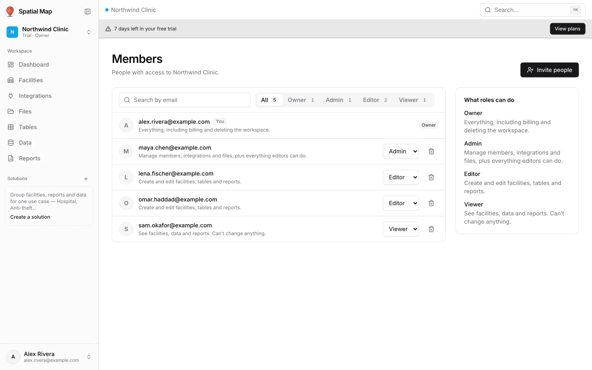
Add teammates who already have a Spatial Map account by email and pick their role — Admin, Editor or Viewer. The workspace appears in their switcher on their next sign-in. No seat provisioning, no SSO wrangling to get started.
- •Add people by email with their role pre-assigned
- •Live member list with owner / admin / editor / viewer
- •Revoke or re-role anyone in one click
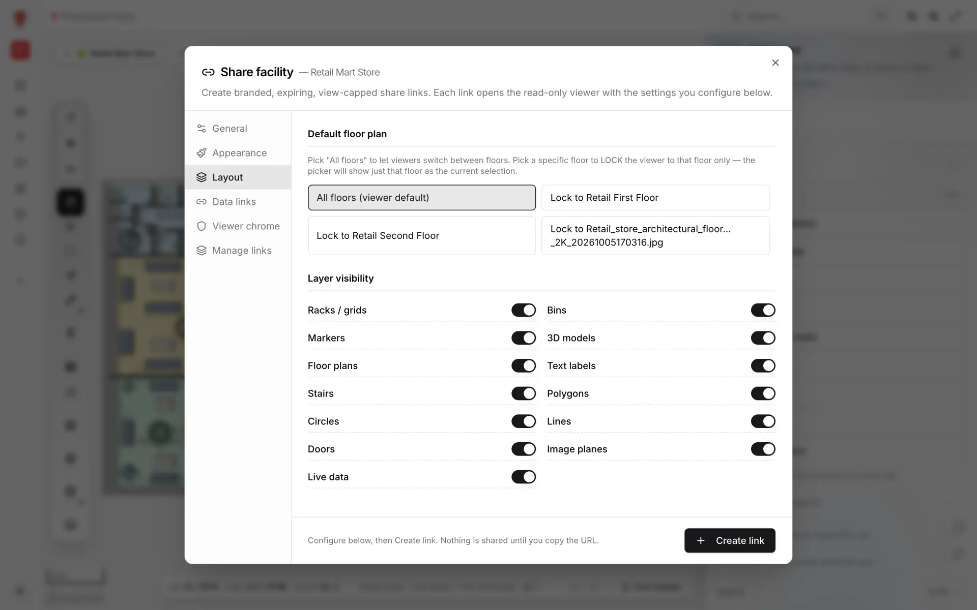
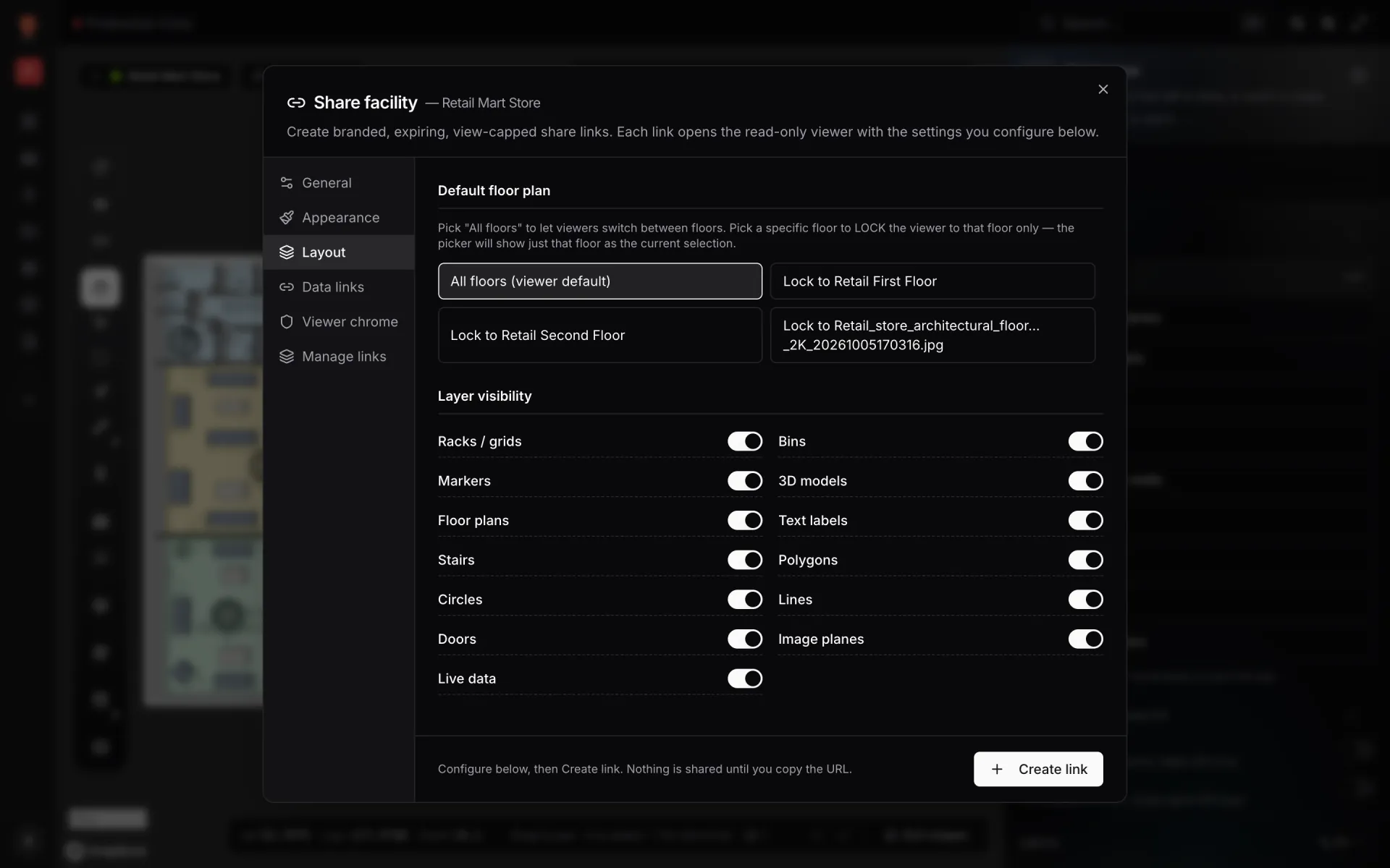
A read-only viewer for anyone outside the workspace.
One link per audience. Configure the label, expiry, view cap, appearance, layout and which data links show — all in one dialog — then create the link and send it.
- •Expiry: 1 hour → 1 year, or never
- •View cap: kill the link after N opens
- •A label and notes so your team knows who each link is for
- •Revoke any link from Manage links, anytime
Guests open a clean, branded viewer — nothing else.
The recipient lands on the facility with only the layers and controls you allowed. No editor, no schema, no member list — just your map and the live overlays you toggled on. Perfect for stakeholders, contractors, and sales demos.
- •Read-only. No accidental edits
- •Only the layers you exposed are visible
- •Live overlays keep updating just like the editor
Four roles. One workspace.
Every member has exactly one role per workspace, and can belong to several workspaces.
Owner
Everything, including billing and deleting the workspace.
Admin
Members, integrations and files, plus everything editors can do.
Editor
Create and edit facilities, tables and reports.
Viewer
Sees facilities, data and reports. Can’t change anything.
Prefer to self-host? Spatial Map is open source.
The same editor and 3D viewer are on GitHub under the MIT licence. Clone the repository, add a free Mapbox token and run it on your own server with Docker Compose — no plans, no limits. Or skip the servers and use the cloud version below.

git clone https://github.com/Siraj-zaki/spatial-map.git
cd spatial-map && cp .env.example .env
docker compose up -dOne plan. Everything included.
Try every feature free for 7 days. Keep going on Pro, or let our team build it for you.
Prices in USD, billed through Stripe. Cancel anytime.