Platform · Floor plan import

From floor plan to indoor map: PDF, DWG or image, to scale and in 3D

Spatial Map takes you from floor plan to indoor map in the browser. Upload a PDF sheet, an AutoCAD DWG or a plain image, set its scale, pin it to the building’s real location and stack the floors in 3D. AI Map can draft walls, doors and racks on top; you check the drafts, draw the rest and bind live data to the shapes.

Last updated:

No credit card. Runs in the browser. Pro is $60/month for up to 4 facilities. Book a demo

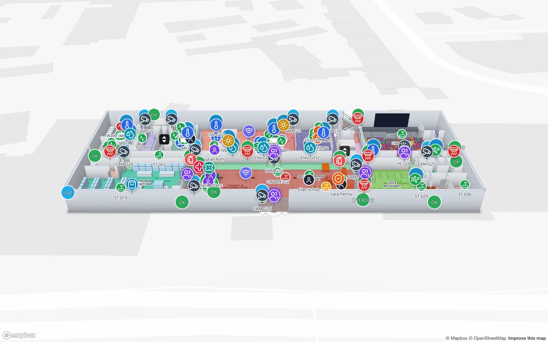
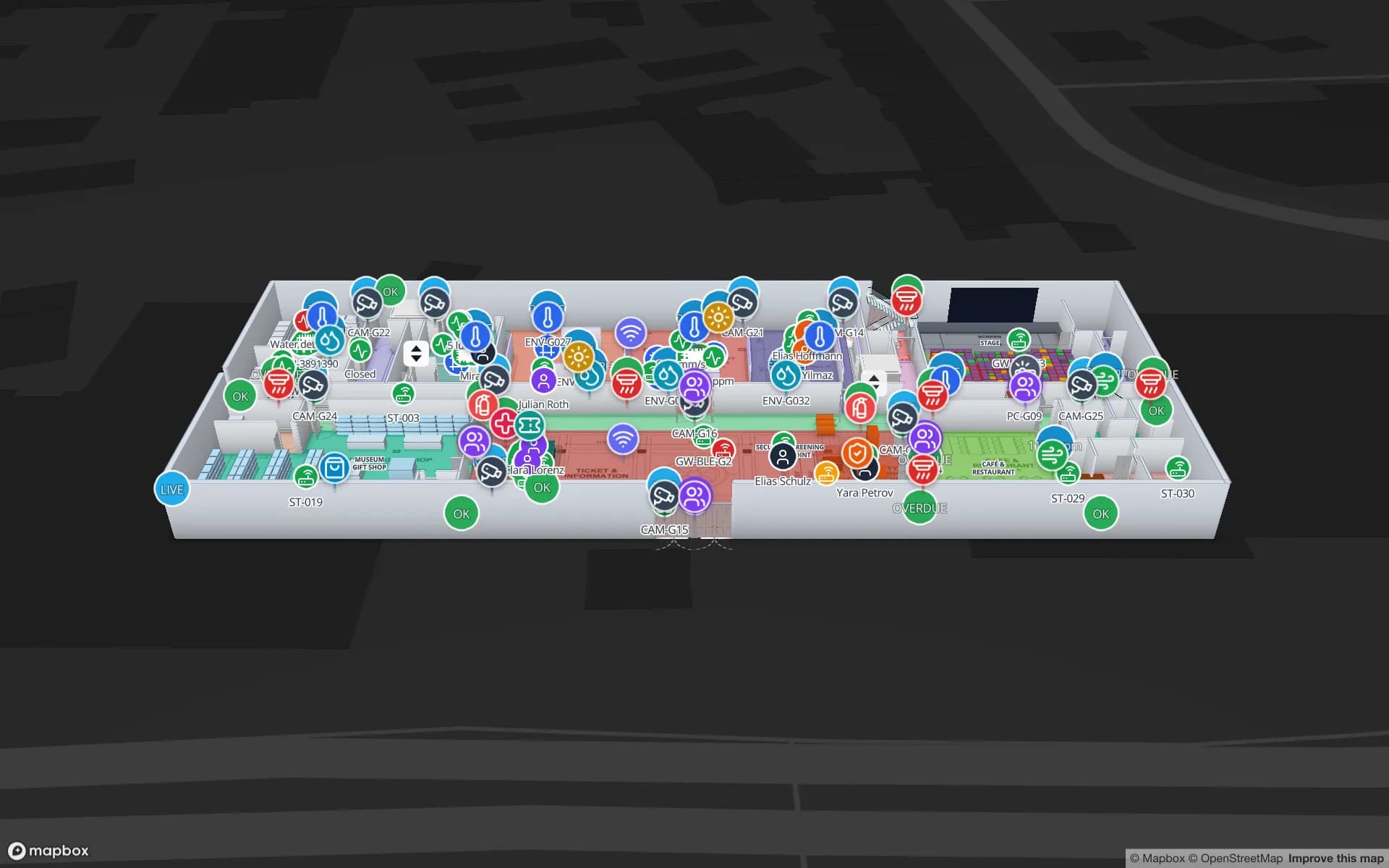
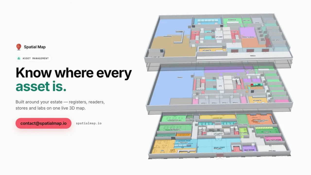
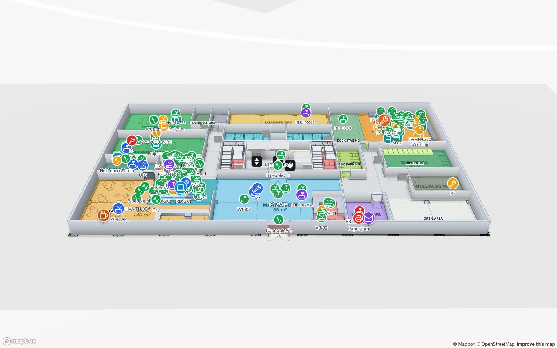
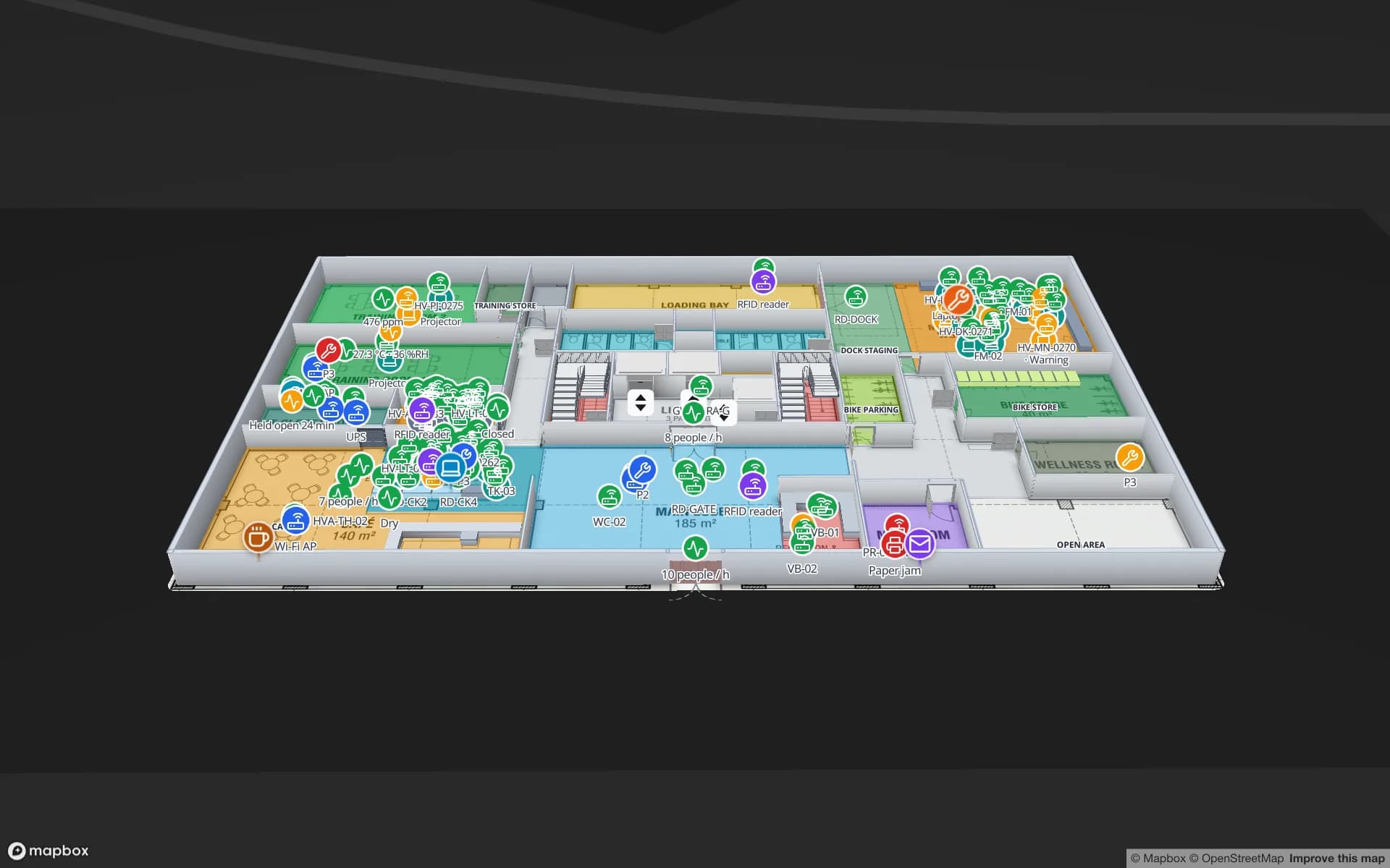
Harborview Corporate Campus — Building A, a corporate office building demo, in the Spatial Map 3D viewer with live device markers
Harborview Corporate Campus — Building A
Harborview Corporate Campus (demo): three office floors, each on its own floor plan at its own elevation, stacked in the 3D viewer.
Floor-plan files, plus GIF and WebP
PDF · DWG · PNG/JPG
AutoCAD DWG releases read directly, no AutoCAD needed
R2004–R2018
Paper sizes recognised on PDF sheets (ISO A, ANSI, ARCH)
17
Free trial, no credit card
7 days

Three kinds of file, one result

Whatever you start from, the import ends the same way: one floor-plan picture per level, placed at real size on the real map. That picture is the backdrop. The indoor map is what goes on top of it — rooms, walls, doors, racks, stairs and lifts as named shapes that data can attach to.

So the file type only changes how the scale is found and what you choose on the way in. The table below sets the three side by side; Import a PDF or DWG floor plan has every dialog step.
PDF: the sheet size sets the scale

A PDF never records the scale it was plotted at, so Spatial Map asks before it places anything. Pick the sheet from the page thumbnails; each shows the paper size it recognised (17 sizes across ISO A, ANSI and ARCH). The Drawing scale chips are ranked guesses such as 1:100 or 1/8" = 1'-0" — check the one you pick against the title block — or type the width the whole sheet covers on the ground.

Places at shows the real-world width and height before you confirm, so a wrong scale is caught before it reaches the map. With Not to scale, the sheet takes the size of the box you drag. PDFs of up to 256 MB and 2,000 pages are accepted.

DWG: AutoCAD drawings at real units

Spatial Map reads DWG files saved as AutoCAD R2004 to R2018 itself; you don’t need AutoCAD. Confirm the drawing units — each unit chip shows how big the building would be in it — and choose the layers. Annotation, dimension and title-block layers start switched off, which leaves a cleaner plan. A DWG always lands at true size, because it is drawn in real-world units.

The drawing is rendered as black linework on white and placed as a picture. Walls and rooms are not pulled out of the linework, and text is not drawn, so room names are added as labels or as the names of the areas you draw. DXF is not read directly: save it as a DWG or plot the sheet to PDF.

Pin it to the site and stack the floors

Search for the address, drag the plan onto the building, lower its opacity and rotate it with the slider or the [ and ] keys until the outline sits on the building. Every level is imported the same way and given its own Elevation, so the floors stack in 3D at their real heights. The order of the Floor plans list decides which floor the viewer opens on.

When the drawing is revised, import the new sheet and use Replace image on the old plan: position and size stay, so everything drawn on top stays aligned. See the Floor plan tool.

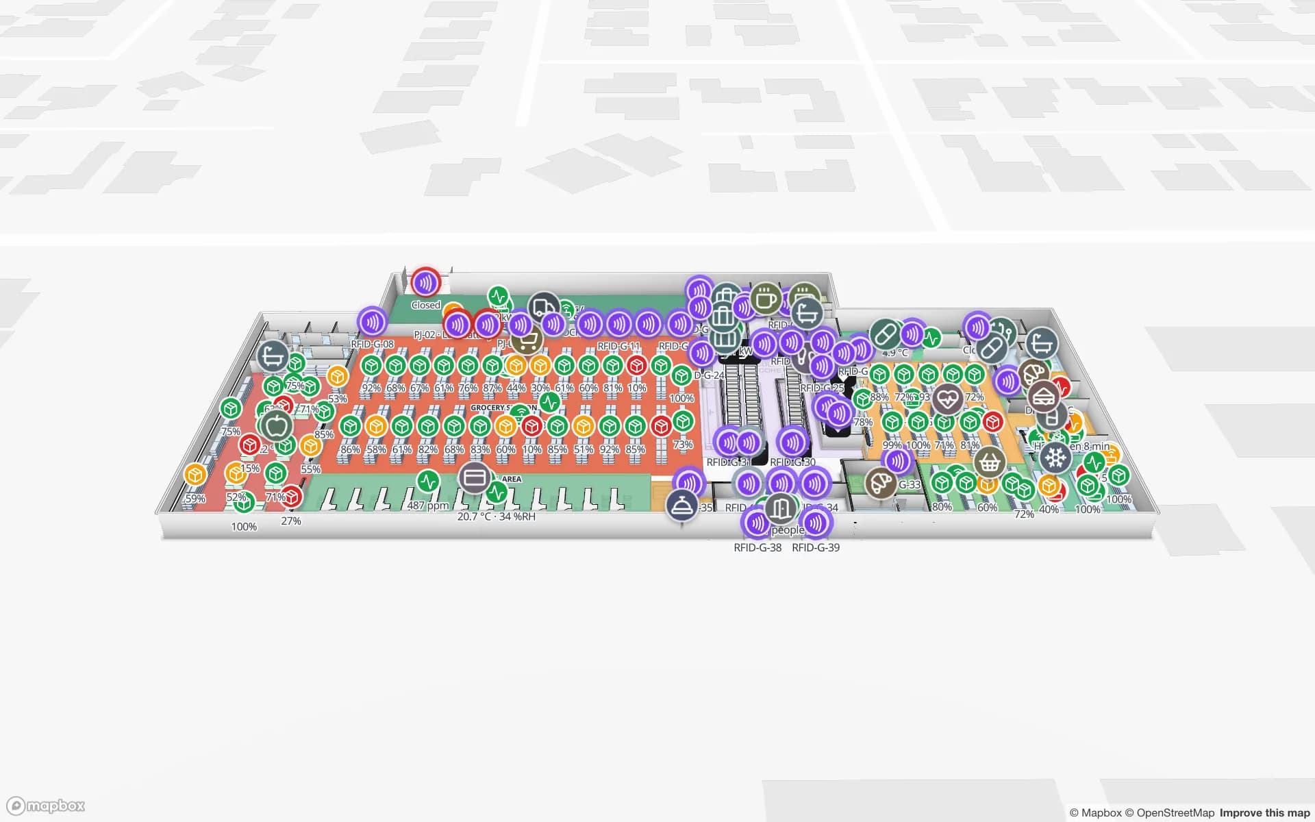
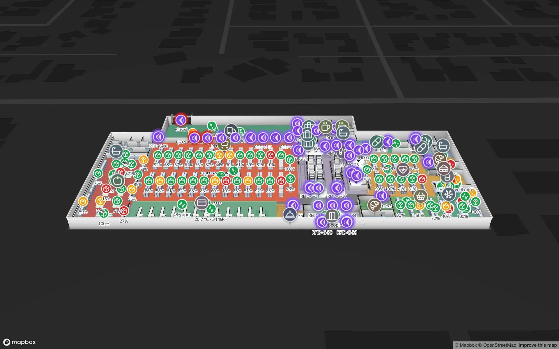
Retail Mart Store, a three-floor retail store demo, in the Spatial Map 3D viewer with live device markers
Retail Mart Store
Retail Mart (demo): three floors stacked by elevation, joined by escalators and a lift that meet each floor at its height.

From picture to map: AI Map, tracing and editing

Once a plan is placed and aligned, AI Map can draft walls, doors, racks, labels, areas, stairs, lifts and escalators from it, on the whole floor or one part. You review the drafts on the map and add the ones you want. What it misses you draw with the editor’s tools: Area, Aisle, Magic walls, Door, Rack and Stairs & lifts.

Walls, rooms and racks have heights, so the result is a floor plan to 3D map from the first shape you add — see the 3D indoor map for what it can hold.

Then bind live data

A map earns its keep when data lands on it. Tables hold your rows — stock, devices, sensors, bookings — fed by CSV or Excel uploads, REST polling or the write API. Data links match rows to shapes by name or code, and style rules colour them, so name racks, rooms and doors the way your systems already do.

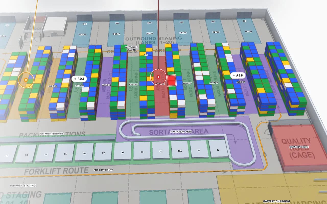
Crestline Fulfillment Center in 3D with every rack location coloured full, OK, low, empty or blocked, and a blocked location highlighted in red
Crestline Fulfillment Center
Crestline Fulfillment Center (demo): every rack location coloured from a stock table — full, OK, low, empty or blocked.

PDF vs DWG vs image: what you get

PDFDWGImage (PNG, JPG)
How the scale is setPaper size plus a drawing scale you confirm, or a known widthFrom the drawing units — always true sizeThe box you drag, or a width you type
What you choose on importThe sheet and its scaleThe units and the layersNothing — it uploads straight away
Room names and textKept, as part of the pictureNot drawn — add labels or name the areasKept, as part of the picture
Shapes extracted from the fileNo — AI Map drafts from the pictureNo — AI Map drafts from the rendered pictureNo — AI Map drafts from the picture
Works best forDrawing sets plotted from CADThe original CAD file, clutter layers offExports, scans and quick starts

GIF and WebP upload like PNG and JPG. DXF is not read directly: save as DWG (R2004–R2018) or plot the sheet to PDF.

How Spatial Map does it

Floor plan to indoor map in four steps

  1. 01

    Upload the plan

    Pick Add floor plan (or press I) and drop a PDF, DWG or image. Set the scale or the units when asked.

  2. 02

    Place and align

    Fly to the site, drag the plan onto the building, rotate and nudge it, and give each floor its elevation.

  3. 03

    Draft and trace

    Run AI Map on the floor or one part, review the drafts, then draw what is missing.

  4. 04

    Connect data and share

    Bind tables to the shapes with data links, then open the viewer or send a read-only share link.

Floor plans turned into maps in the demo workspace

Fulfillment center

Racks, docks and lanes traced over the warehouse plan; stock colours every location.

Multi-floor store

Three floors stacked, with escalators and a lift linked to each one.

Office campus

Three office floors with rooms named like the asset register.

See it on real demo facilities

Fictional names, real floor plans, live sensors, RFID, BLE tags and gateways — open any of them in the browser.

All 13 demo facilities

Floor plan to indoor map — frequently asked questions

Yes. Upload the PDF, pick the sheet and confirm its drawing scale (or type a known width), and it is placed at real size. You then add shapes on top, drafted by AI Map or drawn by hand.

No. Spatial Map reads DWG files saved as AutoCAD R2004 to R2018 itself. Older or newer files show a message asking you to re-save them in that range. DXF is not read directly; save it as a DWG or plot it to PDF.

Not from the file. A PDF or DWG becomes a floor-plan picture. AI Map can draft walls, doors, racks, areas and more from that picture for you to review; anything else is drawn with the editor’s tools.

Yes, as a PNG or JPEG. Drag it to size or type its real width. Expect more hand tracing than with a plan exported from CAD, because photos and scans are harder to read cleanly.

Each floor is its own floor plan at the same spot, with its own elevation. Floors stack in 3D, the viewer switches between them, and stairs, lifts and escalators connect them.

Import the new revision, select the old floor plan and use Replace image. Position and size stay the same, so everything drawn on top stays aligned.

A 7-day free trial covers up to 5 facilities with no credit card. Pro is $60 a month or $600 a year for up to 4 facilities. Done-for-you mapping and integrations are quoted as custom services.

Turn your floor plans into a map this week.

Start a free trial and import a PDF, DWG or image, or send us your drawings and we will map the building for you.