Tracking · UWB RTLS software

UWB RTLS software that lands your tags on the right floor and room

Spatial Map is UWB RTLS software for the map, history and alerting side of an ultra-wideband location system. Your UWB anchors and positioning engine work out the x/y of each tag; Spatial Map aligns that coordinate system to your floor plan, moves every tag live on a 3D map with the room it is in, and adds room visits, dwell, the vendor’s alarms as alerts, reports and history. A BlueIOT server connects directly, and other engines connect through the write API.

Last updated:

No credit card. Runs in the browser. Pro is $60/month for up to 4 facilities. Book a demo

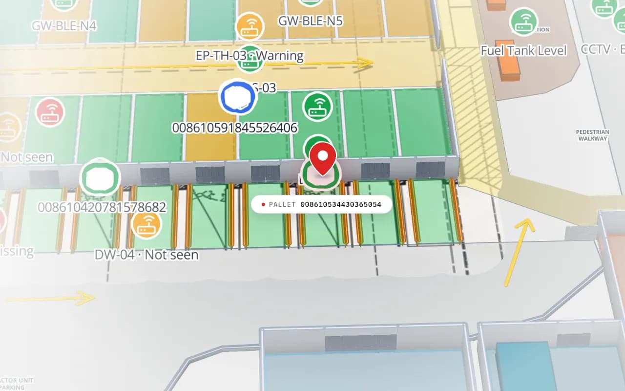
Eastport Cross-Dock in 3D: the view moves from the trailer yard to the dock doors, with RFID pallet markers, gateway markers and a dock reader marked “not seen”
Eastport Cross-Dock Freight Hub
Eastport Cross-Dock (demo): RFID pallet reads at the dock doors and BLE gateways on the same map. Positions from a UWB system appear the same way, as live markers. Cut from the Logistics film.
Ways to align vendor coordinates: import, calibrate, lat/lng
3
Default history thinning: movement, time, or a room change
0.5 m / 10 s
Tables created per connection: tags, room visits, alarms, anchors
4
Free trial, no credit card
7 days

How a UWB system is built

UWB (ultra-wideband) locates a tag by timing short radio pulses between the tag and several fixed anchors, so a tag must be heard by multiple anchors at once. That is why a UWB installation is a grid: anchors mounted at known positions, powered and networked, and a location engine (often a server from the same vendor) that turns the timings into x/y coordinates, and sometimes height and room.

UWB is generally known for the finest accuracy class of the common indoor technologies, often quoted below a metre in published specifications, at the price of more infrastructure and a higher cost per tag than BLE or RFID. That is the trade: you buy it where position inside the room matters, such as forklifts in a lane, staff in a hazardous area or equipment on a production line. For how it compares, read BLE vs UWB vs Wi-Fi RTLS. Real results depend on your building and survey, so pilot first.


Planning the anchors

Anchor planning is the vendor’s job and the biggest part of the project. A survey places anchors so every point you care about is heard by enough of them, usually with a clear line of sight, and checks for metal, racking and walls that reflect or block pulses. Each anchor needs power and a network connection, and the layout is recorded in the vendor’s own map in its own coordinate system.

  • Coverage first — decide the zones where you need positions; outside them a cheaper technology often does the job.
  • Heights and geometry — anchor heights and spread affect results, including the height of the tag.
  • Power and network — often the real cost of the rollout.
  • Test with real tags — walk the routes people and vehicles actually take, then compare the map with reality.
Eastport Cross-Dock Freight Hub, a cross-dock & trailer yard demo, in the Spatial Map 3D viewer with live device markers
Eastport Cross-Dock Freight Hub
Eastport Cross-Dock Freight Hub (demo): yard tractors and pallets moving through the cross-dock, shown as live markers beside dock doors and gates.

From the engine’s x/y to your floor plan

A UWB engine reports coordinates in its own frame: metres or centimetres from a map origin, per map id. For the position to land on your plan, Spatial Map links each vendor map to a facility floor with a transform (offset, rotation, scale and an optional mirror). You set the link in one of three ways:

  • Import the vendor’s map (BlueIOT) — the floor-plan image and its extent are fetched from the vendor server and placed as the floor’s image; the transform follows from its corners, so you only move or rotate it onto the building.
  • Two- or three-point calibration — click a point on the Spatial Map floor, type the vendor x/y for it, and repeat. The fit error is shown, so you can redo a poor point.
  • Latitude and longitude — if the vendor already sends them, no transform is needed.
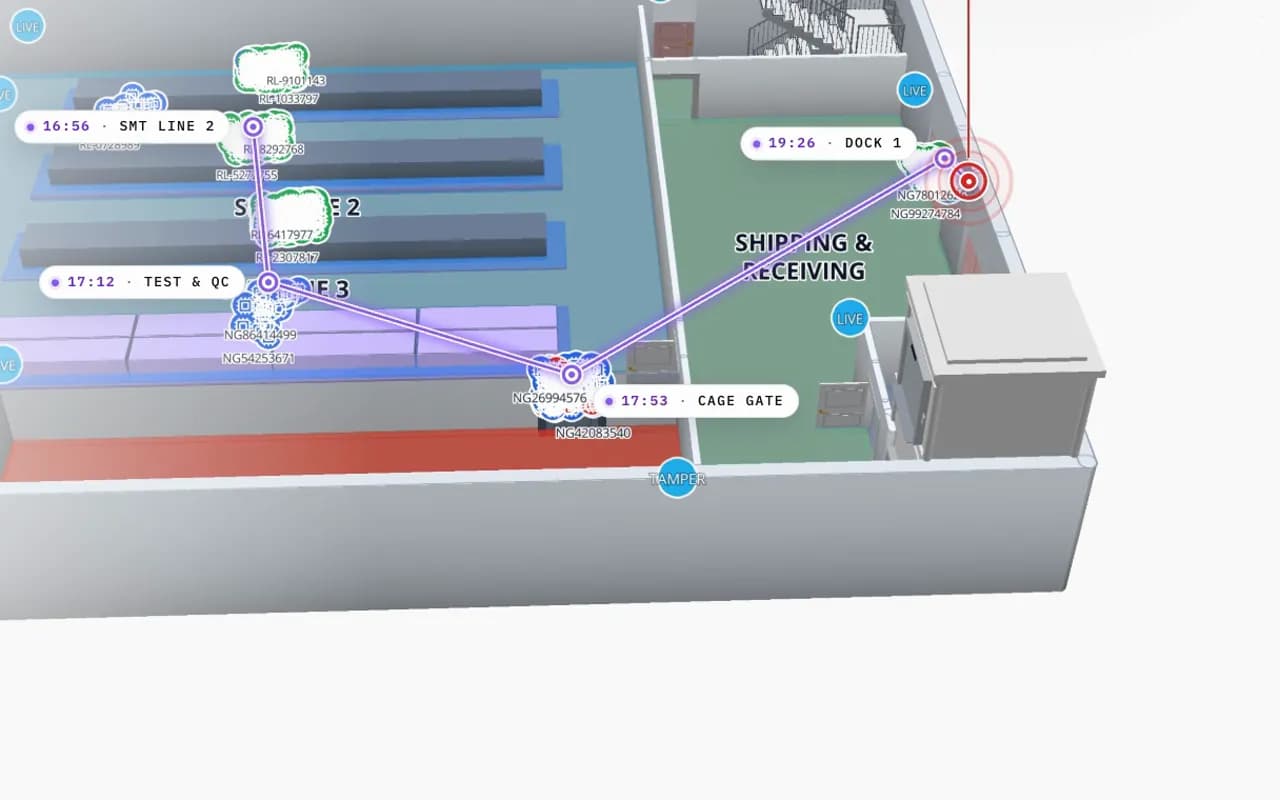
Northgate Electronics in 3D: an RFID read trail drawn from SMT line 2 through test and QC to the cage gate and dock 1, with the time of each read
Northgate Electronics — Assembly & Secure Store
Northgate Electronics (demo): one tagged unit’s read trail from SMT line 2 through test and QC to the cage gate and the dock, with the time of each read.

The BlueIOT connection, step by step

BlueIOT is the one UWB system with a built-in driver. An admin adds it from Integrations in the device connections wizard: server address and login, a connection test, the vendor maps linked to floors, rooms imported as areas, tags imported by name, and then Start. Spatial Map creates the tables, the map layer, reports and a starter set of alert rules for you. The connection runs in the cloud, or through the on-site agent, a small program on a PC in the same network as the vendor server. It makes outbound HTTPS connections only, opens no ports, keeps data on disk if the link drops, and shows Online and a last heartbeat.

From then on, tags move live on the map, each with the room it is in. Spatial Map keeps room visits with dwell times, mirrors the vendor’s alarms (SOS, low battery, tag lost, anchor offline) as in-app alerts, and shows anchor status. Alerts are delivered in the app only, with no email, SMS or push.

How much history is stored

A UWB tag can report several times a second, which is more than a history table needs. By default the connection stores a position only when the tag has moved more than 0.5 m, every 10 seconds while it is on, or when it changes room, whichever comes first. These defaults are set per connection, so a safety application can store more and a bulk-asset one less. The live marker still follows the engine; the thinning only applies to the stored trail used by the History player and reports.

Other UWB vendors, and where Spatial Map stops

Only BlueIOT has a built-in driver today. A different UWB or RTLS engine (such as Sewio, Quuppa or Pozyx) connects by posting rows to a table through the write API or through REST polling, with the coordinate conversion done in the relay or by the calibration above. There is no MQTT input yet. Spatial Map does not compute positions, does not talk to anchors or tags, and writes nothing back to the vendor system. If you need a relay built, that is custom development. If you need anchors and tags, we source UWB hardware for a project: see UWB anchors and tags.

What each part does in a UWB deployment

PartWho provides itRole in the project
TagsYour UWB vendorWorn by people or fixed to vehicles and assets
AnchorsYour UWB vendorMounted at surveyed positions to hear the tags
Location engineYour UWB vendorComputes x/y, height and sometimes room, from the timings
Vendor map and coordinate frameYour UWB vendorThe coordinate system the engine reports in
Map, calibration, roomsSpatial MapAligns the vendor frame to your floor plan, lands tags in rooms
History, visits, alerts, reportsSpatial MapTrails, dwell, alarms in the app, reports and share links

The on-site agent only carries the data. Positions are always computed by the vendor’s engine, never by Spatial Map.

How Spatial Map does it

UWB tags on a map in five steps

  1. 01

    Map the floor

    Import your floor plan into Spatial Map and trace rooms, doors and racks, or let AI Map draft them for you to review.

  2. 02

    Connect the engine

    Add a BlueIOT connection from Integrations, enter the server address and login, and run the connection test.

  3. 03

    Link the maps

    Import the vendor map or calibrate with two or three points, then import the vendor’s rooms as areas.

  4. 04

    Import the tags

    Bring in tag names from the vendor, a CSV, or by typing them inline.

  5. 05

    Start

    Spatial Map creates tables, a layer, reports and alert rules, and tags begin to move.

Where UWB positions earn their cost

Yards and cross-docks

Yard tractors and pallets through gates, dock doors and sortation lanes.

Assembly lines

Carriers and forklifts between stations and QC, with dwell per area.

Fulfillment floors

Forklifts and pickers beside racks, staging lanes and dock doors.

Secure stores

Staff and high-value equipment through zones, with a trail for the incident report.

See it on real demo facilities

Fictional names, real floor plans, live sensors, RFID, BLE tags and gateways — open any of them in the browser.

All 13 demo facilities

UWB RTLS software — frequently asked questions

No. Your anchors and the vendor’s location engine compute x/y. Spatial Map aligns that coordinate system to your floor plan and shows tags on a 3D map with their room, history and alerts.

BlueIOT has a built-in driver. Other engines connect by posting rows to a table through the write API or by REST polling. There are no other built-in vendor drivers and no MQTT yet.

UWB is generally known for sub-metre accuracy in published specifications, finer than typical BLE setups. The result in your building depends on the vendor, the anchor layout, line of sight and the tags, so pilot with real tags before you plan around a number.

Import the vendor’s map (BlueIOT), or calibrate with two or three points that you click on the floor and type in from the vendor system, or use latitude and longitude if the vendor sends them. Spatial Map shows the fit error for calibration.

By default a position is stored when the tag has moved more than 0.5 m, every 10 seconds, or when it changes room. The defaults are set per connection. The live marker still follows the engine.

Only when the vendor server is on a local network that the cloud cannot reach. The agent runs on a PC on that network, uses outbound HTTPS only, opens no ports and buffers to disk if the link drops.

A 7-day free trial covers up to 5 facilities with no credit card. Pro is $60 a month or $600 a year for up to 4 facilities. Hardware, relays and larger estates are quoted per project as custom services or custom development.

Put your UWB tags on a map of your building.

Start a free trial and open the Eastport demo, or send us a floor plan and a few tag names from your UWB system and we will help you connect it.