Taipei · Taoyuan airport, Taipei Main Station, Nangang and Neihu

Indoor mapping in Taipei, from the airport train to the exhibition hall

Spatial Map turns floor plans into live 3D maps in the browser, with routes between floors, tables of live data and read-only links for visitors and contractors. Indoor mapping in Taipei is a question of connections: an airport 40 km away reached by a dedicated train, a station that joins four rail and metro networks to underground malls, exhibition halls at the end of two metro lines, and office parks where hundreds of tenants share a handful of lobbies. A map of each building, with the lifts and passageways drawn in, is what visitors and facilities teams need.

No credit card. Runs in the browser. Pro is $60/month for up to 4 facilities. Book a demo

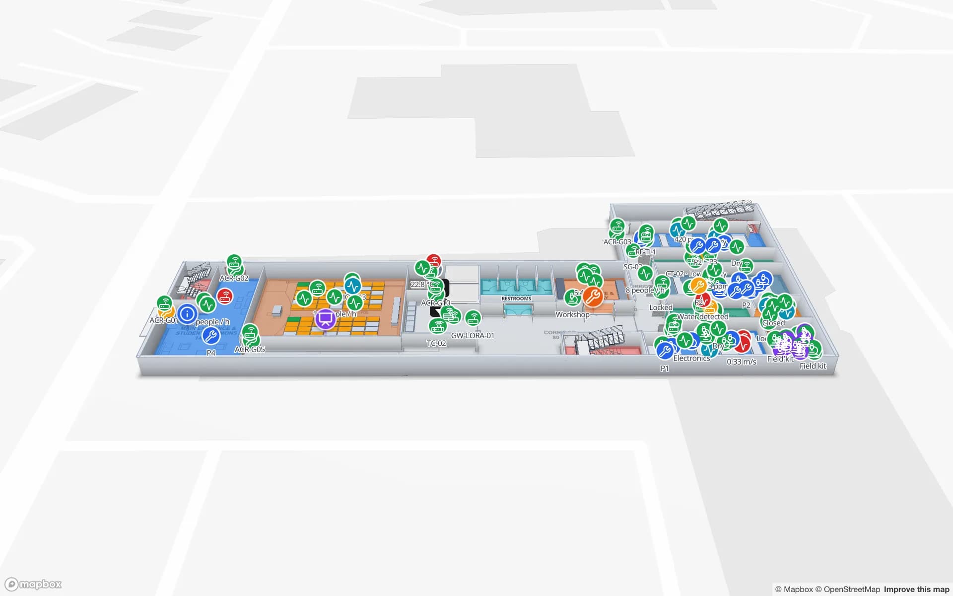
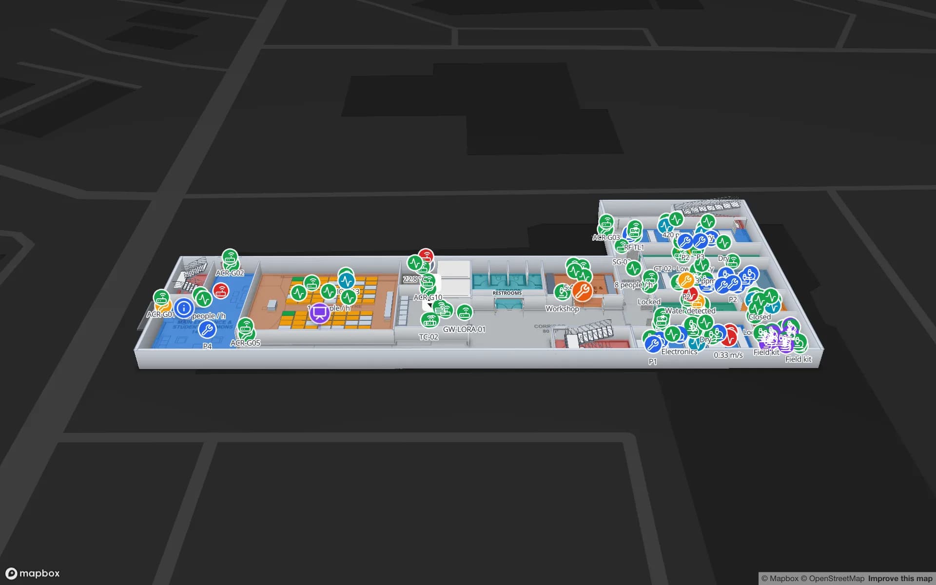
Lakeside Convention Center, a convention center demo, in the Spatial Map 3D viewer with live device markers
Lakeside Convention Center
Lakeside Convention Center, a demo venue: two floors of halls with booth blocks, session rooms, registration and freight docks.
Floors in the Lakeside convention and Silverbay airport demos
2
Route types in wayfinding: Fastest, Step-free and Other
3
Interface languages, including Chinese
6
Free trial, up to 5 facilities, no credit card
7 days

Taoyuan airport and the train into town

Taiwan Taoyuan International Airport lies about 40 km west of Taipei. The Airport MRT began commercial service on 2 March 2017 with Taipei Main Station (A1) as its city end, and in-town check-in is offered at that station and at New Taipei Industrial Park (A3); express trains take 35 to 37 minutes. On the airport side, Customs describes the Taoyuan Aviation Free Trade Port Zone as 34.85 hectares on the north side of the airport, with roadway links to the aircraft aprons.

A terminal is a building where getting lost costs money, and a map with floors, lifts, escalators and gates helps staff and contractors as much as passengers. Draw each level, mark the lifts and escalators, and the indoor wayfinding tool routes across floors with Fastest and Step-free options and walking minutes. Spatial Map does not show a visitor’s own position (no blue dot); the route is from a place you choose. The Silverbay airport demo shows a two-floor terminal with check-in, security, gates and baggage reclaim.


Taipei Main Station and its underground malls

Taipei Main Station is served by Taiwan Railway, Taiwan High Speed Rail, the Taipei Metro, which opened on 28 March 1996 and is owned by the Taipei City Government, and the Airport MRT, and it sits with five connected underground malls. Sources give different lengths for those malls, and the passageways between them have more than one exit to the street, which is exactly why people ask for directions.

For facilities teams the useful map is not the postcard but the plan: which passageway is closed for works, which lift serves which concourse, where the nearest step-free exit is. Place the drawing level by level, add doors and lifts, and publish a read-only share link that locks one floor and one set of layers for a contractor or event team, with an expiry date and no account. The post on wayfinding in airports and malls covers what to draw first, and the shopping-mall page lists the layers that matter.

Nangang: exhibition halls at the end of two metro lines

Taipei Nangang Exhibition Center opened in 2008 and has halls on two floors; a second hall was completed in 2019. The Nangang Exhibition Center station is the terminus of both the Wenhu and Bannan lines, so visitors, exhibitors and freight crews arrive by two very different routes at the same building. Hall-space figures differ between sources, so we quote none.

During a trade show the operations questions are the same everywhere: which hall is full, which booth block is still being built, which loading dock is booked, which lift is out of service. Spatial Map draws the halls, booth blocks, session rooms and docks, and colours them from your booking, badge or counter data; the Lakeside Convention demo shows exactly this across two floors. Read-only links give an exhibitor or a freight contractor one hall with chosen layers and an expiry date. See stadiums and venues for the layers.

Neihu, Nangang and the office-park building

Neihu Technology Park was established in 2001 and is described as the first municipal high-tech park in Taiwan, developed by private enterprises with Taipei City Government support. Nangang Software Park sits in the 87-hectare Nangang Trade and Economic Park, and together the two parks hold nearly one-third of the corporate headquarters and R&D centres in Taipei City, according to the city’s investment agency. Semiconductor parks lie elsewhere on the island and are covered on the Taiwan page.

Inside these buildings the problem is shared space: floors let to different tenants, meeting rooms, labs, storage cages, equipment loaned between teams and visitors who need to find the right lobby. The Harborview demo shows a three-floor office with an asset register, meeting rooms and stores on one plan, and the Westbrook demo shows a campus science building with lab bookings and controlled-access doors, which is a useful model for university and research buildings. See campuses and offices.

Services for teams in Taipei

Taipei teams usually begin with one of these:

  • Building owners, venue operators and campus facilities teams start with indoor maps and wayfinding, because they need a drawing before any device exists.
  • Offices and labs add asset tracking for shared equipment, meeting rooms and storage cages.
  • Event and logistics teams around the airport add inventory tracking for freight and crates.
  • RTLS and UWB is for places where people or equipment must be located continuously; it is rarely the first step.
  • If you need readers, beacons or tags, our team can source them on request, quoted per project, with warranty and device support from the manufacturer: see hardware and demo kits on request. Our team also builds custom software, such as booking systems for rooms and equipment, as client projects. The product runs as cloud or on-premises.

Also served nearby

The same approach covers New Taipei City (Banqiao, Xinzhuang and Zhonghe), Keelung and Taoyuan, including logistics buildings near the airport. Nothing needs to be installed: the map opens in a browser.

How Spatial Map does it

From the paper plan to a published map

  1. 01

    Pick one building

    A terminal area, a station concourse, a hall or an office block in Neihu or Nangang.

  2. 02

    Upload the floor plans

    PDF, DWG (AutoCAD R2004–R2018, placed as a picture) or image, aligned at real scale; AI Map drafts walls, doors, stairs and lifts for a person to review.

  3. 03

    Add routes and data

    Stairs, lifts and escalators give routes across floors; booking, counter or asset rows arrive through the write API or uploads.

  4. 04

    Share it

    Read-only links with expiry, floor lock and chosen layers for contractors, exhibitors and visiting teams.

What Taipei teams map

Terminals and concourses

Floors, gates, lifts and step-free routes for staff and contractors.

Exhibition halls

Halls, booth blocks, session rooms and freight docks with live status.

Office floors and shared equipment

Asset register, meeting rooms, stores and equipment check-out.

Campus laboratories

Labs, timetables, controlled doors and chemical stores on one plan.

See it on real demo facilities

Fictional names, real floor plans, live sensors, RFID, BLE tags and gateways — open any of them in the browser.

All 13 demo facilities

Indoor mapping in Taipei — questions we get

Yes, as plans you upload. Each level is a floor, and doors, lifts, escalators and stairs give routes between them. Keep in mind that Spatial Map draws from your drawings, so a passageway that is not on the plan is not on the map until someone adds it.

No. There is no blue dot or visitor positioning. Wayfinding gives a route from a start point you choose to a destination, with Fastest, Step-free and Other options, turn-by-turn steps and walking minutes.

Only what changed. Re-upload the plan, run AI Map on just that area, and review the drafts before adding them; booth blocks are shapes you edit, and booking data from a table colours them.

Yes, among six languages, and each user picks their own. Check in the free trial that the script fits your team. Room names, booth numbers and report titles are your own text and can be in any script.

No. Spatial Map is sold online and our team works with customers in Taiwan remotely, by video call and through the contact form. There are no local resellers or partners.

In US dollars, the same worldwide: a 7-day free trial for up to 5 facilities with no credit card, then Pro at $60 a month or $600 a year for up to 4 facilities. Hardware, if you ask us to source it, is quoted per project.

Map one Taipei building before the next event.

Start the free trial and open the Lakeside and Silverbay demos, or send us a floor plan of a terminal area, hall or office floor through the contact form.