

Seville · FIBES, La Cartuja, Aerópolis, the river port

Indoor mapping in Seville, for venues that fill and empty in a day

Spatial Map is browser-based indoor mapping software: it turns a floor plan into a 3D map of every floor, with rooms, doors, lifts and stairs, and puts live data on top. Indoor mapping in Seville starts with a city that runs on events and on a few large sites: an exhibition centre, a stadium on an island in the river, an aerospace park beside the airport and a river port. Each one is its own facility, the plans behind them are of every age, and the app speaks Spanish for the team on the ground.

No credit card. Runs in the browser. Pro is $60/month for up to 4 facilities. Book a demo

Lakeside Convention Center, a convention center demo, in the Spatial Map 3D viewer with live device markers
Lakeside Convention Center
Lakeside Convention Center, a demo two-floor venue: exhibition halls with booth blocks, session rooms, registration and loading docks, with live crowd and occupancy.
Floors in the Lakeside convention-centre demo
2
Seats in the Crown Park stadium demo
30,513
Spanish interface, alongside English, French, German, Arabic and Chinese
Español
Free trial, up to 5 facilities, no card
7 days

FIBES: two large areas and a catwalk between them

FIBES, the Seville Conference and Exhibition Centre, describes itself as 50,000 m² of space, with two large areas of different character joined by an exhibition catwalk, and as operating since 1989. Its programme mixes trade fairs, congresses, concerts and consumer shows, so the same hall can be a trade-fair floor one weekend and a seated auditorium the next.

That is the case for one facility per layout. Draw the hall as booth blocks for a fair, duplicate it for the concert set-up, and keep each version separate so organisers, contractors and security are not working from last month’s drawing. The Lakeside demo shows what an event site looks like on the map: halls with booth blocks, session rooms, registration and loading docks, with occupancy per hall and bookings per room. A read-only share link with a floor lock and an expiry date lets a stand-builder open the map on a phone without an account. Spatial Map does not sell tickets or scan badges itself; it shows the data your systems already produce.
La Cartuja: a stadium on an island

Estadio La Cartuja stands on the Isla de la Cartuja and opened on 5 May 1999 with 57,600 seats; its own pages say it was later enlarged and give different seat counts in different places, so we quote none. The operator describes it as a multi-purpose venue for sport, music and corporate events, holding UEFA’s highest “Elite Stadium” category, and with a business centre of more than 25,000 m² in the same complex.

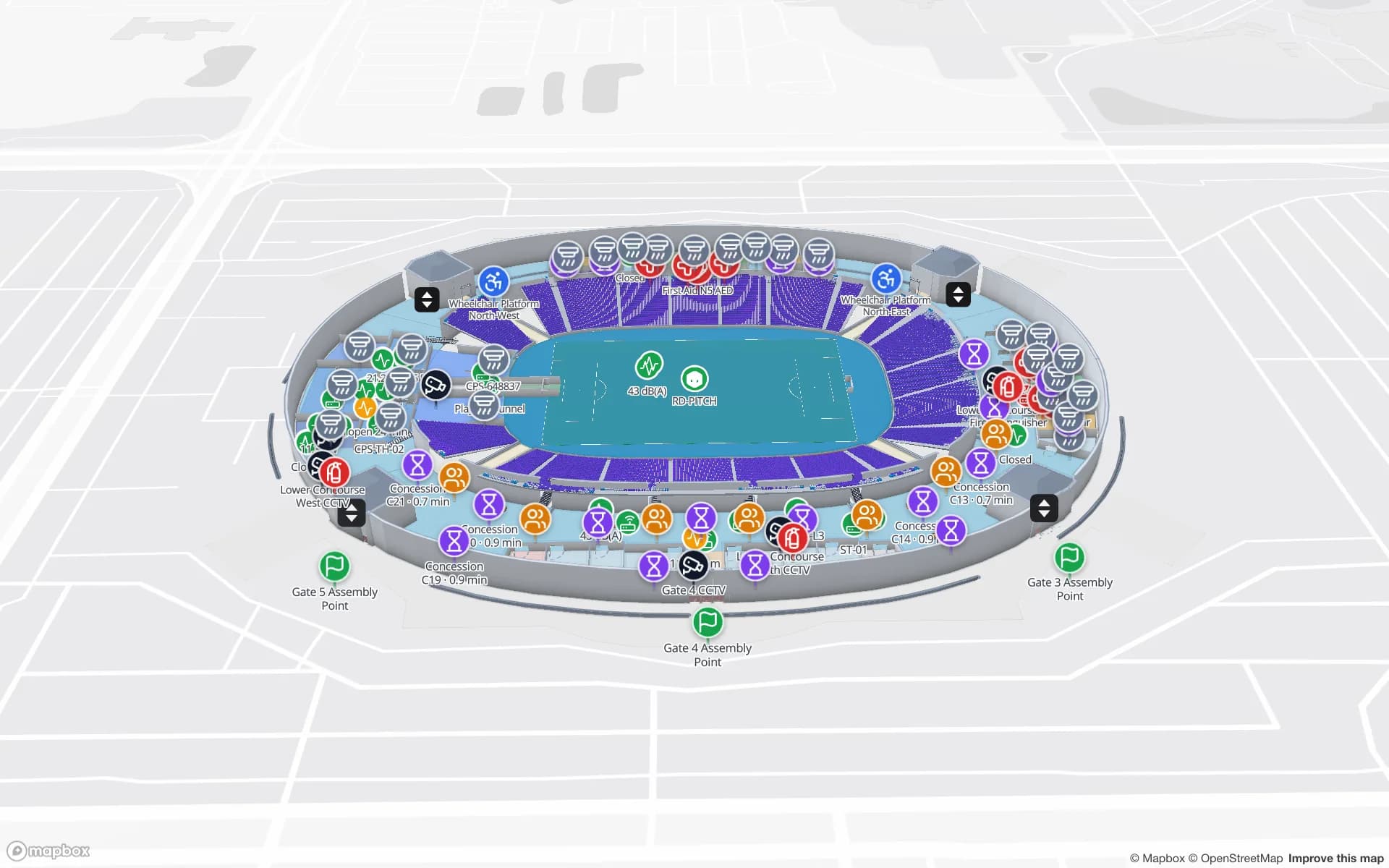
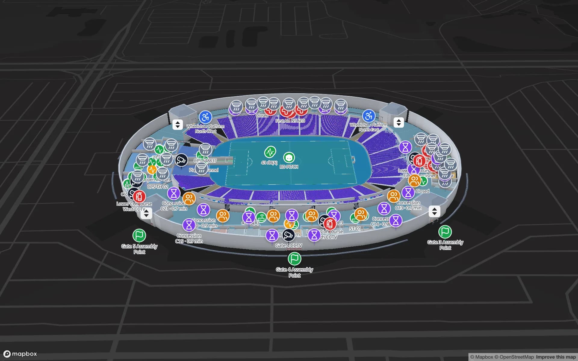
On an event day the operations questions are the same as anywhere: which gates are filling, where the queues are, where stewards and carts are, which counters or devices have gone quiet. The Crown Park demo draws 30,513 seats as rack cells, with turnstile scans, crowd counters, concession sales and crews on one live map, and indoor mapping for stadiums and venues explains the pattern. Wayfinding builds walking routes around walls and through doors for crews and contractors; it does not show a blue dot, because Spatial Map does not locate phones.

Aerópolis: an aerospace park with its own floor plans

Aerópolis, the Andalusian Aerospace Technology Park at La Rinconada, says it hosts more than 90 aerospace and technology companies. It sits next to Seville Airport, 15 minutes from the city centre by motorway, and is run by a management company attached to Andalusian government departments. Its pages list the kinds of space on offer: an engineering and innovation centre, a business centre, a supplier village, industrial units, plots and event spaces.

A park like that is a set of buildings with shared services. Spatial Map can hold the park manager’s view, with the units, meeting rooms and event spaces as areas coloured by availability or booking, and each tenant’s own facility inside the same workspace, visible only to those it concerns through roles and share links. Inside a unit, the asset-tracking pattern from the Harborview demo applies: equipment, spares and meeting-room kit by floor. See indoor mapping for campuses and offices.

The river port: a sea port inland

Seville’s port is on the Guadalquivir and is generally described as Spain’s only commercial inland seaport. Ships reach it through a lock; a new lock opened in November 2010. The Centenario dock has a container terminal and a ro-ro ramp, and the Batán basin has a rail terminal. Sources differ on the distance from the sea, so we give none, and we could not reach the port authority’s own site on the day we checked, so read this section as general context.

Port-side sheds are ordinary warehouses with unusual neighbours. Map the doors and racks of each shed, mark the rail-side and truck doors separately, and put RFID or barcode reads at the doors that matter. Spatial Map does not connect to port, customs or terminal systems; it shows what your own scans say. Warehouse spaces and RFID warehouse management cover the building side.

Services for teams in Seville

Where Seville teams usually start depends on the building:

  • Venue and event teams start with indoor maps of each hall or stand layout and a live occupancy table, often before any hardware is bought.
  • Park and campus managers add a room and asset register, with meeting-room bookings, to the same plan.
  • Port-side and industrial operators move on to inventory tracking and asset tracking once the floor is mapped; RTLS and UWB matters only where people and vehicles must be located continuously.
  • If you have no readers, tags or beacons yet, our team can source devices on request, quoted per project, with warranty and device support from the manufacturer: see hardware and demo kits on request.
  • Where a connector or an in-house tool is missing, our team builds custom software such as POS or booking systems and integrations as client projects. The product runs as cloud or on-premises.

Also served nearby

The same page covers La Rinconada and Camas beside the river, Dos Hermanas and Alcalá de Guadaíra to the south and east, Mairena del Aljarafe on the western side, and Carmona and Utrera in the wider province. Nothing needs to be installed at any of them: the map opens in a browser.

How Spatial Map does it

From a scanned plan to a live Seville map

  1. 01

    Start with the plan you have

    A PDF, a DWG or a photo of a printed drawing. Align it to the street at real scale.

  2. 02

    Draw each floor

    Walls, doors, lifts, stairs and rooms, drafted by AI Map if you like and reviewed by a person.

  3. 03

    Keep one facility per layout

    Duplicate a hall or a unit when the layout changes between events or tenants.

  4. 04

    Connect a table and share

    Post occupancy, bookings or an asset register through the write API, then send a read-only link with an expiry date.

What Seville teams map

Exhibition halls and congress floors

Halls, stands, session rooms and loading docks with occupancy and bookings.

Stadium event operations

Gates, turnstiles, crowd counters, concessions and crews on one map.

Technology-park buildings

Units, meeting rooms and shared equipment by floor.

Port-side sheds and stores

Dock doors, rail-side doors and pallets staged for the right departure.

See it on real demo facilities

Fictional names, real floor plans, live sensors, RFID, BLE tags and gateways — open any of them in the browser.

All 13 demo facilities

Indoor mapping in Seville — questions we get

Yes. Upload the scan or a photo of the print, align it at real size against the street, and draw over it. AI Map can draft walls and rooms from the placed picture for a person to check, and our services team can also do the mapping remotely for a fixed price. Expect to correct door positions and room names by hand.

Yes. Each facility is its own map, and you can duplicate one when the hall layout changes between events. Read-only share links can lock a floor and carry an expiry date, so a contractor sees only what you choose.

No. Spatial Map plans routes between rooms across floors, with a step-free option and walking minutes, but it does not locate a phone. A blue dot needs a positioning system of its own.

No. It shows the data your own systems post through the write API, a polled REST endpoint or a CSV or Excel upload. It has no link to ticketing, access-control vendors, port or customs systems.

Yes. Spanish is available alongside English, French, German, Arabic and Chinese, and each user picks their own language. Hall names, stand numbers and report titles stay exactly as you write them, accents included.

No. Spatial Map is sold online and our team works with customers in Spain remotely, by video call and through the contact form, in Spanish or English. There are no local resellers or partners.

In US dollars, the same worldwide: a 7-day free trial for up to 5 facilities with no card, then Pro at $60 a month or $600 a year for up to 4 facilities. Larger estates are quoted as custom services.

Map one Seville hall before the next event.

Start the free trial in Spanish or English and open the Lakeside demo, or send us a scanned plan of a hall, stadium floor or park building through the contact form.






