Stockholm · Arlanda, Älvsjö, Solna and Hagastaden

Indoor mapping in Stockholm, from Arlanda to the lab corridors of Hagastaden

Spatial Map is browser-based indoor mapping software: it turns a floor plan into a 3D map of every floor, with rooms, doors, lifts and stairs, and puts live data from your own systems on top. Indoor mapping in Stockholm is mostly about big, busy buildings with many tenants and many floors — an international airport north of the city, an exhibition centre and arenas, and a life-science district that straddles the border with Solna — and each can be a facility of its own in one workspace.

No credit card. Runs in the browser. Pro is $60/month for up to 4 facilities. Book a demo

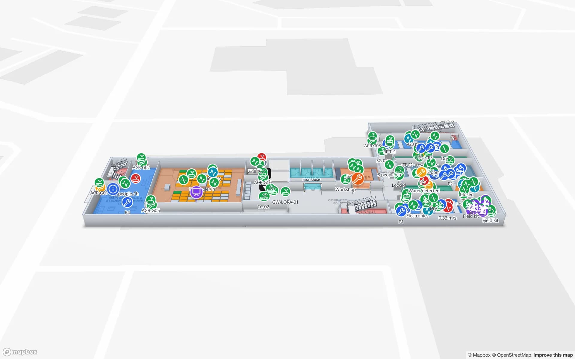
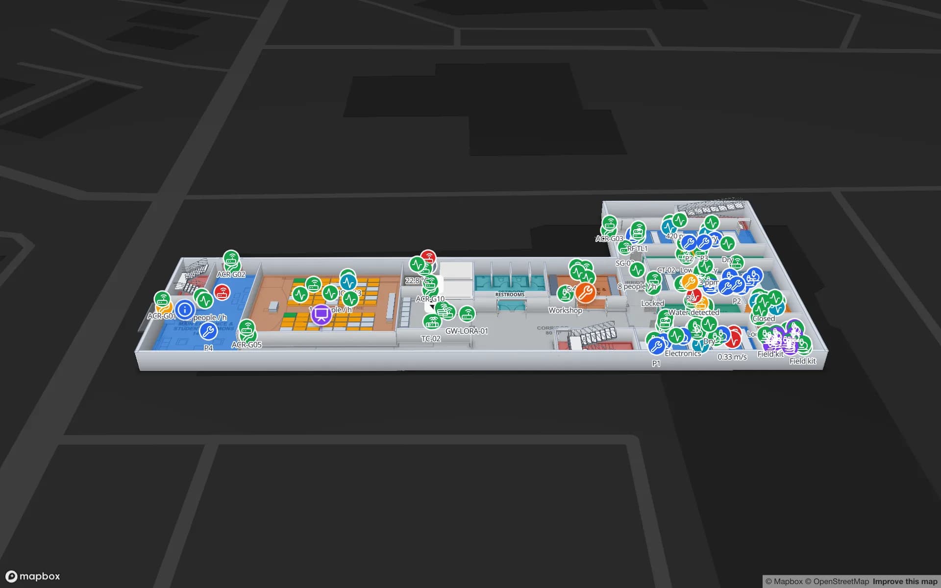
Lakeside Convention Center, a convention center demo, in the Spatial Map 3D viewer with live device markers
Lakeside Convention Center
Lakeside Convention Center, a demo venue: exhibition halls with booth blocks, session rooms, registration, food outlets and loading docks on two floors.
Floors in the Lakeside convention-centre demo
2
Floors in the Harborview office-campus demo
3
Seats drawn in the Crown Park stadium demo
30,000+
Free trial, up to 5 facilities, no card
7 days

Arlanda: terminals and a cargo area

Stockholm Arlanda’s passenger buildings include Terminals 4 and 5, and the airport operator describes the Stockholm region as the best location for deliveries to Scandinavia and the Baltic: from Arlanda all major Scandinavian destinations can be reached within two hours by air, and 24-hour distribution is possible throughout the Baltic Sea region. It also says Arlanda has the capacity for larger all-cargo aircraft and lists a Border Inspection Point at the airport that specialises in cold-chain logistics.

Indoor mapping helps the businesses working inside that setting, not the airport itself. A ground handler, a forwarder or a caterer can map its own shed: dock doors, staging lanes, cold rooms and the doors between airside and landside, with each lane coloured by what your system says is waiting. For a terminal-style building the Silverbay demo shows the pattern: check-in islands, security lanes, gates and baggage reclaim on two floors, with lifts, escalators and stairs in place. Spatial Map is independent of the airport operator and its systems; it shows only what your own team sends, and airport indoor mapping covers the general case.


Exhibition halls and arenas: layouts that change every week

The exhibition and congress centre in Älvsjö was inaugurated in 1971 with two halls and about 20,300 square metres; after its 2009 extension the centre gives its total floor space as 70,000 square metres and calls itself the largest exhibition and congress centre in the Nordic region. Elsewhere, Visit Stockholm gives the arena in the suburb of Solna a capacity of 75,000 attendees and the spherical Avicii Arena 16,000.

A venue like that has a fixed shell and a floor that is rebuilt for every event. Draw the shell once — halls, lifts, doors, loading docks — and draw each event’s booth blocks as areas that a table colours by booking or build status; crates tagged with RFID or BLE show up between the dock and the stand. The Lakeside demo shows booths, session rooms, registration and freight bookings, and the Crown Park demo shows gates and a 30,000-seat bowl. For visitors, the wayfinding tool plans a route across floors with Fastest and Step-free options and shares it as a read-only link — there is no live blue dot.

Hagastaden and the Stockholm–Uppsala life-science buildings

Stockholm Science City Foundation, founded in 1990 and funded by Karolinska Institutet, KTH and Stockholm University with the City of Stockholm and Region Stockholm, calls Hagastaden a leading life-science innovation district; a shared vision for the area was signed in 2007. The wider Stockholm–Uppsala cluster, which Region Stockholm brands Capital of Life, counts five universities and “more than a thousand life science companies from start-ups to global actors”; its actors agreed a joint memorandum of understanding in June 2024.

Buildings in a district like that are dense: teaching rooms, wet labs, cold rooms, instrument bays and loading docks stacked over many floors, with equipment shared between groups. A map answers practical questions — which floor is the freezer on, which room has a sensor out of range, where is the shared centrifuge booked — and a read-only link lets a visiting engineer see one floor without an account. The Westbrook demo shows lab equipment bookings, lab-environment readings and chemical stores on two floors, and the Polar Pharma demo shows cold rooms and temperature zones. Spatial Map makes no compliance claim: your quality system remains the record.

Office campuses: rooms, equipment and step-free routes

Office and campus buildings in Stockholm change tenants and layouts often, and the drawings are usually a PDF from an architect or a DWG from a property manager. Upload either (a DWG, AutoCAD R2004–R2018, is placed as a picture), align it to real scale and let AI Map draft walls, doors, rooms and lifts for a person to review; AI Map is available on paid plans and the trial, with a monthly limit. Then colour rooms by booking, occupancy or sensor readings from your own tables, and give contractors a share link that opens on one floor and expires.

The Harborview demo is a three-floor office building with an asset register, equipment check-out, stores and spares, work orders and meeting rooms. Heatmaps of occupancy stop at walls and closed doors, which makes a quiet floor easy to see. See campus and office indoor mapping for more.

Services for teams in Stockholm

Where Stockholm teams usually start depends on the building:

  • Venue and facility managers start with indoor maps of the shell and one event layout, then colour rooms by live status.
  • Airport-area handlers and forwarders usually add inventory tracking at dock doors and cold rooms before anything else.
  • Laboratories and research buildings begin with asset tracking for shared instruments and a temperature monitoring view of cold rooms.
  • RTLS and UWB is for the few buildings where people or vehicles must be located continuously; a BlueIOT server connects directly and other engines through the table write API.
  • If you have no readers, tags or sensors yet, our team can source devices on request, quoted per project, with warranty from the manufacturer: see hardware and demo kits on request. Booking, visitor or event-registration systems can be built as client projects — see custom software development — and the product runs as cloud or on-premises.

Also served nearby

The same page covers Solna, Sundbyberg and Kista, Märsta and Sigtuna beside Arlanda, Södertälje to the south and Uppsala to the north. Nothing needs installing at any of them: the map opens in a browser, and the interface is in English — names like Älvsjö, Hagastaden or a room called “Förråd” stay exactly as you type them.

How Spatial Map does it

From a drawing to a live Stockholm building map

  1. 01

    Pick one building

    A hall, a terminal-side shed, a lab block or an office floor plate — wherever finding things costs most.

  2. 02

    Import and align the plan

    Upload the PDF, DWG or image, place it at real scale, and let AI Map draft walls, doors, rooms and lifts for review.

  3. 03

    Connect your data

    Bookings, sensors and assets arrive through the table write API, a polled REST endpoint or CSV and Excel uploads.

  4. 04

    Share and alert

    Read-only links for contractors and visitors, and in-app alert rules for rooms over capacity or readers that went quiet.

What Stockholm teams map

Exhibition and arena operations

Halls, gates, booth blocks and loading docks, with crowd counters and freight bookings on one map.

Terminal and airside operations

Zones coloured by crowding, lifts and escalators in place, and routes across floors.

Lab and research buildings

Shared equipment, lab-environment readings and chemical stores by room.

Office campuses

Asset register, equipment check-out and meeting rooms across floors.

See it on real demo facilities

Fictional names, real floor plans, live sensors, RFID, BLE tags and gateways — open any of them in the browser.

All 13 demo facilities

Indoor mapping in Stockholm — questions we get

No. It has no link to airport, airline or border systems. It shows what happens inside a building you operate, from your own tables, sensors and readers, so it complements the airport’s own systems rather than replacing them.

No. Draw the hall shell, doors, lifts and docks once, then draw each event’s booth blocks as areas and colour them from a booking table. When the next event moves in, change the table and the booth areas; the shell stays.

Yes. A read-only share link can be limited to chosen layers and locked to one floor, with an expiry date and a view cap. Tags and sensors on the link move live.

No. The interface is available in English, German, French, Spanish, Arabic and Chinese, so Swedish teams use it in English. Room names, report titles and table contents are yours and can be in Swedish, å, ä and ö included.

No. Spatial Map is sold online and our team works with customers in Sweden remotely, by video call and through the contact form. There are no local resellers or partners.

In US dollars, the same worldwide: a 7-day free trial for up to 5 facilities with no card, then Pro at $60 a month or $600 a year for up to 4 facilities. Larger estates are quoted as custom services; hardware, if you ask us to source it, is quoted per project.

Map one Stockholm building before the next event.

Start the free trial and open the Lakeside demo, or send us the plan of a hall, a lab floor or a terminal-side shed through the contact form.