

Ankara · OSTİM, Esenboğa, Söğütözü and the station

Indoor mapping in Ankara: workshops, halls, arenas and the airport apron

Spatial Map is browser-based indoor mapping software: it turns the floor plan of a building into a 3D map of every floor, with rooms, doors, lifts and stairs, and puts live data on top. Indoor mapping in Ankara covers a different set of buildings from Istanbul’s warehouse belts: the small workshops and plants of OSTİM, an airport that has just added a cargo apron, convention halls and arenas, and a station with a new concourse built over the old one. Each is its own facility, and one workspace can hold them all.

No credit card. Runs in the browser. Pro is $60/month for up to 4 facilities. Book a demo

Lakeside Convention Center, a convention center demo, in the Spatial Map 3D viewer with live device markers
Lakeside Convention Center
Lakeside Convention Center, a demo venue: exhibition halls, booths, session rooms, a plenary auditorium, registration and the loading docks on two floors.
Floors in the Lakeside convention demo
2
Seats drawn in the Crown Park stadium demo
30,513
Floors in the Production Museum demo
3
Free trial, up to 5 facilities, no card
7 days

OSTİM: a workshop district that became an industrial city

OSTİM describes itself in its own brochure as an industrial city on an open area of about 5 million square metres in the north-west of Ankara. Its history is that of a cooperative: it began in 1967 as a small industrial-site construction cooperative with 1,748 members and was granted the status of an organised industrial zone in 1998. Counts of the companies inside it differ from source to source, so the useful picture is simply a very large number of small and mid-sized units, many of them built plot by plot over decades.

That is the awkward case for any plan: a workshop extended twice, a mezzanine added without a drawing, a unit whose only plan is a municipal blueprint. Upload what exists, whether a PDF, a DWG (AutoCAD R2004–R2018, placed as a picture), a scan or a photograph, align it at real scale and let AI Map draft walls, doors, racks and areas for a person to review. AI Map is available on paid plans and the trial, with a monthly limit. The Summit demo shows lines, workstations and 867 rack locations on one plant map, and factory indoor mapping explains the layers. Some plants in a capital hold sensitive drawings; Spatial Map names none and makes no claim about any standard, but it does let you limit who sees a plan, as the FAQ below explains.
Esenboğa: a bigger airfield, and the buildings that serve it

The operator’s release says the first phase of the Esenboğa expansion, worth EUR 230 million and inaugurated in January 2026, added a third runway of 3,750 by 75 metres, a 77-metre control tower, a 27,000-square-metre taxiway and an 85,000-square-metre cargo apron with six aircraft positions. The same release puts the airport at about 13.99 million passengers in 2025, with direct flights to 79 destinations, 46 of them international.

An apron is outdoors, but what feeds it is indoors: a terminal, cargo sheds, cold rooms, bonded stores and the offices around them. Spatial Map draws each of those as a facility, with check-in, gates, lifts and escalators in a terminal and with dock doors and build-up areas in a shed. The Silverbay demo shows two terminal floors with security lanes, gates and baggage reclaim, coloured by crowding from your counters. It is a tool for the operations team, not a passenger app: it has no blue dot and no mobile app. Airport indoor mapping covers the general case. Spatial Map is independent of the airport and reads only data your own team sends.

Söğütözü convention halls and the city’s arenas

Ankara hosts fairs, congresses and matches in buildings that were built for them. The convention and exhibition centre in Söğütözü, in Çankaya, belongs to the Ankara Trade Chamber; one listing gives it 80,000 square metres in total, 10,000 square metres of ground-floor exhibition space and an auditorium of 3,107 seats. Ankara Arena, opened in April 2010 for the FIBA World Championship, is listed with 10,400 seats. For event staff, what matters on the day is which hall is filling up, which booth is still closed and where a freight crate has been left.

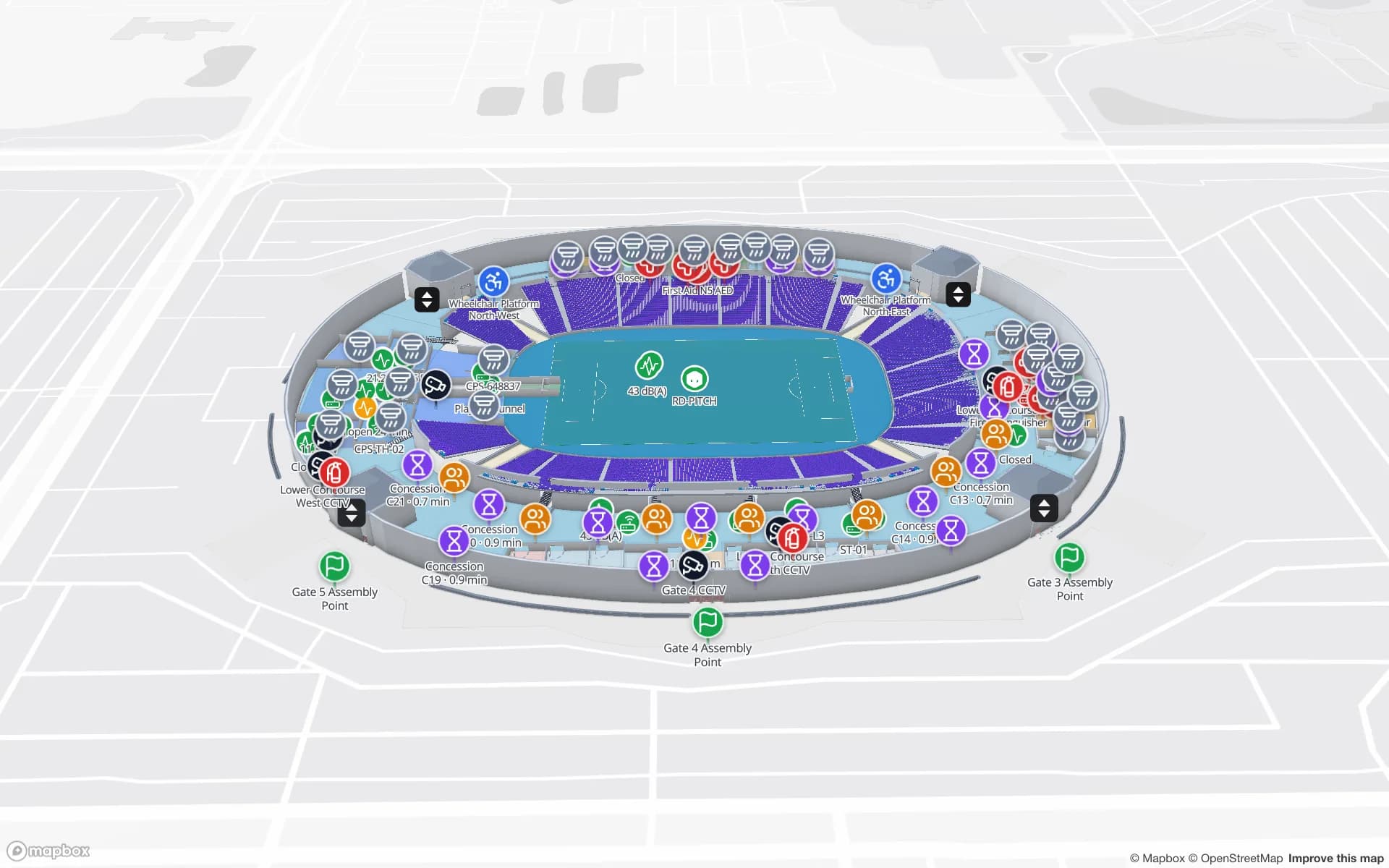
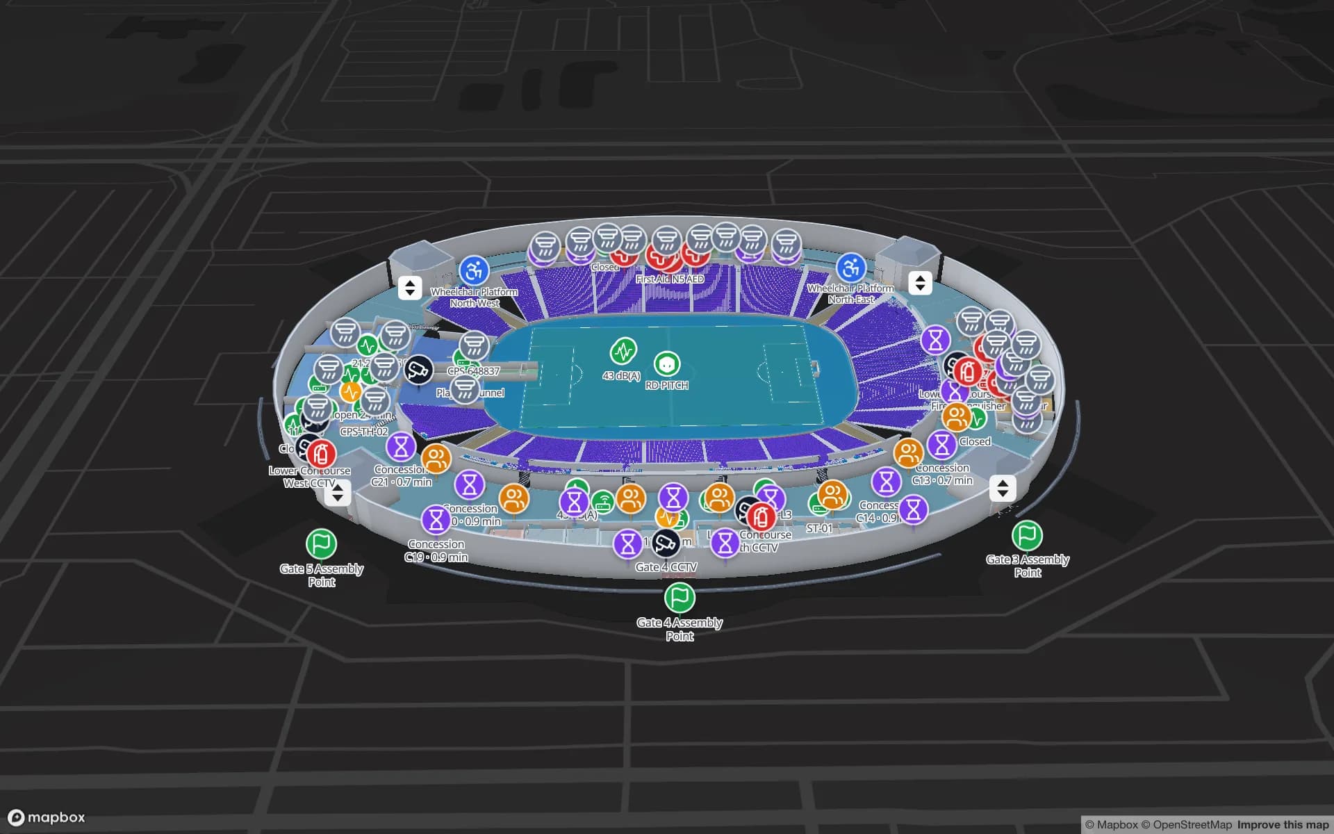
The Lakeside demo shows exactly that layout: exhibition halls with booth blocks, session rooms, a plenary auditorium, registration and loading docks, with occupancy from your counters and bookings from your tables. For a stadium or arena the Crown Park demo draws 30,513 seats as cells in seating sections, with gates, turnstiles and crowd counters. See stadium and venue indoor mapping. A heatmap of counter readings stops at walls and closed doors and is shown one floor at a time, which suits halls on two levels.

The station concourse and routes across floors

Ankara railway station opened in 1892 and its present Art Deco building dates from 1937. In 2016 a new building was opened above the high-speed (YHT) platforms, with its own concourse and a skybridge to the older station, and the Başkentray commuter line was reopened in April 2018. Interchanges like this are where people ask for the lift, the way between platforms and the step-free route.

Spatial Map’s wayfinding plans routes across floors through stairs, lifts and escalators, with Fastest, Step-free and Other route options, turn-by-turn steps and walking minutes, and shows them in the browser, including on read-only share links. It does not show a live position and it is not a transit journey planner. For malls attached to stations and for museums, the Production Museum demo shows three floors of galleries with visitor counters and climate sensors.

Services for teams in Ankara

Ankara teams usually begin with the map and add data afterwards:

  • Venue, campus and building managers start with indoor maps from drawings they already hold, then colour rooms and halls from a table of bookings or counts.
  • Workshops and plants in OSTİM add asset tracking for moulds, gauges and portable tools, and inventory tracking for finished goods.
  • RTLS and UWB matters mainly for large, busy sites where vehicles and people must be located continuously; most buildings will not need it first.
  • If you want devices to test with, our team can source RFID, BLE and UWB hardware and demo kits on request, quoted per project, with manufacturer warranty: see hardware and demo kits on request.
  • Room, hall and desk booking is a common request in venues and campuses; our team builds booking systems and other custom software as client projects. The product runs as cloud or on-premises.

Also served nearby

The same approach covers Sincan, Etimesgut and Gölbaşı around the capital, and the plants and warehouses along the roads out of Ankara. Nothing needs to be installed at any of them: the map opens in a browser.

How Spatial Map does it

Mapping an Ankara building

  1. 01

    Start from what you have

    A PDF, a DWG (AutoCAD R2004–R2018, placed as a picture), a scan or a photographed plan, aligned at real scale.

  2. 02

    Let AI Map draft, then check

    Walls, doors, labels, stairs, lifts and escalators are drafted for a person to review and add.

  3. 03

    Colour areas from your tables

    Halls, workshops and rooms take colour from bookings, counts or readings you upload or post through the write API.

  4. 04

    Share only what each person needs

    Read-only links with expiry, view caps, floor lock and layer choice, or a self-hosted copy where data must stay inside.

Where Ankara teams start

Convention halls and fairs

Hall occupancy, booth status, session rooms and freight at the docks.

Arenas and stadiums

Gates, turnstiles, crowd counters and seating sections on one map.

Airport terminals and cargo sheds

Zones coloured by crowding, gates, lifts and escalators in place.

OSTİM workshops and plants

Lines, racks and portable tools drawn from whatever plan survives.

See it on real demo facilities

Fictional names, real floor plans, live sensors, RFID, BLE tags and gateways — open any of them in the browser.

All 13 demo facilities

Indoor mapping in Ankara — questions we get

Yes. Upload the photo or scan and align it at real size, or sketch the outer walls and racks and photograph the sketch. AI Map can draft from the picture, and you correct what it gets wrong. Our services team can also do the mapping remotely for a fixed price.

The buildings can: terminal floors, cargo sheds, cold rooms and bonded stores are drawn from their plans like any other facility. Spatial Map does not connect to the airport’s, customs or air-traffic systems, and it does not draw aircraft positions; it shows what your own team’s data says about your own building.

Yes, by self-hosting the MIT-licensed open-source edition with Docker Compose, or by a hybrid setup with an on-site agent beside your devices. In the cloud, access is limited to named members with roles, and share links can expire and be locked to chosen floors and layers. We make no certification claim; check your own requirements.

No live position. Spatial Map plans routes across floors, with Fastest, Step-free and Other route options and walking minutes, and shows them in the browser, for example on a share link. It has no blue-dot visitor positioning and no mobile app.

Not yet. The app is available in English, Arabic, Chinese, French, German and Spanish, and each user picks their own. Your own room names, rack codes and report titles can be written in Turkish, with Turkish characters.

No. Spatial Map is sold online and our team works with customers in Türkiye remotely, by video call and through the contact form. There are no local resellers or partners.

In US dollars, the same worldwide: a 7-day free trial for up to 5 facilities with no card, then Pro at $60 a month or $600 a year for up to 4 facilities. Larger estates are quoted as custom services.

Map one Ankara floor from the plan you already have.

Start the free trial and let AI Map draft a floor of a workshop, hall or terminal, or send us the drawings through the contact form.





