Lisbon · the airport, Parque das Nações, the congress centre and Belém

Indoor mapping in Lisbon, from the terminal to the oldest drawing

Spatial Map is browser-based indoor mapping software: it turns a floor plan, even a scanned one, into a 3D map of every floor, with rooms, doors, lifts and stairs, and puts live data on top. Indoor mapping in Lisbon covers a wide range of buildings: an airport with two terminals, exhibition and congress halls that fill for a few days at a time, office campuses, and historic buildings whose only plans were drawn by hand for a municipal permit.

No credit card. Runs in the browser. Pro is $60/month for up to 4 facilities. Book a demo

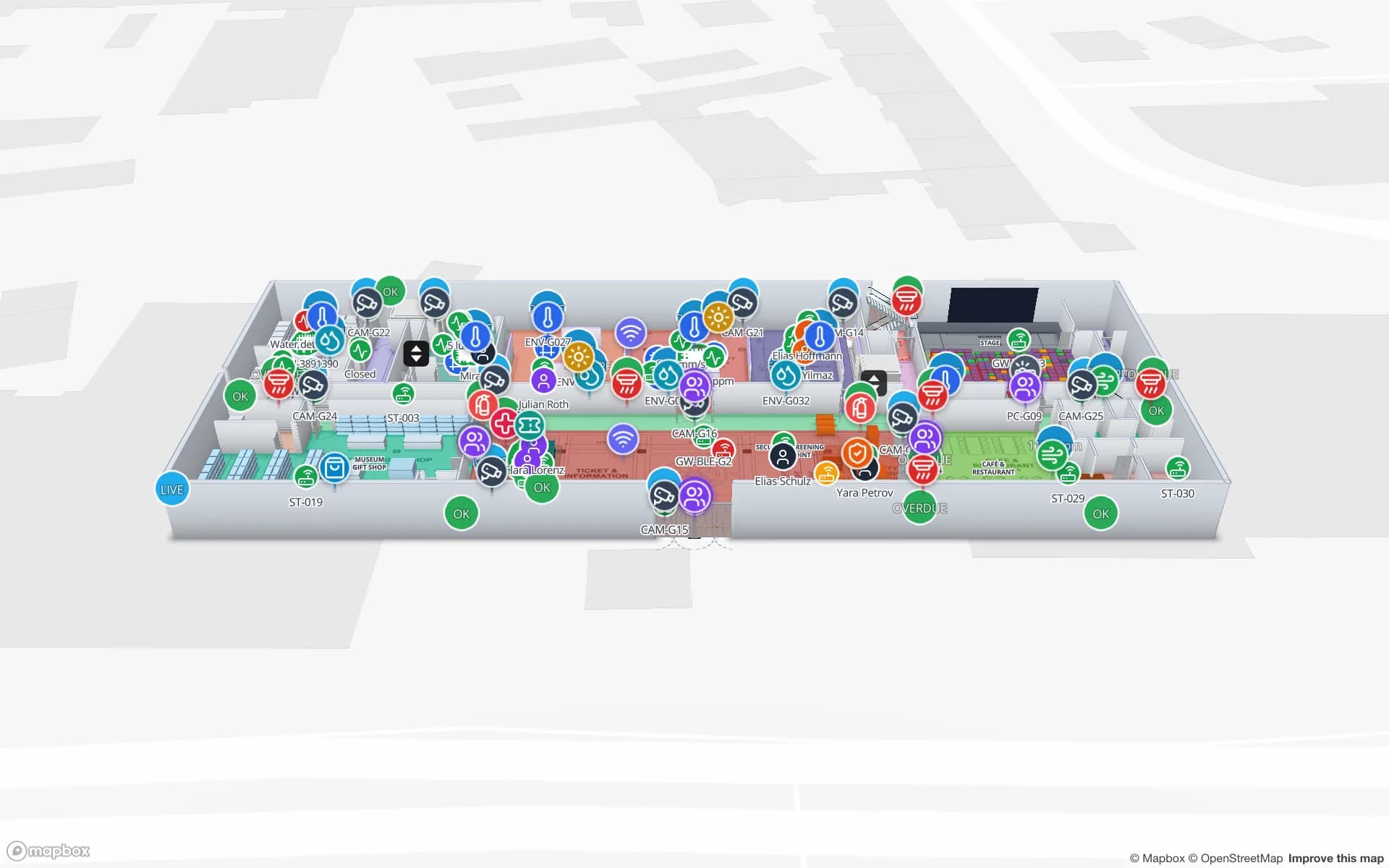
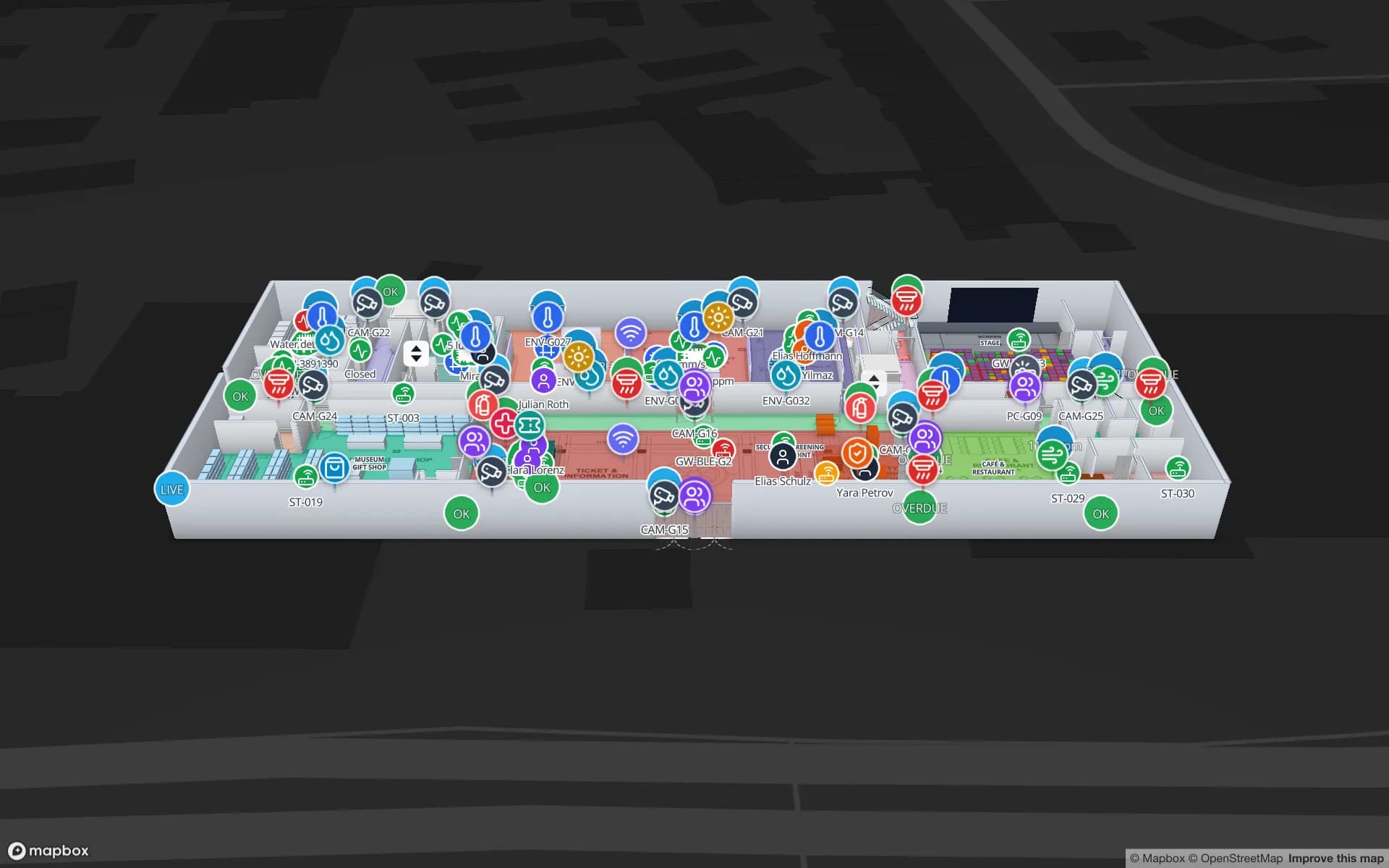
Silverbay International Airport — Terminal 2, a airport terminal demo, in the Spatial Map 3D viewer with live device markers
Silverbay International Airport — Terminal 2
Silverbay Airport, a demo terminal: check-in, security screening, gates, baggage reclaim and retail on two floors, with routes that cross floors by lift, escalator or stairs.
Floors in the Silverbay airport demo
2
Floors in the Production Museum demo, with 187 assets
3
Interface languages, none of them Portuguese
6
Free trial, up to 5 facilities, no card
7 days

The airport and its two terminals

Lisbon Airport opened in 1942 and lies about 7 km north-east of the historic centre. Its main runway, 02/20, is 3,705 m long. Terminal 1 is the main building; the smaller Terminal 2, in use since 2007, serves low-cost carriers and is reached from Terminal 1 by a free shuttle. Two buildings with a transfer between them is exactly what a single map is good at: a route a person can follow, and lifts, escalators and crowded zones on the same plan.

The Silverbay demo shows the pattern on a terminal of two floors: check-in islands, security lanes, gates and baggage reclaim, each zone coloured by crowding from your counters, with lifts and escalators as part of the route. It is for the operations team, not for passengers, and Spatial Map is independent of the airport operator and its systems: it reads only the data your own team sends. See airport indoor mapping for the general case.


Fair grounds and a congress centre, two sites

Lisbon’s event calendar runs on two venues. The international fair’s premises have been at Parque das Nações since the end of Expo ’98, when the old exhibition site reopened in 1999 as a park; the fair itself dates back to 1957. A large annual technology conference used the fair halls and the neighbouring arena in November 2025, with about 70,000 attendees expected. Across town at Praça das Indústrias, the Lisbon congress centre lists 29,000 m², eight auditoriums, five pavilions, 34 meeting rooms, six foyers and a restaurant that seats 400.

A venue like this changes layout every week. Spatial Map keeps the permanent plan (halls, foyers, loading docks, lifts) and lets each event add its own layer: booth blocks, session rooms, registration, food outlets. The Lakeside Convention demo shows halls with live occupancy, booths and session rooms with their bookings, badge scans at registration and crate tags read from the docks to the booths. A read-only share link, limited to chosen floors and layers and with an expiry date, gives an exhibitor or contractor the plan without an account. For the general case see stadiums and venues.

Old buildings and the permit archive

Many central Lisbon buildings have no CAD file, but they may well have a paper plan. The municipal archive, the Arquivo Municipal de Lisboa, holds the “processos de obra particulares” series: about 68,000 private building files kept at Campolide, which include architectural drawings, topographic plans, inspection reports and licences, and which the archive has been digitising since 2005. Belém’s Monastery of the Hieronymites and Tower of Belém, begun in 1502 and inscribed by UNESCO in 1983, are the grand end of the same situation: a building whose best drawings are historical documents.

Spatial Map starts from whatever you have. Upload a scan or PDF of the drawing, or a DWG from AutoCAD R2004–R2018 (placed as a picture), align it to the building at scale and let AI Map draft walls, doors, stairs and rooms for a person to review; the draft is a starting point and a person always checks it. Then draw what the drawing lacks, such as the lift that was added later. The Production Museum demo shows three floors of galleries with climate sensors, cameras and 187 tagged assets. Spatial Map makes no claim about heritage protection or conservation rules; it shows where things are and what your sensors report.

Office campuses and shared floors

Lisbon’s offices are often several tenants or teams on shared floors, with meeting rooms, stores, IT equipment and printers that people can never quite find. An asset register by room, a checkout table and a space-use report answer most of the questions before any tags are bought; RFID or BLE can follow where something goes missing. The Harborview demo shows three floors with an asset register, equipment checkout, stores and spares, work orders and meeting rooms. See office and campus maps.

Services for teams in Lisbon

Lisbon teams usually start with the building, then the data:

  • Airport and event teams start with indoor maps and routes, then add live crowding or booking tables from their own systems.
  • Estates and facilities teams start with an asset register by room, then tag the items that go missing.
  • Logistics sheds near the airport begin with inventory tracking at rack and dock level.
  • RTLS and UWB fits large halls where equipment must be located continuously; a BlueIOT server connects directly and other engines through the write API.
  • If you have no readers or tags yet, our team can source them on request, quoted per project, with warranty and device support from the manufacturer: see hardware and demo kits.
  • Booking, ticketing or visitor systems and back-office integrations are built as custom software client projects. The product runs as cloud or on-premises.

Also served nearby

The same page covers Oeiras and Cascais along the coast, Amadora, Sintra and Loures, and the south bank at Almada and Seixal. The app has no Portuguese interface; room names and labels in Portuguese display exactly as typed.

How Spatial Map does it

From an old drawing to a live map

  1. 01

    Scan or export the plan

    A PDF, a photo of the paper plan, an image, or a DWG (R2004–R2018, placed as a picture).

  2. 02

    Align and review

    Place it at scale on the map, let AI Map draft walls, doors and rooms, and correct the draft where the building has changed.

  3. 03

    Name rooms and routes

    Rooms, lifts, stairs and escalators with the codes your team uses; wayfinding plans routes across floors.

  4. 04

    Add live data

    Occupancy, bookings or asset tables by CSV, a polled REST endpoint or the table write API, with in-app alerts.

What Lisbon teams map

Terminals and transfers

Two buildings, one route, with crowding by zone and lifts and escalators in the path.

Exhibition and congress halls

Hall occupancy, booths, session rooms and the loading docks on one plan.

Historic buildings and museums

Galleries, climate sensors and tagged objects from a scanned plan.

Shared offices

Asset register, checkout and meeting rooms by floor.

See it on real demo facilities

Fictional names, real floor plans, live sensors, RFID, BLE tags and gateways — open any of them in the browser.

All 13 demo facilities

Indoor mapping in Lisbon — questions we get

Not yet. The app is available in English, Spanish, French, German, Arabic and Chinese, and each user picks their own language. Your own content — room names, event layers, report titles — can be in Portuguese, accents included.

Yes. Upload the scan as a PDF or image, align it to the building at scale and draw over it, with AI Map drafting walls, doors and rooms for a person to review. Check the drawing against the building on site, because old plans often miss later changes such as lifts and partitions.

Yes. Keep one facility for the permanent building and use layers for each event’s booths, rooms and routes. Read-only share links limited to chosen floors and layers, with an expiry date, can go to exhibitors and contractors without an account.

No. Spatial Map is independent of airport operators and their systems. It shows the data your own team sends, through CSV or Excel uploads, a polled REST endpoint or the table write API.

No. Spatial Map is sold online and our team works with customers in Portugal remotely, by video call and through the contact form, in English. There are no local resellers or partners.

No. Pricing is the same worldwide and in US dollars: a 7-day free trial for up to 5 facilities with no card, then Pro at $60 a month or $600 a year for up to 4 facilities. Readers and tags, if you ask us to source them, are quoted per project.

Map one Lisbon building from the plan you already have.

Start the free trial and open the Silverbay or Lakeside demo, or send us a scan of a plan through the contact form.