Kuwait City · Shuwaikh, Shuaiba and the industrial areas

Warehouse tracking in Kuwait City, behind the gates of Shuwaikh and Shuaiba

Spatial Map shows what is in a warehouse and where it is on a live 3D map: racks and bins coloured from your WMS or ERP, pallets placed by RFID read, trailers in yard slots. Warehouse tracking in Kuwait City starts at two ports that do different jobs, with Shuwaikh the main commercial port beside the city and Shuaiba the main industrial port to the south. The Kuwait Ports Authority offers container tracking in its own port system; your warehouse map starts at your own gate.

No credit card. Runs in the browser. Pro is $60/month for up to 4 facilities. Book a demo

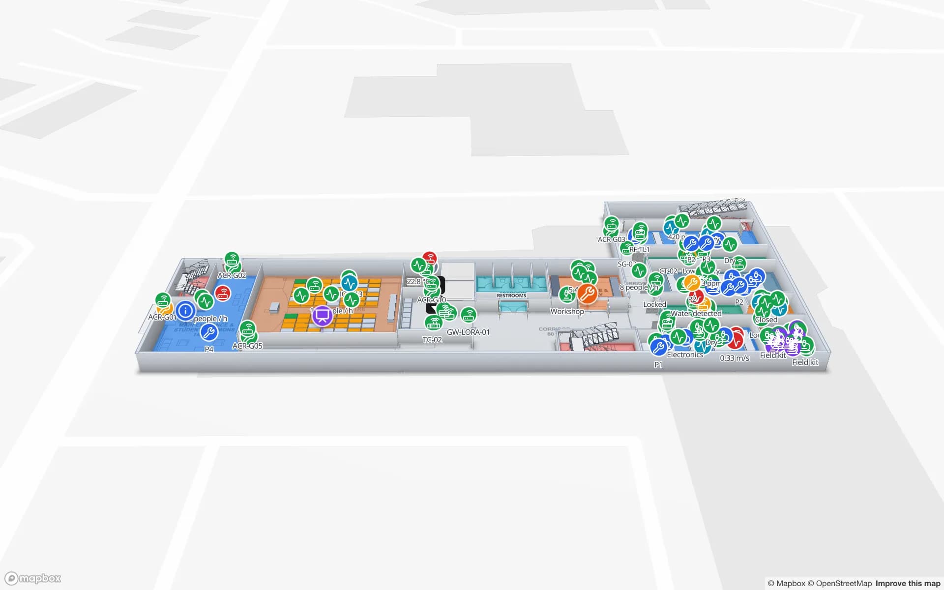
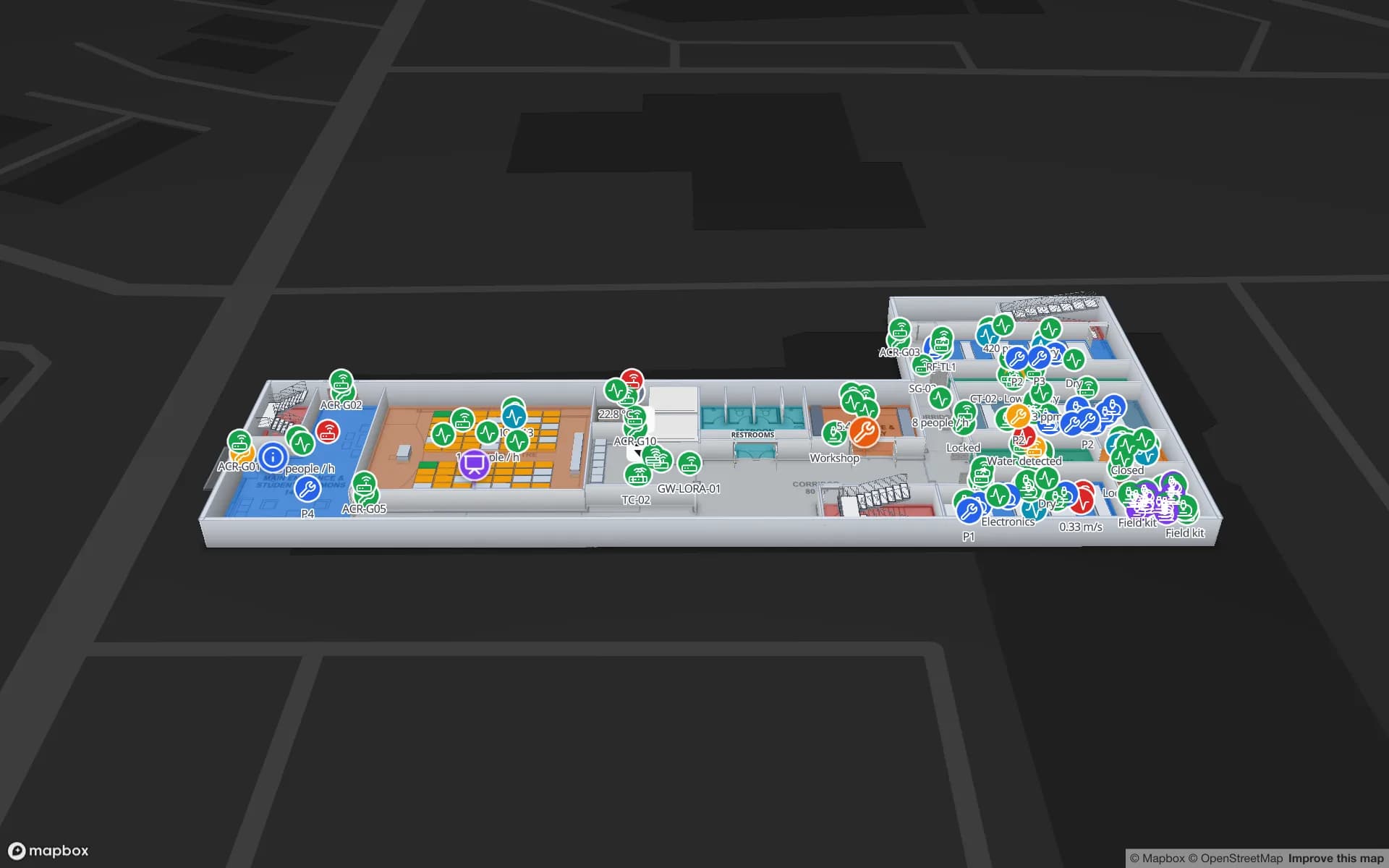
Eastport Cross-Dock Freight Hub, a cross-dock & trailer yard demo, in the Spatial Map 3D viewer with live device markers
Eastport Cross-Dock Freight Hub
Eastport Cross-Dock, a demo freight hub: 50 dock doors, 44 yard slots and 1,180 RFID pallets, with the gate and weighbridge.
Yard slots in the Eastport demo
44
RFID pallets in that demo
1,180
Rack locations in the Crestline demo
2,204
Free trial, up to 5 facilities, no card
7 days

Two ports, two jobs

The Kuwait Ports Authority oversees three commercial ports: Shuwaikh, Shuaiba and Doha. Its own pages call Shuwaikh the main commercial port, a place for storing and distributing goods and hosting commercial ships, and Shuaiba the main industrial port, handling commercial cargo, heavy equipment, raw materials and chemicals. Its site also offers container tracking and vessel search.

That tracking follows a box through the port system. Inside your shed the question is different: which pallet is in which bay, which carton went into which container, which trailer is waiting at which door. A warehouse map answers it, and it is built from your own data, not the authority’s. Spatial Map does not connect to the Authority’s systems, customs or terminal operators.


Shuwaikh: 4.4 million square metres and the sheds around it

According to the authority, Shuwaikh Port has been under it since 1977, covers 4.4 million square metres in total with 21 berths and 600,000 square metres of storage area, and in 2024 handled 613,093 TEU and 3,230,749 tonnes of general cargo. The port sits in Shuwaikh Industrial Area, which is divided into three districts, and a free trade zone lies on the road that connects it to the city centre. Between them are consolidators, forwarders, spare-parts importers and distributors in sheds of every age.

In a shed like that, the biggest wins are usually at the dock door and the rack: pallets read as they enter, bins coloured by what they hold, and a staging lane for anything about to leave. The Eastport demo shows doors, yard slots and RFID pallets; the Crestline demo shows 20 racks with 2,204 locations coloured from inventory. Both can be started from a spreadsheet, as the post on CSV bin inventory to a live rack map shows.

Cars by the hundred thousand

In 2024 Shuwaikh handled 177,394 cars, a figure the authority publishes on its own port page. A vehicle yard is an odd kind of warehouse: the stock is large, valuable, parked in rows, and moved by many different drivers, and the cost of “which row is it in?” is paid in minutes per car.

Draw each row or bay as an area in the yard, or draw every bay if your yard is formal, and post the vehicle’s bay from your dealer or import system. A windscreen RFID tag read at the yard gate and at the exit can mark arrival and departure, and the RFID gates page explains how to place portals. The map then shows rows by how full they are and lists the vehicles that have been in the yard longer than a limit you set. Spatial Map does not read licence plates or VINs itself; it displays the rows your systems send.

Shuaiba: heavy cargo, raw materials, chemicals and clinker

Shuaiba Port, in Ahmadi Governorate, has been under the authority since 1986. It covers 2.2 million square metres with 20 berths and 318,000 square metres of container-terminal storage, and in 2024 it handled 23,688,110 tonnes of general cargo, 282,870 TEU and 2,725,156 tonnes of clinker. Its role is industrial: heavy equipment, raw materials and chemicals for the plants nearby.

The stores behind that traffic are spare-parts and materials stores, and a store for project cargo looks like the rack and bin plan in the Summit Assembly demo, with 867 raw-material and finished-goods locations. Where stores hold chemicals, the map can show each container’s location and last read, as in the chemical and hazmat stores of the Westbrook demo. Spatial Map is not a hazardous-goods system and makes no compliance claim; the safety record stays in yours.

Services for teams in Kuwait City

Kuwait City teams tend to start in one of three places:

Also served nearby

The same approach covers Sabhan and Amghara, Jleeb Al-Shuyoukh, Ahmadi and Mina Abdullah. Nothing needs to be installed at any of them: the map opens in a browser, in Arabic or English.

How Spatial Map does it

From a port gate to a stock map

  1. 01

    Pick one shed or yard

    The warehouse where a missing pallet or car costs most, in Shuwaikh, Shuaiba or the industrial areas.

  2. 02

    Draw doors, racks and bays

    Upload the plan, photo or sketch, align it at real size and let AI Map draft the floor for review.

  3. 03

    Connect stock and reads

    Upload a CSV or Excel stock list today; add RFID middleware, gate reads or your ERP through the write API or a polled REST endpoint later.

  4. 04

    Add age and silence rules

    In-app alerts for pallets staged too long, cars parked beyond a limit and readers that stopped reporting.

What Kuwait City teams track

Port-side warehouses and cross-docks

Dock doors, yard slots and RFID pallets for import and re-export flows.

Distributor racks

Bin-level stock coloured from the WMS export, with staging lanes and packing.

Vehicle yards

Rows and bays by how full they are, and cars parked longer than a limit.

Project and chemical stores

Raw materials and containers by rack, with the last read and holds.

See it on real demo facilities

Fictional names, real floor plans, live sensors, RFID, BLE tags and gateways — open any of them in the browser.

All 13 demo facilities

Warehouse tracking in Kuwait City — questions we get

No. That service follows a container through the port system. Spatial Map starts at your own gate: it shows what your RFID reads, WMS or ERP say about your own sheds and yards. It has no connection to port, customs or terminal systems.

It shows them by bay or row from your own system’s data, and RFID tags on windscreens read at the yard gate can mark arrival and exit. Spatial Map does not read plates or VINs itself, and it does not position a car moving around the yard unless a tag or gateway sends a position.

It can show where each container is and when it was last read, and hold the batch, quantity and status in a table. It is not a hazardous-goods or safety system and makes no compliance claim; your own safety records stay the record.

Yes. Upload a photo or scan of any plan, or sketch the walls and racks and photograph the sketch. AI Map drafts the walls and racks for a person to review. Our services team can also do the mapping remotely for a fixed price.

Yes, with a full right-to-left layout, alongside English, Chinese, French, German and Spanish; each user picks their own. Names you give racks, bays and areas can be in Arabic or English.

No. Spatial Map is sold online and our team works with customers in Kuwait remotely, by video call and through the contact form, in Arabic or English. There are no local resellers or partners.

In US dollars, the same worldwide: a 7-day free trial for up to 5 facilities with no card, then Pro at $60 a month or $600 a year for up to 4 facilities. RFID hardware, if you ask us to source it, is quoted per project and is not part of the subscription.

Map one Kuwait City shed or yard first.

Start the free trial and open the Eastport and Crestline demos, or send us a stock export and the plan of a warehouse or yard through the contact form.