Orlando · Convention center, large venues and the airport

Indoor wayfinding in Orlando, for buildings where the walk is the problem

Spatial Map is browser-based indoor mapping software that turns a floor plan into a 3D map of every floor and builds walking routes across floors, through stairs, lifts and escalators. Indoor wayfinding in Orlando is a question of distance: the biggest buildings in the city are measured in acres under one roof, visitors are unfamiliar with the building, so a route that is quick, step-free where needed and easy to share matters more than a pretty map.

No credit card. Runs in the browser. Pro is $60/month for up to 4 facilities. Book a demo

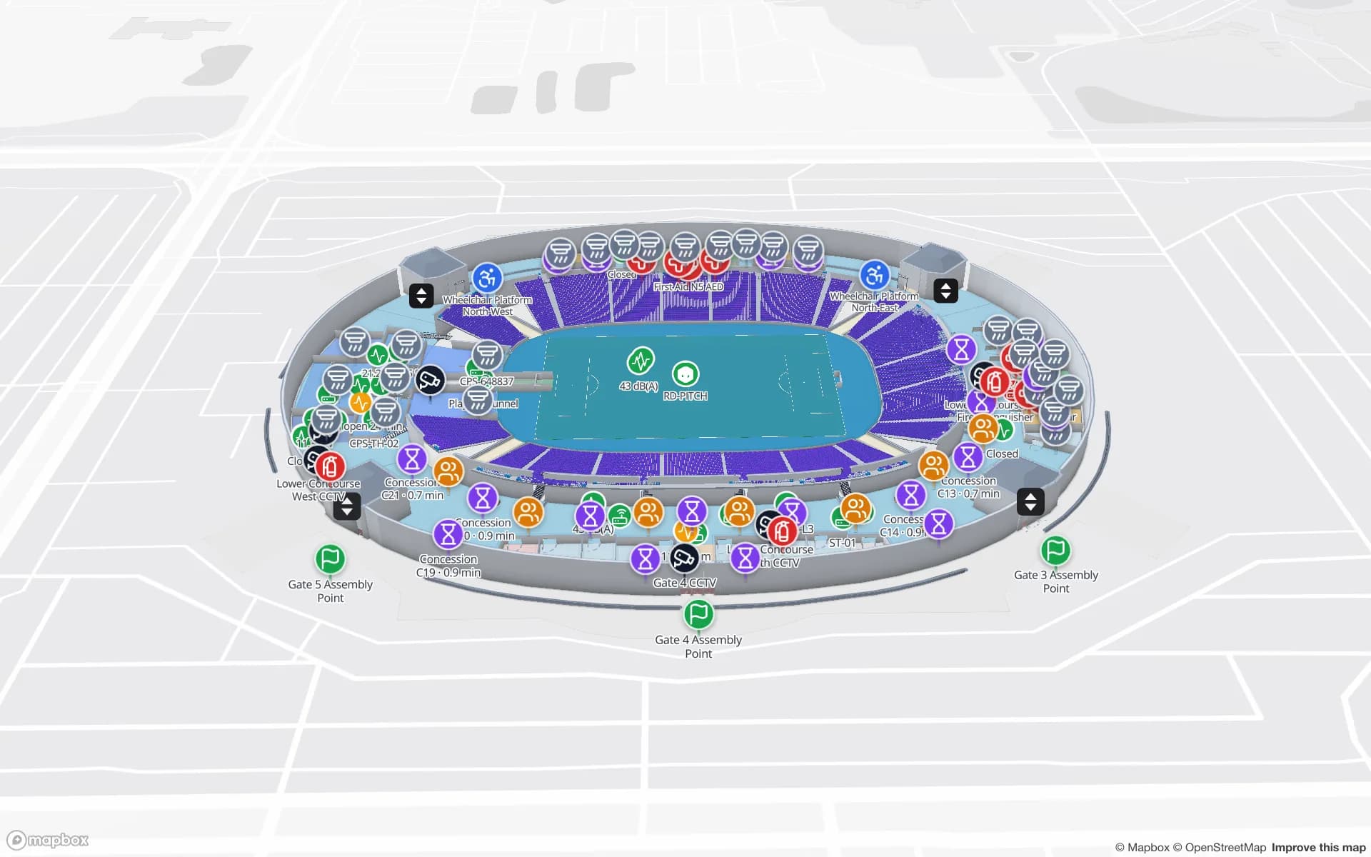
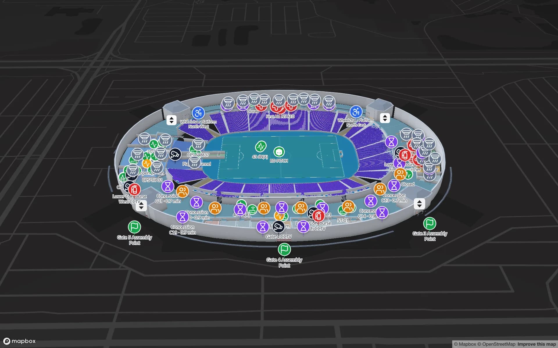
Silverbay International Airport — Terminal 2, a airport terminal demo, in the Spatial Map 3D viewer with live device markers
Silverbay International Airport — Terminal 2
Silverbay Airport, a demo terminal: check-in, security, gates, baggage reclaim and retail on two floors, with routes that cross floors by lift, escalator or stairs.
Floors in the Silverbay terminal demo
2
Route types: Fastest, Step-free and Other
3
App interface languages, including Spanish
6
Free trial, up to 5 facilities, no card
7 days

A convention center measured in acres

The Orange County Convention Center lists 2,053,820 square feet of exhibit space, split between the West Building (1,103,538) and the North-South Building (950,282), with 74 meeting rooms, and describes the North-South exhibit hall as 22 acres under roof. It is owned by Orange County Government, opened in 1983, gained the North/South Building in 2003 and links the two buildings with a covered pedestrian bridge, at the south end of International Drive.

Those numbers put the walk between a registration desk and a meeting room well past what a printed floor plan solves. A visitor who needs a particular meeting room asks the nearest person, who may not know the other building. Spatial Map builds routes between named places across floors and between buildings you draw, with a Fastest route, a Step-free route and an Other route, turn-by-turn and with walking minutes. The map does not show a live blue dot for a visitor. The Lakeside demo shows halls, session rooms and a plenary auditorium drawn for a venue, and the indoor wayfinding page covers how routes work.


Step-free routes and visitors from everywhere

For a convention audience, the Step-free route is not a nicety. It sends people who use wheelchairs, push strollers or carry crates around stairs, through lifts and across ramps, with the walking time shown. Whether a route is right depends on whether the plan is: mark the lifts and ramps you actually have, and re-check them when a building changes. Spatial Map makes no accessibility-compliance claim, and a map does not replace signage or staff.

Visitors come from many countries. The app’s interface is in English, Spanish, French, German, Arabic and Chinese; labels and names on the map are text you write, in any language. Spanish is an app language, so floor teams can use it alongside English; Portuguese and other languages are not app languages today.

The airport: four runways, a new terminal and an intermodal terminal

Orlando International Airport is run by the Greater Orlando Aviation Authority and has four parallel runways. Its Intermodal Terminal opened in November 2017, with intercity passenger rail service beginning in September 2023, and Terminal C opened on 19 September 2022 with 20 gates. A traveler, a driver or a contractor changes levels, rides a transit link and walks long concourses, which is a multi-floor routing problem.

Spatial Map does not model the airport’s trains or schedules, and the airport’s own plans are the airport’s to share. For a tenant, a contractor or a concession team with plans for their own area, it draws each level in 3D and builds routes through stairs, lifts and escalators. The Silverbay demo shows a terminal with check-in, security lanes, gates, lifts and escalators, and airport indoor mapping and the post on wayfinding for airports and malls cover what teams do with it.

Exhibitors, crews and freight on a big floor

Wayfinding is one half of operating a large venue; the other half is knowing where the people and goods are. In the demo, booth blocks and session rooms carry their bookings, crates are tagged with RFID and read from the dock to the booth, BLE tags locate crews and equipment by hall and occupancy sensors color rooms by how full they are. A share link lets an exhibitor or a contractor open only the floors and layers you choose, with an expiry and a view cap.

Teams that also run distribution buildings in the area use the same RFID and rack-map methods as in warehouses and inventory tracking; this page keeps to venues and the airport.

Services for teams in Orlando

Orlando teams usually start with the map and the routes:

  • Convention and venue operators start with the indoor map and routes between halls and rooms, then add occupancy sensors.
  • Airport tenants and contractors start with the map for their area and routes, then add equipment with asset tracking.
  • Exhibition services add RFID or BLE for crates, carts and crews; RTLS and UWB is rarely needed first.
  • If you have no tags or gateways yet, our team can source BLE and RFID devices on request, quoted per project, with warranty and device support from the manufacturer: see hardware and demo kits on request.
  • Where a system is missing, our team builds custom software, including booking systems, as client projects. The product runs as cloud or on-premises.

Also served nearby

The same approach covers venues and conference wings in Kissimmee, Lake Buena Vista, Winter Park and Sanford, and distribution buildings along the interstates around the city. Nothing needs to be installed on site: the map opens in a browser.

How Spatial Map does it

From a floor plan to routes between halls

  1. 01

    Import the plans

    Upload each building’s plan as a PDF, DWG or image, align it at real size and let AI Map draft the shell for review.

  2. 02

    Name the places

    Draw rooms, halls, registration, lifts, escalators and ramps as named areas, and join buildings where a bridge or link connects them.

  3. 03

    Check the routes

    Test Fastest and Step-free routes between real pairs of places and fix what is wrong on the plan.

  4. 04

    Share and update

    Send read-only links with expiry to exhibitors and contractors, and redraw areas as layouts change.

What Orlando teams map

Routes between halls and rooms

Fastest and Step-free routes with walking minutes, sent as share links.

Terminal levels and concourses

Check-in, security, gates, lifts and escalators with routes that cross floors.

Crates, carts and crews

RFID and BLE reads from dock to booth, with crews located by hall.

Venue operations on event day

Crowd, doors and crews on one live map.

See it on real demo facilities

Fictional names, real floor plans, live sensors, RFID, BLE tags and gateways — open any of them in the browser.

All 13 demo facilities

Indoor wayfinding in Orlando — questions we get

No. There is no live blue dot for visitors. Spatial Map draws walking routes between places you name, across floors and between buildings you connect, and shows turn-by-turn steps and walking minutes. It can locate staff and equipment that carry tags, for your team.

Yes. Each route has a Fastest option, a Step-free option and an Other option. The Step-free route follows the lifts and ramps you have drawn, so it is only as good as the plan. Spatial Map makes no accessibility-compliance claim.

Yes. Draw each building and its floors, then draw the link between them as part of the route network. A route from a room in one building to a room in the other then crosses the link, with the walking minutes added up.

The interface is available in English, Spanish, French, German, Arabic and Chinese. Names and labels on the map are text you write, so they can be in any language. Portuguese is not an app language today.

No. Spatial Map is sold online and our team works with customers in the United States remotely, by video call and through the contact form. There are no local resellers or partners.

In US dollars, the same worldwide: a 7-day free trial for up to 5 facilities with no card, then Pro at $60 a month or $600 a year for up to 4 facilities. Larger estates are quoted as custom services, and devices we source are quoted per project.

Map one Orlando hall and test a route before the next show.

Start the free trial and open the Silverbay demo, or send us the plan of a hall or terminal area through the contact form.