Las Vegas · Convention halls, show floors and event-day operations

Indoor mapping in Las Vegas, for show floors that are rebuilt every week

Spatial Map is browser-based indoor mapping software: it turns a floor plan into a 3D map of every floor, with rooms, doors, lifts, escalators and stairs, and puts live data on top. Indoor mapping in Las Vegas is mostly about halls that change shape: the walls stay, but the aisles, booths and freight lanes are laid out again for each event. A map that a small team can redraw per event, and share with exhibitors and crews without accounts, fits that rhythm better than a drawing that is updated once a season.

No credit card. Runs in the browser. Pro is $60/month for up to 4 facilities. Book a demo

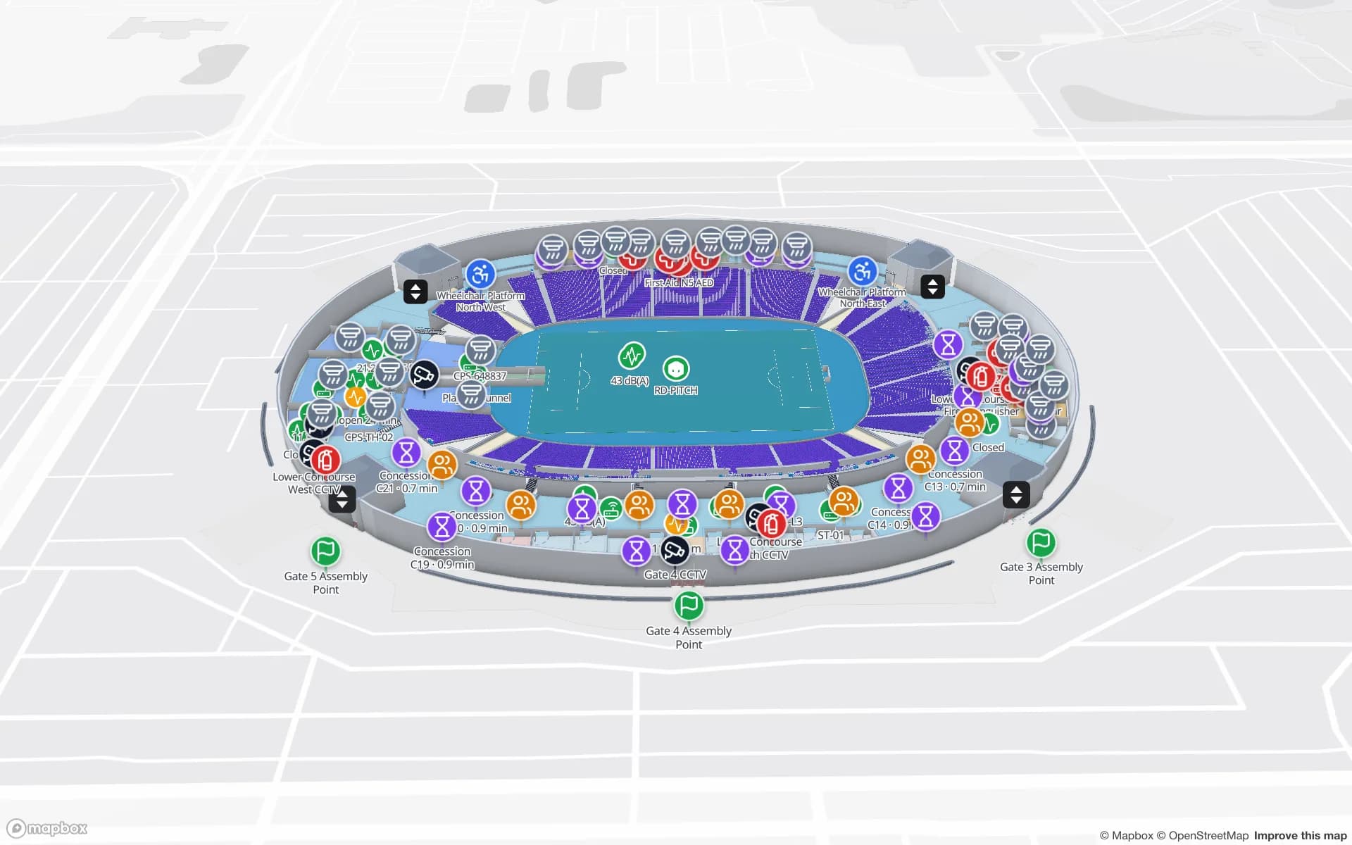
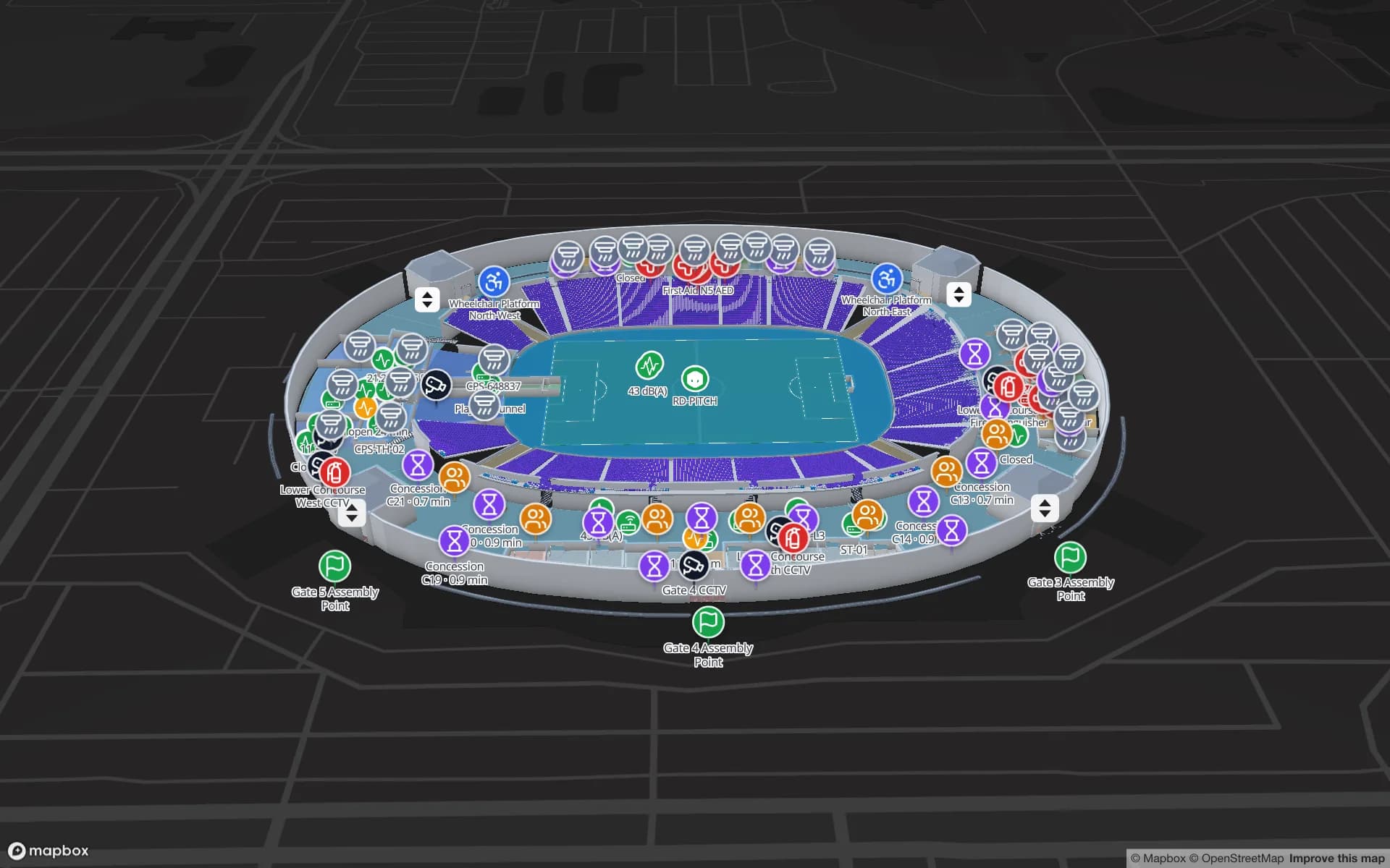
Lakeside Convention Center, a convention center demo, in the Spatial Map 3D viewer with live device markers
Lakeside Convention Center
Lakeside Convention Center, a demo venue: exhibition halls with booth blocks, session rooms and a plenary auditorium, registration, food outlets and loading docks on two floors.
Floors in the Lakeside convention demo
2
Tables behind the Lakeside demo
26
App interface languages, including Spanish and Chinese
6
Free trial, up to 5 facilities, no card
7 days

A public campus built in stages

The Las Vegas Convention Center is owned and operated by the Las Vegas Convention and Visitors Authority and opened on 12 April 1959. Its West Hall debuted on 8 June 2021 as a 1.4-million-square-foot expansion with 600,000 square feet of exhibition space, 328,000 of it column-free. The authority’s release calls the whole facility 4.6 million square feet on 200 acres, and a reference work puts the campus at about 2.5 million square feet of exhibit space.

A campus built in stages tends to have plans in several generations: a drawing from the original building, another from the 2000s extensions and a BIM model for the newest hall. Spatial Map takes whatever you have: a PDF, a DWG (AutoCAD R2004–R2018, placed as a picture) or an image. You align it at real scale and draw or let AI Map draft the walls, doors, areas, stairs, lifts and escalators for a person to review. AI Map is on paid plans and during the trial, with a monthly limit. The CAD and PDF import guide covers the steps, and the Lakeside demo shows a finished venue.


The show floor is the part that changes

In a hall that hosts a different event every few days, the permanent map is only the shell. Booth blocks, aisles, registration, meeting rooms, freight lanes and staging areas are specific to each show. The practical approach is one facility for the building, with each event’s booths and lanes drawn as areas on their own layer that you can show, hide and share.

Draw booths as areas and keep the exhibitor list in a table with booth number, name, size and status; color the booths by status, such as freight arrived, booth built or cleared, and the show manager sees the state of the floor without walking it. Crates tagged with RFID and read from the dock to the booth show which exhibitor’s freight has arrived. The Lakeside demo shows booth blocks, session rooms and a plenary auditorium, with crates tracked from dock to booth.

Getting between halls: routes, and what the underground link changes

The authority’s release describes the Convention Center Loop as an underground system with two one-way tunnels and three passenger stations, about 40 feet below ground, that joins West Hall to the North and South Halls and cuts a trip to under two minutes from a walk of more than 20 minutes. A visitor who takes the link emerges in a different hall from where they started, and a floor team must plan crews around the same fact.

Spatial Map’s wayfinding draws walking routes across floors through stairs, lifts and escalators, with a Fastest route, a Step-free route and an Other route, turn-by-turn and with walking minutes. It does not show a live blue dot for a visitor, and it does not model the underground link’s vehicles or timing; treat the tunnel as a documented connection in your plan. Routes can be sent as a read-only share link to exhibitors or contractors who need to find a dock, a booth or a first-aid room. See indoor wayfinding and the post on turn-by-turn directions.

Crowds, crews and doors on event day

Operations teams need to see which halls are filling up, where crews and carts are, which doors are open and which devices are offline, during the event and afterwards for the review. In the demo, occupancy sensors color the halls, BLE tags locate staff and equipment by hall, and badge scans show registration and access. Row history and the History player replay a day so a post-event review can look at the hour a hall filled, not just an average.

Heatmaps work on any point layer: footfall counts, badge scans or sensor readings, weighted by a number field, stopping at walls and closed doors, one floor at a time. See heatmaps and stadium and venue operations on a live map. Alert rules on a table, checked every 15 seconds, raise in-app alerts when a hall passes a limit you choose. They are not sent by email, SMS or push.

Services for teams in Las Vegas

Las Vegas teams usually start with the shell, then add the event layer:

  • Venue and event operators start with the indoor map and one layout per event, with exhibitors and contractors receiving share links.
  • Exhibition services and freight contractors add asset tracking for crates, carts and equipment between dock and booth.
  • Event-day operations add sensors and counters for occupancy; RTLS and UWB is rarely needed first.
  • If you have no tags or gateways yet, our team can source BLE and RFID devices on request, quoted per project, with warranty and device support from the manufacturer: see hardware and demo kits on request.
  • Where a system is missing, our team builds custom software, including booking systems, as client projects. The product runs as cloud or on-premises.

Also served nearby

The same approach covers venues, hotels’ conference wings and warehouses in Henderson, North Las Vegas and Summerlin, and show-contractor yards around the city. Nothing needs to be installed on site: the map opens in a browser.

How Spatial Map does it

From a hall plan to an event-day map

  1. 01

    Import the plan

    Upload the hall as a PDF, DWG or image, align it at real size and let AI Map draft the shell for review.

  2. 02

    Lay out the event

    Draw booth blocks, aisles, session rooms and freight lanes as named areas, one layout per event.

  3. 03

    Connect the lists

    Exhibitors, bookings and badge scans come in as CSV or Excel uploads or through the table write API.

  4. 04

    Share and operate

    Share read-only links with expiry and view caps to exhibitors and contractors, and watch occupancy and alerts live.

What Las Vegas teams map

Show floors

Booth blocks and aisles colored by exhibitor status, one layout per event.

Freight and loading docks

Crates read from the dock to the booth, with marshalling areas and freight bookings.

Crews and equipment

Staff and carts located by hall and zone with BLE tags.

Wayfinding for exhibitors and visitors

Routes across floors with step-free options, sent as share links.

See it on real demo facilities

Fictional names, real floor plans, live sensors, RFID, BLE tags and gateways — open any of them in the browser.

All 13 demo facilities

Indoor mapping in Las Vegas — questions we get

Yes. Map the building once, then draw each event’s booths, aisles and freight lanes as areas on their own layer. Floors and layers can be chosen on a share link, so exhibitors see only their event’s layout.

No. There is no live blue dot for visitors. Spatial Map draws routes between places and can locate staff and equipment that carry BLE or other tags, and show that on the map for your team.

Yes. A read-only share link lets you choose the floors and layers they see, set an expiry and a view cap, and revoke it at any time. For ongoing access you can add people with the Viewer role or a custom role.

Often yes. Upload the PDF or DWG (AutoCAD R2004–R2018, placed as a picture), align it at real size and draw over it, or let AI Map draft the walls and doors for a person to review. Then correct the areas you changed since the drawing was made.

No. Spatial Map is sold online and our team works with customers in the United States remotely, by video call and through the contact form. There are no local resellers or partners.

In US dollars, the same worldwide: a 7-day free trial for up to 5 facilities with no card, then Pro at $60 a month or $600 a year for up to 4 facilities. Larger estates are quoted as custom services, and devices we source are quoted per project.

Map one Las Vegas hall before the next move-in.

Start the free trial and open the Lakeside demo, or send us the plan of a hall and an exhibitor list through the contact form.