Latin America · Mexico

Indoor mapping & RFID tracking in Mexico

Spatial Map is browser-based software for indoor mapping & RFID tracking in Mexico: the plan of a plant, warehouse, cold room or store becomes a live 3D map, coloured by the data your MES, WMS, RFID readers and sensors already produce. Mexico’s freight has three poles: export plants that run on the IMMEX programme, container ports on both coasts and the airports around the capital, and a growing set of inland logistics parks. The app has a Spanish interface, so a Mexican team can work in its own language.

No credit card. Runs in the browser. Pro is $60/month for up to 4 facilities. Book a demo

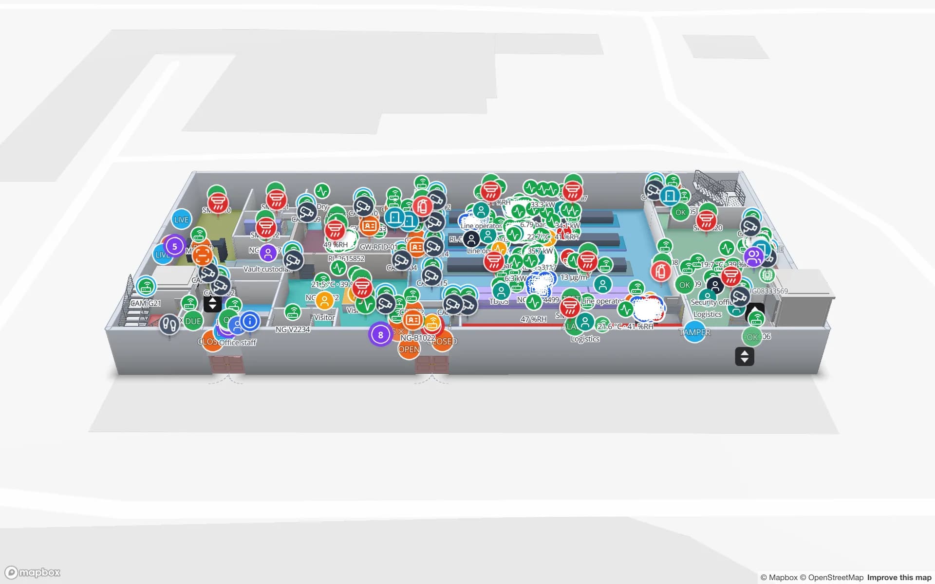
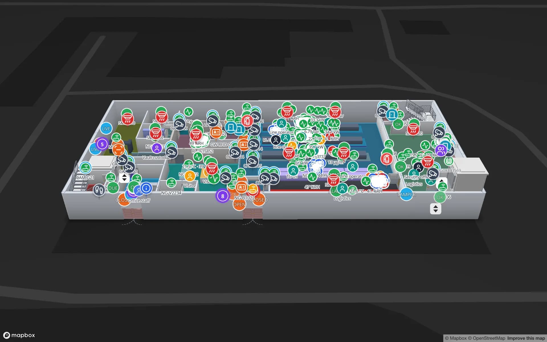
Summit Assembly Plant, a assembly plant demo, in the Spatial Map 3D viewer with live device markers
Summit Assembly Plant
Summit Assembly Plant, a demo plant: assembly lines and workstations, WIP carriers read by RFID between stations, and 867 rack locations for raw materials and finished goods.
Rack locations in the Summit assembly-plant demo
867
Spanish interface, one of six app languages
Español
How often alert rules are checked, with alerts shown in the app
15 s
Free trial, up to 5 facilities, no card
7 days

IMMEX plants: the factory that exports its whole output

A large share of Mexican manufacturing for export runs through IMMEX, the programme of the Ministry of Economy that lets a company bring in goods temporarily, without paying the general import tax or VAT, when they are used to produce, transform or repair goods for export or to provide export services. It stems from a decree published on 1 November 2006 for the manufacturing, maquila and export-services industry, and the older “maquiladora” name is still what most people say.

For a plant under that regime the floor question is simple and hard: which imported lot is on which line, which finished cartons belong to which export order, and what is still sitting in the quarantine bay. Spatial Map draws lines, workstations, WIP buffers and raw-material and finished-goods racks and colours them from your MES or ERP; RFID tags on carriers, totes and cartons show where they were last read. A read-only share link lets a customer on the other side of the border see one plant, with the floors and layers you choose, an expiry date and no account. The Summit Assembly demo shows the pattern on 867 rack locations. Your IMMEX records, customs filings and tax records stay in your own systems, and Spatial Map makes no compliance claim.


Ports on two coasts, and a corridor across the isthmus

Manzanillo on the Pacific is the country’s busiest container port: port-authority statistics reported for 2025 come to about 3.9 million TEU, and about 2.1 million in the first half of 2026. Containers from there go inland by road and rail to Guadalajara, the Bajío and the capital, so freight stations and distribution centres sit at the port and again in each of those cities.

The federal government is also developing the Interoceanic Corridor of the Isthmus of Tehuantepec, which its investment portal describes as coordinating the port administrations of Salina Cruz and Coatzacoalcos (with Dos Bocas and Puerto Chiapas), linked by the Isthmus of Tehuantepec railway, with “development poles” for new industry. How many poles are tendered and when differs between sources, so treat any plan for a warehouse there as your own. In each of these buildings the questions are the same: which container is at which dock door, which pallet is in which lane, which trailer waits in which yard slot. Spatial Map draws doors, yard slots and staging lanes and colours them from your yard or WMS data, as in the Eastport Cross-Dock demo with 50 dock doors, 44 yard slots and 1,180 RFID pallets. Customs and port records stay in their own systems.

Air cargo has moved: AICM, AIFA and Guadalajara

The Felipe Ángeles International Airport (AIFA) in the State of México opened on 21 March 2022. A federal decree in force from 3 February 2023 then ended cargo operations at Mexico City’s international airport (AICM), exempting airlines that carry cargo on the same aircraft as their passengers, and AIFA became the widely reported destination for the cargo carriers, which the transport ministry later said had completed the move. Guadalajara’s airport has since been reported as the third-busiest in the country for cargo, behind AIFA and AICM.

For a forwarder or an exporter the lesson is practical: sheds that were laid out around one airport may now serve another, and staging lanes, cold rooms and bonded areas get re-drawn. A map that opens in a browser is easy to redraw. See Mexico City and Guadalajara for each airport’s side of the story.

Four cities, four different problems

Mexico’s freight does not look the same everywhere. Mexico City is about warehouse stock and the Central de Abasto’s early-morning docks; Monterrey is about the plants, tooling and trailers of more than 250 industrial parks in Nuevo León, state figures say; Guadalajara is about electronics components and tequila barrels, with Jalisco at 27.4 % of national electronics-branch exports in the first quarter of 2026; and Tijuana is about twin plants on the Otay Mesa commercial crossing into California. Each page covers what the others do not.

Spanish, data protection and working with us

The Spatial Map interface is available in Spanish, English, French, German, Arabic and Chinese, and each user picks their own. A Mexican team can run the app in Spanish; the services page in Spanish describes the mapping and integration work our team does for larger estates. Room names, rack codes and report titles are your own text and appear exactly as typed.

Where location data can be linked to a person, Mexico’s data-protection law is the context: a new Ley Federal de Protección de Datos Personales en Posesión de los Particulares was published on 20 March 2025 and took effect the next day, replacing the 2010 law, with the Secretaría Anticorrupción y Buen Gobierno taking over oversight from the former institute (INAI). Your legal advisers decide what applies; tags on pallets, totes and stock do not identify anyone. A data processing agreement is available. Teams that must keep data inside their own network can run the open-source edition or an on-premises deployment. Spatial Map is sold online at the same USD price everywhere, and our team works with customers remotely.

Services for teams in Mexico

Where Mexican teams usually start:

Also served

The same approach covers Querétaro, León, Puebla, Toluca, Saltillo, Ciudad Juárez, Veracruz and Mérida. None of them needs anything installed: the map opens in a browser.

How Spatial Map does it

From plan to live map

  1. 01

    Import the plan

    A PDF or a DWG from AutoCAD R2004–R2018 of the plant, warehouse or cold room, or a photographed plan, placed at scale.

  2. 02

    Draw the building

    Lines, racks with their locations, dock doors, yard slots, stairs and lifts; AI Map drafts them for a person to review.

  3. 03

    Connect the data

    Your MES, WMS and RFID middleware post rows to a table, or Spatial Map polls a REST endpoint.

  4. 04

    Share and alert

    Read-only links for customers on either side of the border, and in-app alerts for the team.

What teams in Mexico map first

Export plants

Lines, WIP carriers and racks coloured from the MES, shared with the customer.

Port, border and cross-dock yards

Dock doors, yard slots and RFID pallets staged for the next truck.

Distribution and fulfilment

Every rack location coloured from WMS stock, with staging lanes at the docks.

Electronics assembly and secure stores

Components, tools and high-value stock by room, with BLE-tagged equipment.

See it on real demo facilities

Fictional names, real floor plans, live sensors, RFID, BLE tags and gateways — open any of them in the browser.

All 13 demo facilities

Questions from teams in Mexico

Yes. Spanish is one of six interface languages, with English, French, German, Arabic and Chinese, and each user picks their own. See the services page in Spanish for the project work our team does. Your own room names, rack codes and report titles can be written in any language.

No. It has no link to the Ministry of Economy’s IMMEX records, to customs or to the tax service. It shows what happens inside your own building, from your own RFID reads, MES, WMS or ERP and sensors, so it complements those systems rather than replacing them.

Yes, through a read-only share link: you choose the floors and layers, set an expiry and a view cap, and can revoke it at any time. The customer does not need an account. Reports can also be shared through public read-only report links.

Fixed readers, portals or handhelds approved for use in Mexico; UHF settings differ between countries, so ask your supplier for the right model and region. Spatial Map has no reader drivers: your middleware posts reads to a table with the write API, or exposes a REST endpoint Spatial Map polls. Our team can source devices on request, quoted per project.

Yes, in two ways: the open-source edition is MIT-licensed and self-hosted with Docker, with no plans or limits, and the product can also be run on-premises. The cloud edition is the managed service.

No. Spatial Map is sold online and our team works with customers in Mexico remotely, by video call and through the contact form. There are no local resellers or partners.

In US dollars, the same worldwide: a 7-day free trial for up to 5 facilities with no card, then Pro at $60 a month or $600 a year for up to 4 facilities. Larger estates are quoted as custom services. Hardware, if you ask us to source it, is quoted per project.

Map your first Mexican plant or warehouse this week.

Start the free trial in Spanish or English, or send us the plan of a plant, port warehouse or cross-dock and a sample of your MES, WMS or RFID data through the contact form.