Zurich · Zurich Airport, The Circle and ETH Hönggerberg

Indoor mapping in Zurich, from the dock building to the lecture hall

Spatial Map turns a floor plan into a live multi-floor 3D map in the browser, with rooms, lifts, stairs and routes you can search and share. Indoor mapping in Zurich is about big buildings that many people use at once: an airport with long piers, an office and congress district beside it, and university campuses on a hillside. Each building becomes its own facility, the app runs in German, French or English, and nothing has to be installed.

No credit card. Runs in the browser. Pro is $60/month for up to 4 facilities. Book a demo

Silverbay International Airport — Terminal 2, a airport terminal demo, in the Spatial Map 3D viewer with live device markers
Silverbay International Airport — Terminal 2
Silverbay International Airport, a demo terminal on two floors: check-in and bag drop, security lanes, gates with jet-bridges, lifts and escalators, baggage reclaim and live crowding.
Floors in the Silverbay terminal demo, with lifts and escalators
2
German and French interface, alongside English
DE · FR
How often alert rules are checked, with alerts shown in the app
15 s
Free trial, up to 5 facilities, no card
7 days

Zurich Airport: a pier you cannot see the end of

Zurich Airport reported 32.6 million passengers in 2025. One of its piers, Dock E, opened in September 2003: four floors, 500 metres long and 24 metres wide, with 27 stands, two of them for the Airbus A380. Passengers reach it from the Airside Center by the Skymetro, a ride of about three minutes under runway 10/28. The ground floor is baggage sorting and operations rooms, the first floor arrivals, the second departures, and the top floor lounges and an observation deck.

A building like that is hard to describe in a list of room numbers. Its users — ground staff, cleaners, contractors, retail tenants, security — each need a different slice of it. Spatial Map draws every floor on the real plan, with stairs, lifts and escalators as connections, so a route between two points is calculated across floors with walking minutes, and a Step-free option for people who cannot use stairs. Zones can be coloured from the counts your own systems produce. The Silverbay demo shows the same ideas in a terminal: check-in islands, security lanes, gates, baggage reclaim and crowding by zone. Spatial Map does not connect to airport operating systems, and it has no blue-dot positioning for travellers; it shows the data you send it.


Air cargo: the sheds that sit behind the terminal

The same airport handled 440,930 tons of cargo in 2025, 1.1 % more than in 2024. Cargo does not move through the passenger piers; it moves through handling halls, bonded stores and road-feeder docks that are rarely drawn well. Floor plans of such halls are often old PDFs or CAD files with several revisions.

Upload what you have — PDF, DWG (AutoCAD R2004–R2018, placed as a picture) or an image — align it at real scale, and let AI Map draft walls, doors, racks and areas for a person to review. AI Map is available on paid plans and the trial, with a monthly limit. Dock doors, staging lanes and storage zones then become named areas that a table can colour, and read-only share links with an expiry date give a forwarder or contractor the view they need without an account. The Eastport demo shows 50 dock doors and 44 yard slots on one site.

The Circle and the multi-tenant building

The Circle, the district beside Zurich Airport, was opened to the public on 5 November 2020. The airport describes two hotels with a congress centre, numerous shops and restaurants, headquarters of international companies and, in its newsroom wording, more than 50 companies and more than 90 % of the space rented. Its Convention Hall can hold 2,500 people.

Multi-tenant buildings have a particular problem: the owner manages the common parts, each tenant manages its own, and visitors only want to find the room. Draw each tenant’s floor area as an area on the plan, colour them from a table of leases or occupancy, and keep meeting rooms, event halls and technical rooms on separate layers so each audience sees only what it should. For events, the Lakeside demo shows exhibition halls, session rooms and live occupancy on two floors, with loading docks mapped alongside the halls. A share link locked to one floor and a few layers is enough for an organiser or an exhibitor.

ETH Hönggerberg and the campus problem

ETH Zurich has two campuses at its main location, Zentrum and Hönggerberg, and ETH says almost half of its students and academics now work at Hönggerberg, where development follows the Science City masterplan of 2005 and the Campus Hönggerberg 2040 masterplan. A campus that keeps adding and converting buildings has the opposite problem to an airport: its drawings are many, scattered between departments, and out of date soon after they are filed.

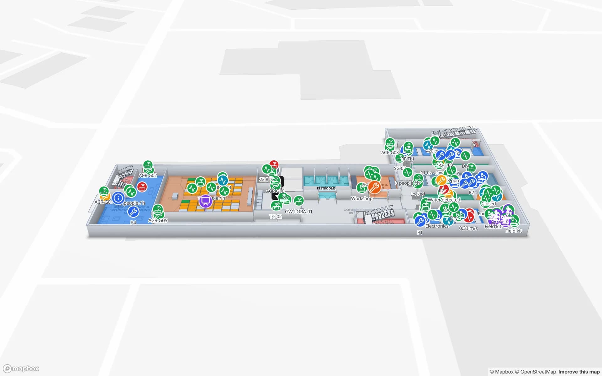
One facility per building keeps it manageable: teaching rooms with their timetable, labs with equipment bookings, stores and chemical cabinets as separate tables and layers. The Westbrook demo shows a two-floor science building with lab equipment bookings, lab environment readings and chemical stores. Rooms keep the names your own system uses, in German, French, English or any mix of them.

Services for teams in Zurich

Zurich teams usually begin with the map, not the sensors:

  • Facility and property teams start with indoor maps of the building they already have plans for, then add wayfinding routes between floors and a table of rooms by status.
  • Airport-side logistics and handling teams usually start with asset tracking for ground equipment and unit load containers, then inventory tracking for stores and bonded areas.
  • RTLS and UWB only matters where people or vehicles must be located continuously; a BlueIOT server connects directly and other engines through the write API.
  • If you do not yet have tags, beacons or readers, our team can source them on request, quoted per project, with warranty and device support from the manufacturer: see hardware and demo kits on request.
  • Integrations with a CAFM, ERP or booking system, and custom software such as POS or booking systems, are built as client projects. The product runs as cloud or on-premises.

Also served nearby

The same page covers Kloten, Opfikon-Glattbrugg and Dübendorf around the airport, the Limmattal logistics belt towards Schlieren and Dietikon, and Winterthur. All of them work the same way in a browser; the Switzerland page covers German, French and data-protection basics.

How Spatial Map does it

From a building plan to a live map

  1. 01

    Pick one building

    A pier, a tenant district, a lecture-hall block or a handling hall — wherever people most often ask “where is it?”.

  2. 02

    Upload the plan

    PDF, DWG (R2004–R2018, placed as a picture) or image, aligned at real scale; AI Map drafts walls, doors, stairs and lifts for a person to review.

  3. 03

    Add rooms, zones and routes

    Name areas the way your system names them, then connect floors so routes, including Step-free ones, work across levels.

  4. 04

    Colour from your tables

    Occupancy, bookings or equipment status come from CSV, Excel, JSON or the write API and colour the map; share a floor with a link.

What Zurich teams map

Terminals and piers

Routes across floors, lifts and escalators, and zones coloured by crowding from your counters.

Congress and event halls

Halls, session rooms and docks with live occupancy and a link per exhibitor.

University buildings

Teaching rooms, lab equipment and stores on a campus map by building.

Office buildings

Departments, meeting rooms and an asset register placed where things stand.

See it on real demo facilities

Fictional names, real floor plans, live sensors, RFID, BLE tags and gateways — open any of them in the browser.

All 13 demo facilities

Indoor mapping in Zurich — questions we get

No. It has no link to airport operating, baggage, flight-information or security systems. It shows the data your own teams and systems send it — counts, bookings, readings — on a map of the building.

No. Spatial Map plans routes between rooms across floors — Fastest, Step-free and Other route, with turn-by-turn steps and walking minutes — and shows them in the browser, for example on a share link. It has no blue-dot positioning for visitors and no mobile app.

Yes. DWG files from AutoCAD R2004–R2018 are placed as a picture at real-world units and AI Map reads that picture to draft walls, doors, labels, stairs, lifts and escalators; PDFs and images work the same way. A person reviews the draft, and DXF is not supported, so export a PDF or DWG instead.

German, French and English are available for the app, and each user picks their own. Room names, floors and report titles stay exactly as you write them, so a building can mix German, French and English labels.

No. Spatial Map is sold online and our team works with customers in Switzerland remotely, by video call and through the contact form, in German, French or English. There are no local resellers or partners.

No. Pricing is the same worldwide and in US dollars: a 7-day free trial for up to 5 facilities with no card, then Pro at $60 a month or $600 a year for up to 4 facilities. Larger estates are quoted as custom services.

Map one Zurich building from the plan you already have.

Start the free trial and let AI Map draft a floor of a pier, tenant block or lecture hall, or send us the drawings through the contact form.