Bucharest · A0 ring, A1 west belt, Otopeni and the road to Constanța

Inventory tracking in Bucharest, around the ring road

Spatial Map shows where stock sits on a live 3D map of the building, using the counts, scans and RFID reads your own systems produce, so a rack location or a staged pallet is a place rather than a code. Inventory tracking in Bucharest is shaped by roads: warehouses cluster on the A1 to the west, the A2 runs east to the Black Sea at Constanța, and the A0 ring is being closed around the capital. Each building is its own facility, and an operator with several keeps them in one workspace.

No credit card. Runs in the browser. Pro is $60/month for up to 4 facilities. Book a demo

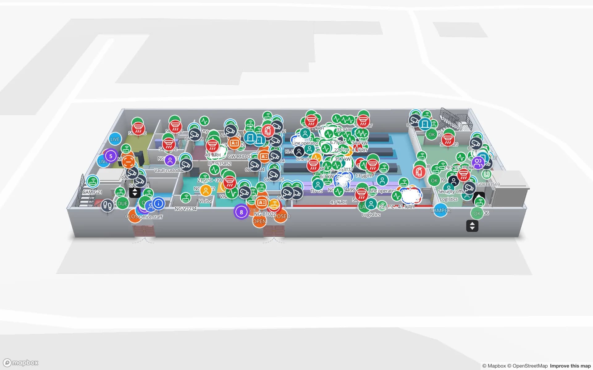
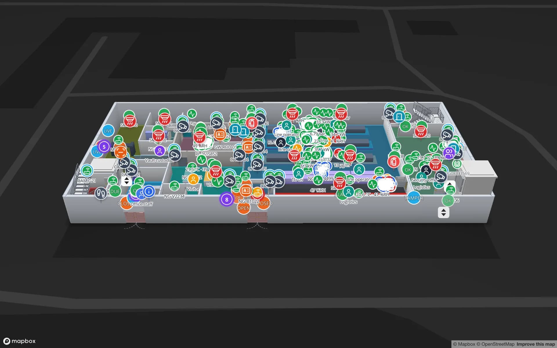
Crestline Fulfillment Center, a fulfillment center demo, in the Spatial Map 3D viewer with live device markers
Crestline Fulfillment Center
Crestline Fulfillment Center, a demo warehouse: 20 racks with 2,204 locations, pick-to-light, packing output, staging lanes, forklifts and the trailer yard.
Rack locations in the Crestline demo warehouse
2,204
Racks in the Crestline demo warehouse
20
Interface languages (Romanian not yet available)
6
Free trial, up to 5 facilities, no card
7 days

The western belt on the A1

Property-market research splits Bucharest into eight submarkets. It says the west of the city, through the A1-km 13 and A1-km 23 submarkets, concentrates the largest share of industrial and logistics stock, and its chart puts West Bucharest at 55 % of all Bucharest stock. Outside the city the belt continues towards Pitești, and property-market outlooks for 2026 say the A1 corridor still concentrates the largest share of modern logistics stock.

Warehouses in the belt tend to be large, similar and leased by several tenants. A distribution centre for a retail network, a wholesaler’s hub or a 3PL running several clients under one roof all need the same thing: to know what is where, by tenant, without walking the aisles. The Crestline demo shows 20 racks with 2,204 locations coloured full, OK, low, empty or blocked, and stock by bin on a rack grid shows how a CSV export drives them.


The A0 ring and the roads out

The final 18 km of the A0 southern half-ring opened on 30 June 2025; the southern half-ring is 51 km and links the A1 and A2, so freight from Pitești can reach Constanța without crossing the city. Sections of the northern half are being added, so the full ring of roughly 100 km is getting closer.

For a warehouse that changes the shape of the day. Trucks arrive from several directions at once, and the sheds on the ring become gateways for the city as well as for the country. Staging by outbound route (A1 west, A2 east, A3 north) is more useful than staging by customer. Name the staging lanes after the routes, post each trailer’s lane and time to the yard table, and the map shows what is staged, what is late and what has gone.

Constanța in the background

Constanța is the only Black Sea port in Eurostat’s 2024 ranking of EU seaports, where it came tenth, and in 2023 dry bulk made up 60.6 % of its tonnage; sources give different totals for its volume, so we leave it out. Motorway from Curtea de Argeș to Constanța is continuous since the A0 opening, 395 km.

For a Bucharest operator the port is context: it is where containers arrive, and the unloading, deconsolidation and put-away happen in the ring of warehouses. Tag the inbound pallets, read them at the dock door, and a table of putaway status colours the racks as they fill. RFID warehouse management shows how portals at docks make the reads automatic. Spatial Map has no link to port, customs or terminal systems.

Henri Coandă and the Otopeni sheds

The National Institute of Statistics reports that Henri Coandă airport handled 43,915 tonnes of cargo in 2025, 76.7 % of the national air-cargo total, and the airport operator reports just over 17 million passengers. The forwarders and couriers in the sheds around Otopeni work to flight cut-offs with small parcels and high turnover.

There the inventory question is time: which pallets on which lane must leave on which flight. A count rule on a staging lane raises an in-app alert when it is short, and Show on map takes the supervisor to it. RFID stock counting covers the cycle-count side. Spatial Map does not connect to airport or airline systems.

Services for teams in Bucharest

Bucharest teams usually start where the volume is:

Also served nearby

The same page covers Chitila, Otopeni, Voluntari and Buftea to the north, Popești-Leordeni and Berceni to the south, Ploiești along the A3, and Pitești along the A1. The app has no Romanian interface; room names, rack codes and report titles in Romanian display exactly as typed.

How Spatial Map does it

From a warehouse plan to a live map

  1. 01

    Map one building

    Upload the layout as PDF, DWG (R2004–R2018, placed as a picture) or image, align it at scale, and let AI Map draft racks, doors and areas for a person to review.

  2. 02

    Name locations and lanes

    Use the codes your WMS uses so every row finds its place on the map.

  3. 03

    Connect stock

    CSV or Excel exports, a polled REST endpoint, or the table write API for bulk upserts from your WMS and RFID middleware.

  4. 04

    Add count rules

    In-app alerts for low or empty locations, short lanes and readers that stopped reporting; reports to PDF or Excel.

What Bucharest teams track

Retail and e-commerce distribution centres

Rack-level stock, pick zones and packing output on one map.

Port-fed cross-docks

Dock doors, yard slots and pallets staged for the A1, A2 or A3.

Airport-side forwarding

Staging lanes by flight cut-off, with an in-app alert for a short lane.

Multi-tenant buildings

One solution and one share link per tenant, each limited to its own floors.

See it on real demo facilities

Fictional names, real floor plans, live sensors, RFID, BLE tags and gateways — open any of them in the browser.

All 13 demo facilities

Inventory tracking in Bucharest — questions we get

Not yet. The app is available in English, German, French, Spanish, Arabic and Chinese, and each user picks their own language. Your own content — rack codes, room names, report titles — can be in Romanian, diacritics included.

No. It reads from your WMS and shows its data on the building: stock by rack location, pallets by dock door, trailers by yard slot. Data comes in through REST polling, file uploads (CSV, Excel, JSON, GeoJSON) or the table write API, and Spatial Map does not write back to the WMS.

Yes. Each building is a facility, and a workspace holds them together with shared members and roles. The Pro plan covers up to 4 facilities; larger estates are quoted as custom services.

Yes. Read-only share links show only the layers and floors you choose, with an expiry date and a view cap, and can be revoked at any time; viewers need no account.

No. Spatial Map is sold online and our team works with customers in Romania remotely, by video call and through the contact form, in English. There are no local resellers or partners.

No. Pricing is the same worldwide and in US dollars: a 7-day free trial for up to 5 facilities with no card, then Pro at $60 a month or $600 a year for up to 4 facilities. Readers and tags, if you ask us to source them, are quoted per project.

Map one Bucharest warehouse before the next count.

Start the free trial and open the Crestline demo, or send us a warehouse layout and a CSV export of your bin stock through the contact form.