Germany · Deutschland

Indoor mapping and RFID tracking software for Germany

German manufacturing runs on precise material flow: parts sequenced to the line, load carriers that come back on time, warehouses that feed plants several times a shift. Spatial Map puts that flow on a live 3D map of your plant or warehouse, fed by the RFID, BLE and sensor hardware you already run — with the interface in German for the shop floor and in English for global teams.

No credit card. Runs in the browser. Pro is $60/month for up to 4 facilities. Book a demo

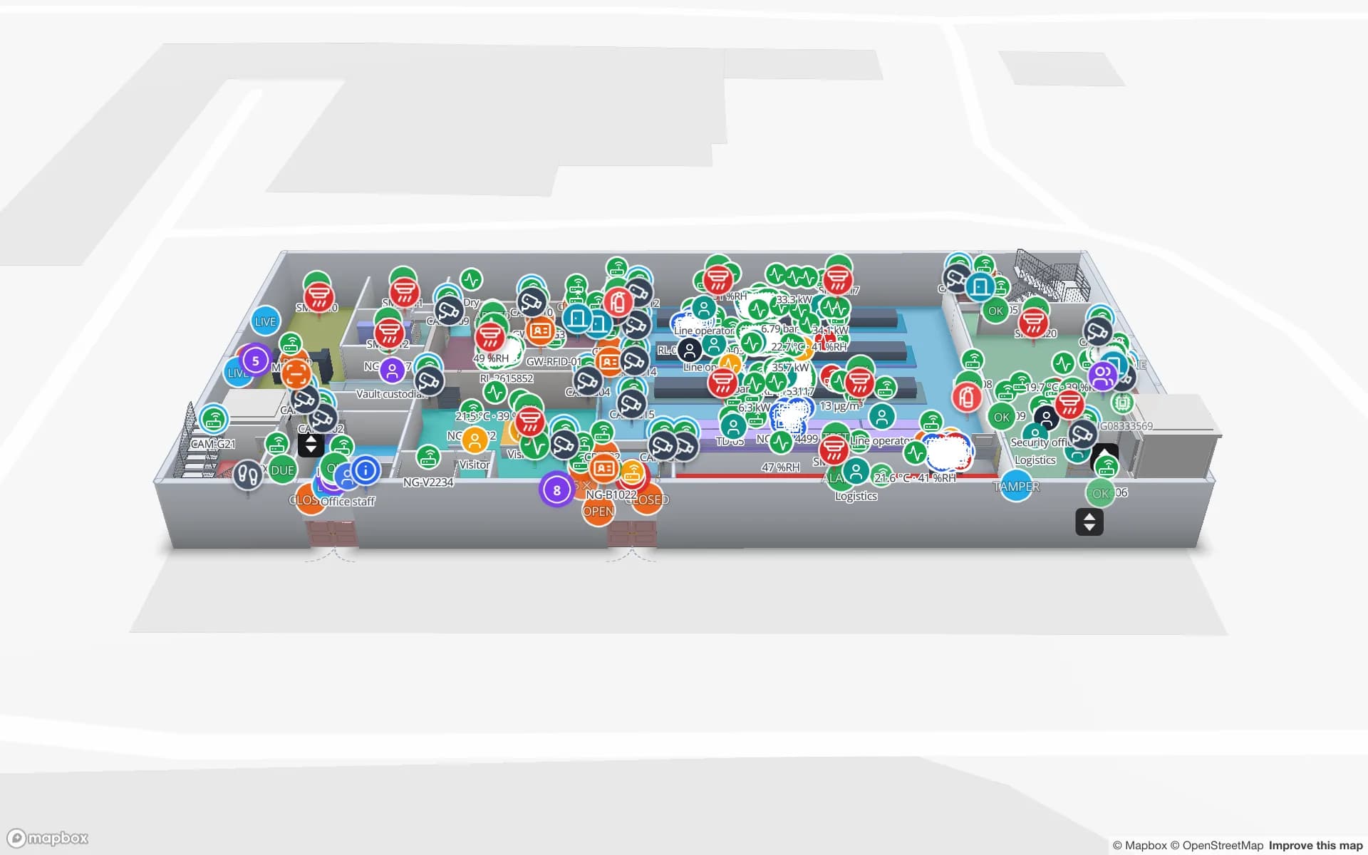
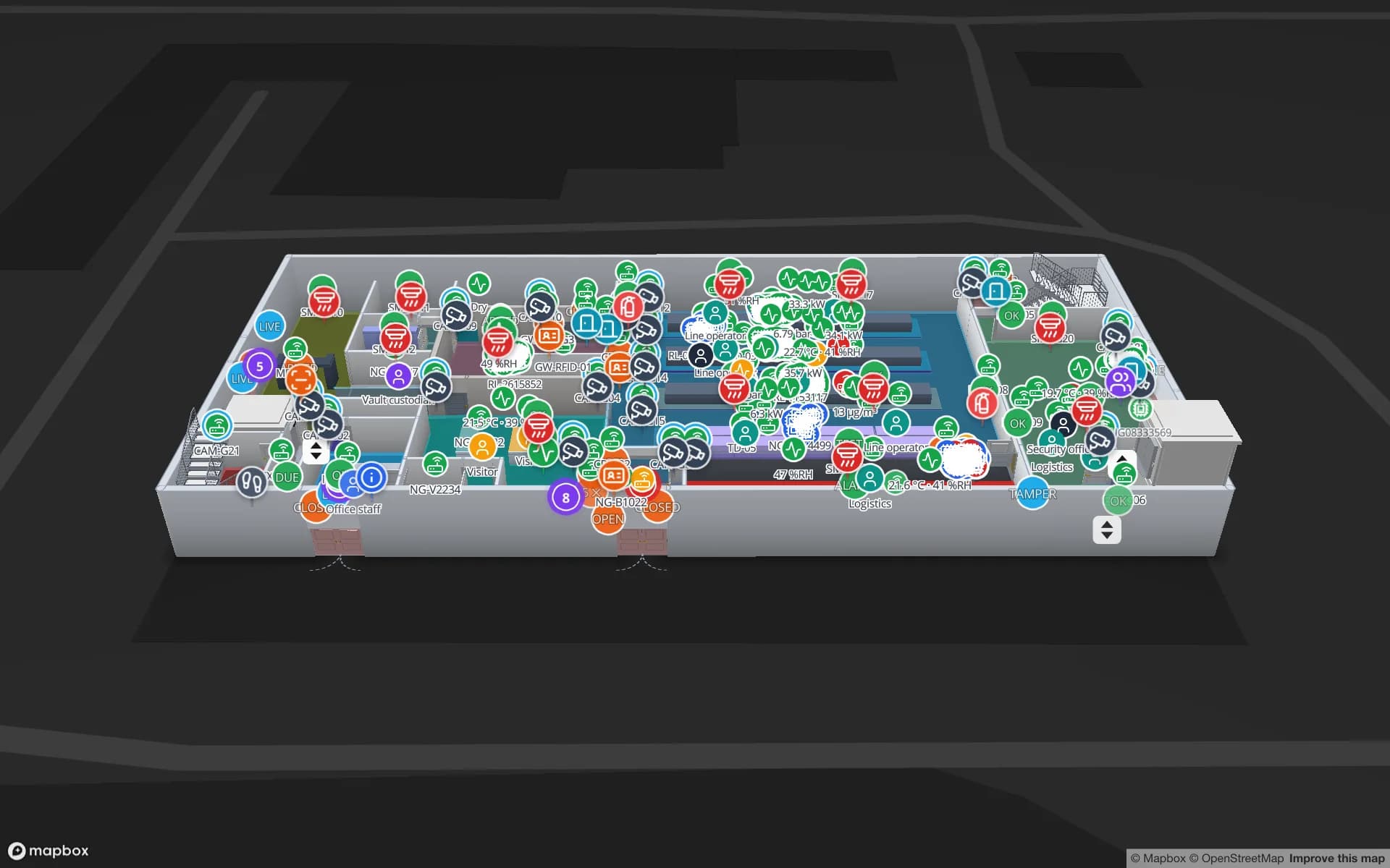
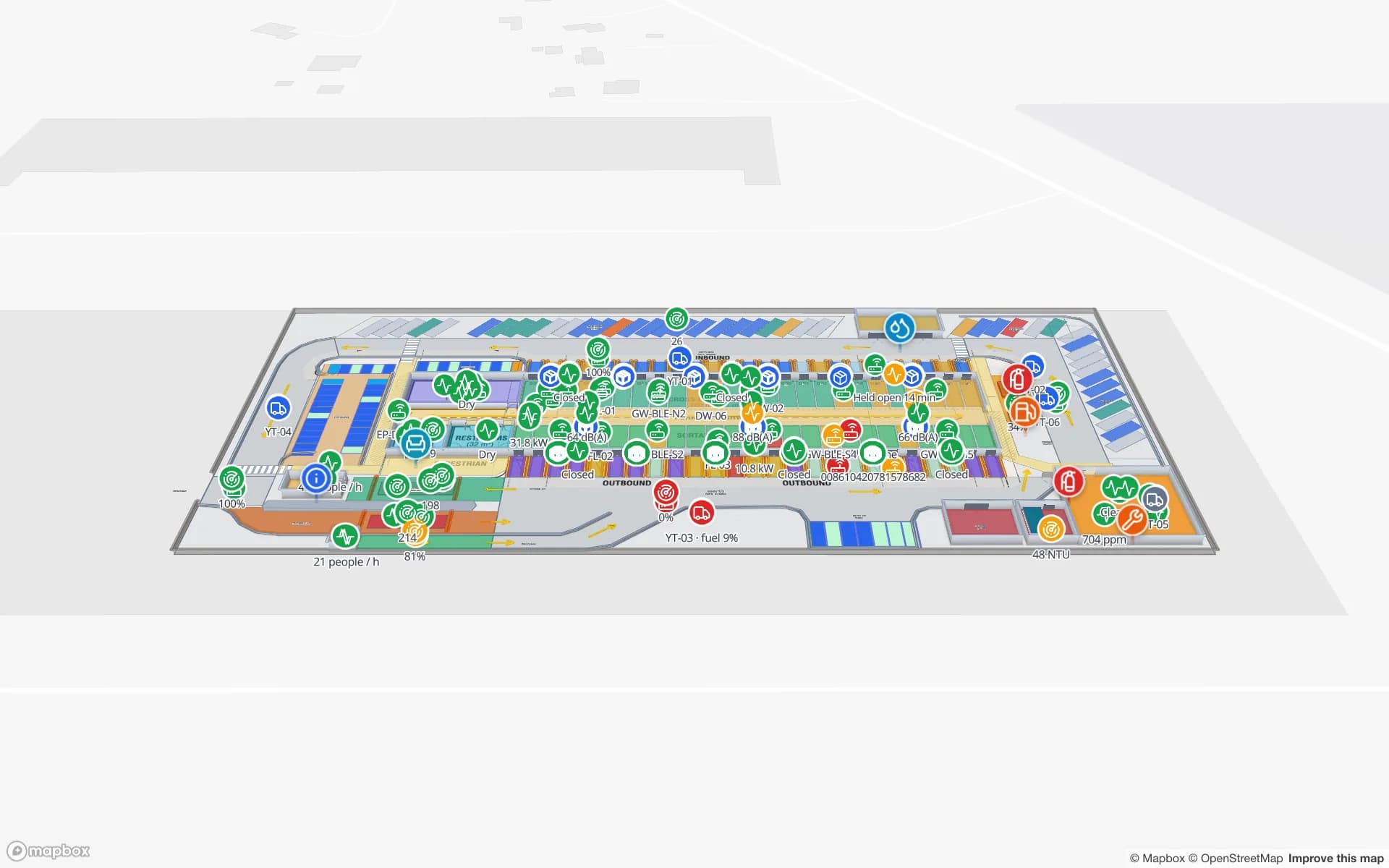
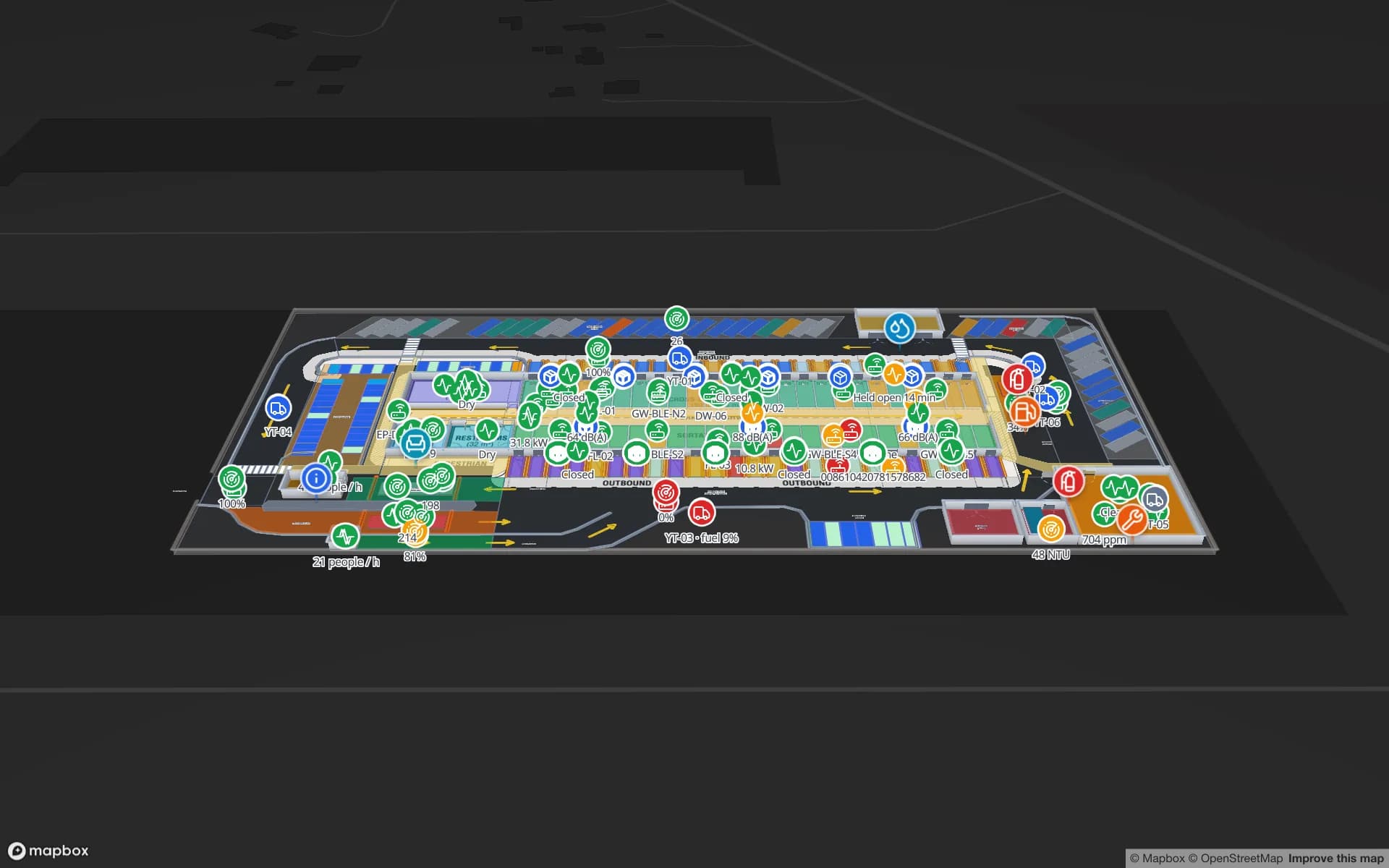
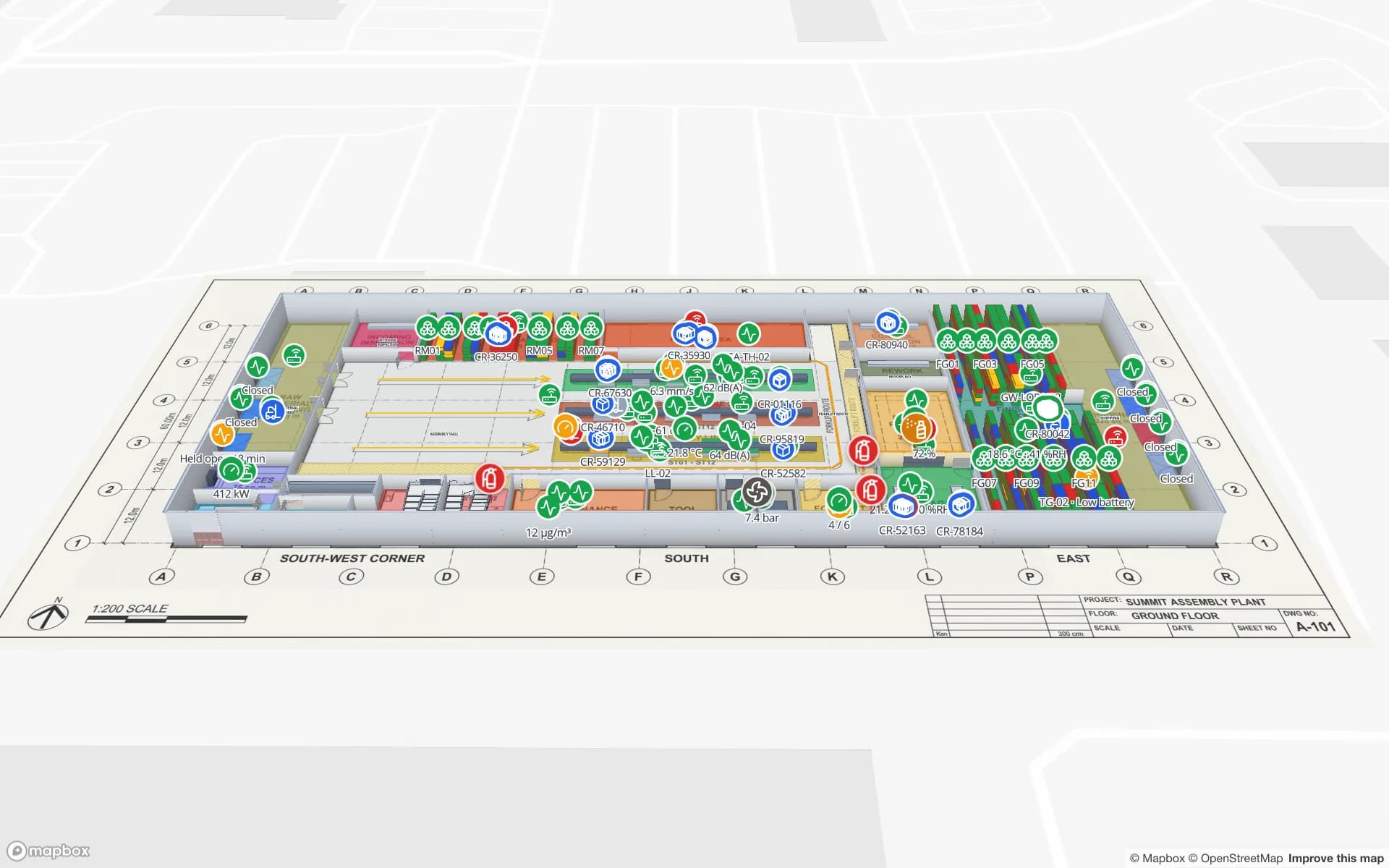
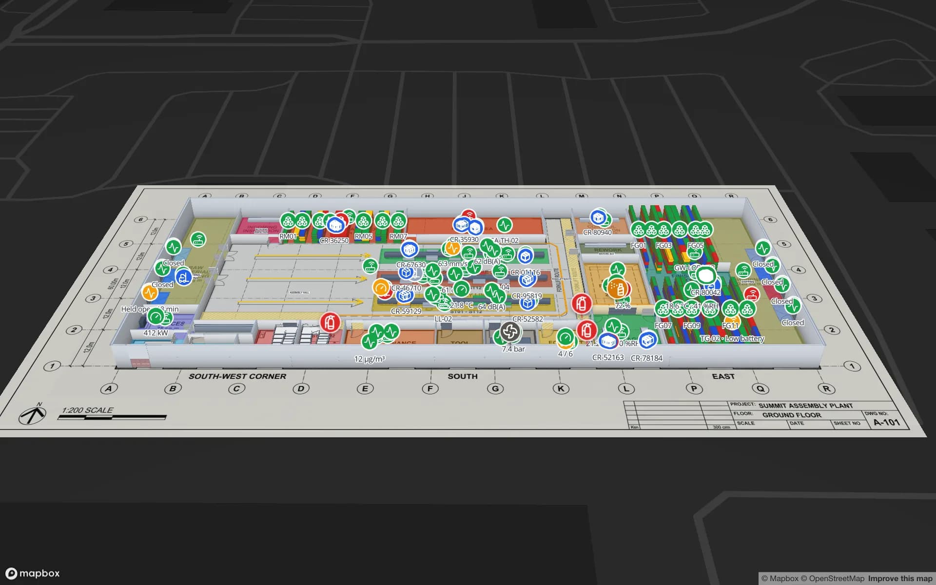
Summit Assembly Plant, a assembly plant demo, in the Spatial Map 3D viewer with live device markers
Summit Assembly Plant
Summit Assembly Plant, a demo plant: assembly lines, WIP and 867 raw-material and finished-goods rack locations, with the docks that feed them.
German interface for every user who wants it
Deutsch
Rack locations in the Summit Assembly demo plant
867
Software to install — runs in any modern browser
0
Free trial, up to 5 facilities
7 days

Automotive and machinery supply chains

Germany’s automotive industry and its mechanical and plant engineering sector (Maschinen- und Anlagenbau) depend on tightly timed supply. Vehicle plants call off parts just in time (JIT) and, for variant-rich modules such as seats or cockpits, just in sequence (JIS); suppliers and logistics providers stage, sequence and deliver against those call-offs. A late or out-of-sequence delivery shows up on the assembly line very quickly.

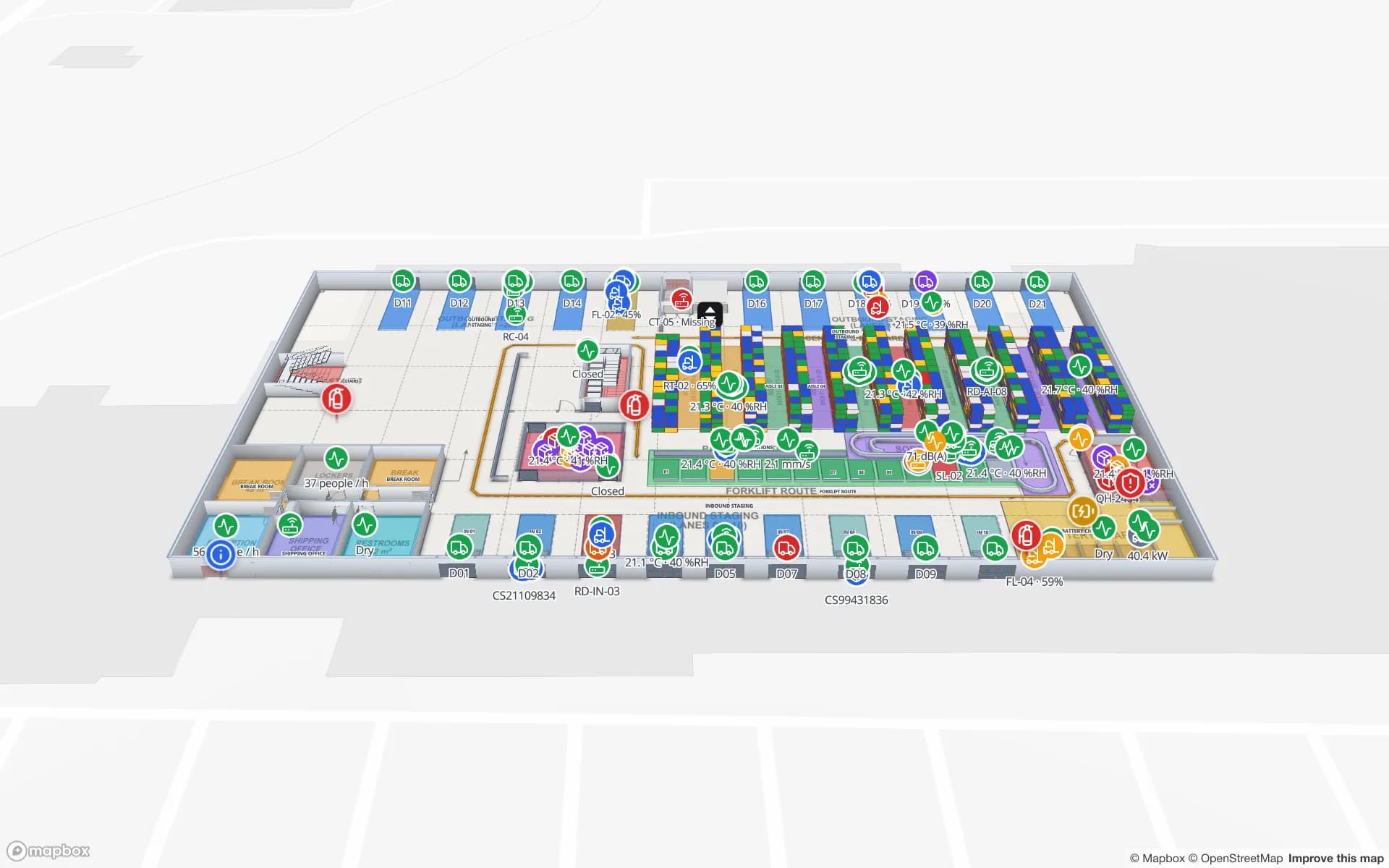
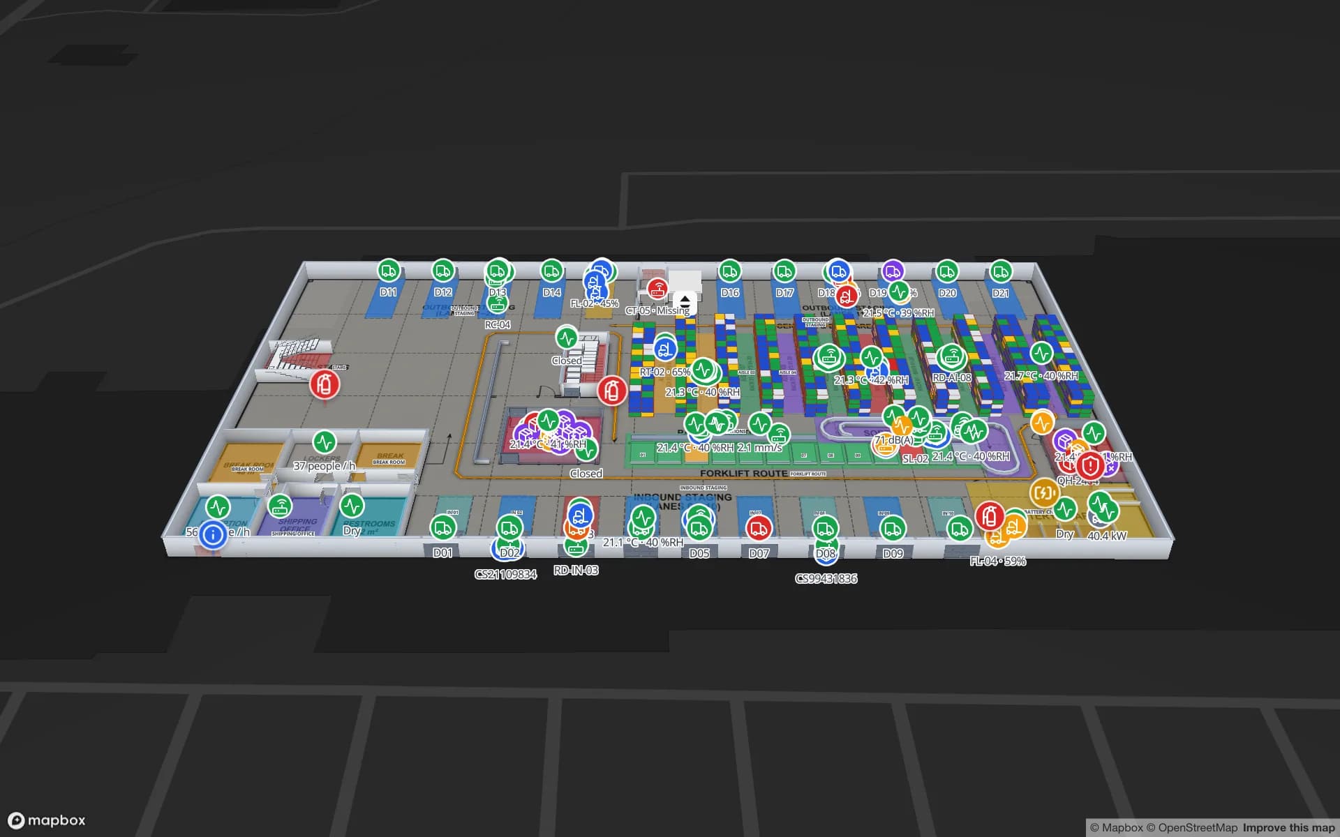
Spatial Map shows where that material actually is inside the building. Supermarkets, sequencing areas, line-side buffers, racks and docks are drawn on the floor plan; RFID reads on load carriers, WIP status from your MES and stock by bin from your WMS turn into live markers and coloured areas. The Summit Assembly demo shows three lines, RFID WIP carriers and a held lot traced to the line it starves.
Industrie 4.0 and intralogistics

Industrie 4.0 has shaped German factory investment for well over a decade, and intralogistics — conveyors, AGVs and AMRs, tugger trains, automated small-parts stores — is a field with many well-known German suppliers. What is often still missing is one shared view of the building that operations, maintenance and planning can all read.

Spatial Map is that view, not another control system. It does not drive conveyors or vehicles; it shows their state. Positions from your RTLS engine, counts from light barriers, temperatures from sensors and machine states from your gateway or IoT platform arrive as table rows — posted through the write API or polled from a REST endpoint — and appear on the map with style rules, history playback and reports.

A fit for Mittelstand plants and warehouses

Much of German industry is Mittelstand: often family-owned, export-oriented companies with one or a handful of plants, lean IT teams and little appetite for long software projects. Spatial Map fits that shape. It runs in the browser with nothing to install, the 7-day trial covers up to 5 facilities, and Pro costs $60 a month or $600 a year for up to 4 facilities.

Existing drawings carry over. Upload the hall layout as a PDF — the scale is read from standard sheet sizes — or as a DWG from AutoCAD R2004–R2018, placed as a picture at real-world units, then trace halls, racks, walls, doors, stairs and lifts on top. If you prefer, our services team digitises the plans for you as a fixed-price custom service, in German or English.

DSGVO and the works council

Under the GDPR (DSGVO), location data that can be tied to an employee is personal data. In addition, introducing a technical system that could be used to monitor employees’ behaviour or performance typically needs your works council’s involvement under the co-determination rules of the Works Constitution Act (BetrVG §87(1) no. 6). Projects go more smoothly when this is planned in from the start, often with a works agreement (Betriebsvereinbarung) that sets out purpose and limits.

Spatial Map makes that conversation easier. Most plant projects tag assets — load carriers, containers, tools, pallets — rather than people, and the map only shows the data you choose to send. Roles limit who can see a facility, share links expose only selected layers and floors, and every workspace is isolated. A data processing agreement (Auftragsverarbeitungsvertrag) is available, and the security page describes how data is protected.

German interface, global teams

The app ships in German as well as English, French, Spanish, Arabic and Chinese, and every user chooses their own. A shift supervisor can work in German while a group logistics team abroad uses English on the same facility; room names, column names and report titles stay exactly as you write them, umlauts included. Reports export to PDF, Excel, CSV and JSON for shift handovers and management reviews.

Our team works with German customers remotely, by video call and through the contact form. This page is also available in German.

How Spatial Map does it

From hall layout to live plant map

  1. 01

    Import the layout

    Upload the hall layout as a PDF or as a DWG (AutoCAD R2004–R2018) and place it at real-world scale.

  2. 02

    Model the material flow

    Draw lines, supermarkets, racks with their bins, docks, doors, stairs and lifts.

  3. 03

    Connect MES, WMS and RFID

    Your integration layer posts rows to a table with the write API, or Spatial Map polls its REST endpoint.

  4. 04

    Run the shift on the map

    Live status, history playback, reports in PDF or Excel, and read-only links for suppliers or auditors.

What German teams use it for

JIT and JIS line supply

Sequencing areas, line-side buffers and WIP carriers on one plant map.

Returnable load carriers

RFID-tagged small and large load carriers (KLT/GLT) and racks followed from dock to line and back.

Warehouse and spare-parts stock

Stock by bin from your WMS, coloured on every rack location.

High-value components and secure stores

Security zones, access points and RFID-tagged units read at every choke point.

Inbound docks and yard

Dock doors, yard slots and the gate for supplier deliveries and outbound loads.

See it on real demo facilities

Fictional names, real floor plans, live sensors, RFID, BLE tags and gateways — open any of them in the browser.

All 13 demo facilities

Questions from German teams

Yes. The app ships in German alongside English, French, Spanish, Arabic and Chinese, and each user picks their own language. Your own content — room names, columns, report titles — stays as you write it.

If the system could be used to monitor employees’ behaviour or performance, co-determination under BetrVG §87(1) no. 6 typically applies and your works council needs to be involved; your legal advisers and works council decide the details. Projects that tag only assets such as load carriers, tools and pallets usually raise fewer questions, and Spatial Map only shows the data you send it.

Yes, through the three ways data comes in: a REST endpoint Spatial Map polls on a schedule (JSON, GeoJSON or CSV), file uploads (CSV, Excel, JSON, GeoJSON), or the table write API (HTTPS, bearer API key, bulk upsert, 60 requests per minute per key). Your integration layer delivers the rows; there are no device drivers inside Spatial Map.

The ones you already run. Spatial Map is hardware-agnostic: your RFID middleware or RTLS engine computes reads, positions or zone presence, and Spatial Map displays them on the map.

Yes. DWG files from AutoCAD R2004–R2018 are placed as a picture at real-world units, and PDFs are scaled from standard sheet sizes. DXF is not supported; export a PDF or DWG instead.

Map your first German plant this week.

Start the free trial in German or English, or send us a hall layout and a sample of your MES or WMS data through the contact form.