

Tallinn · Old Town, the airport, Ülemiste and the Song Festival Grounds

Indoor mapping in Tallinn, from medieval cellars to the airport terminal

Spatial Map turns floor plans into a live 3D map in the browser: rooms, doors, stairs and lifts across several floors, with tagged equipment, sensors and visitor counts shown where they are. Indoor mapping in Tallinn spans unusually different buildings: a medieval Old Town on the UNESCO list, an airport that is a short drive from the centre, a rail and tram node taking shape at Ülemiste, and a vast open-air concert ground. Every one of them can be a facility, and a building owner or tenant opens it with a link.

No credit card. Runs in the browser. Pro is $60/month for up to 4 facilities. Book a demo

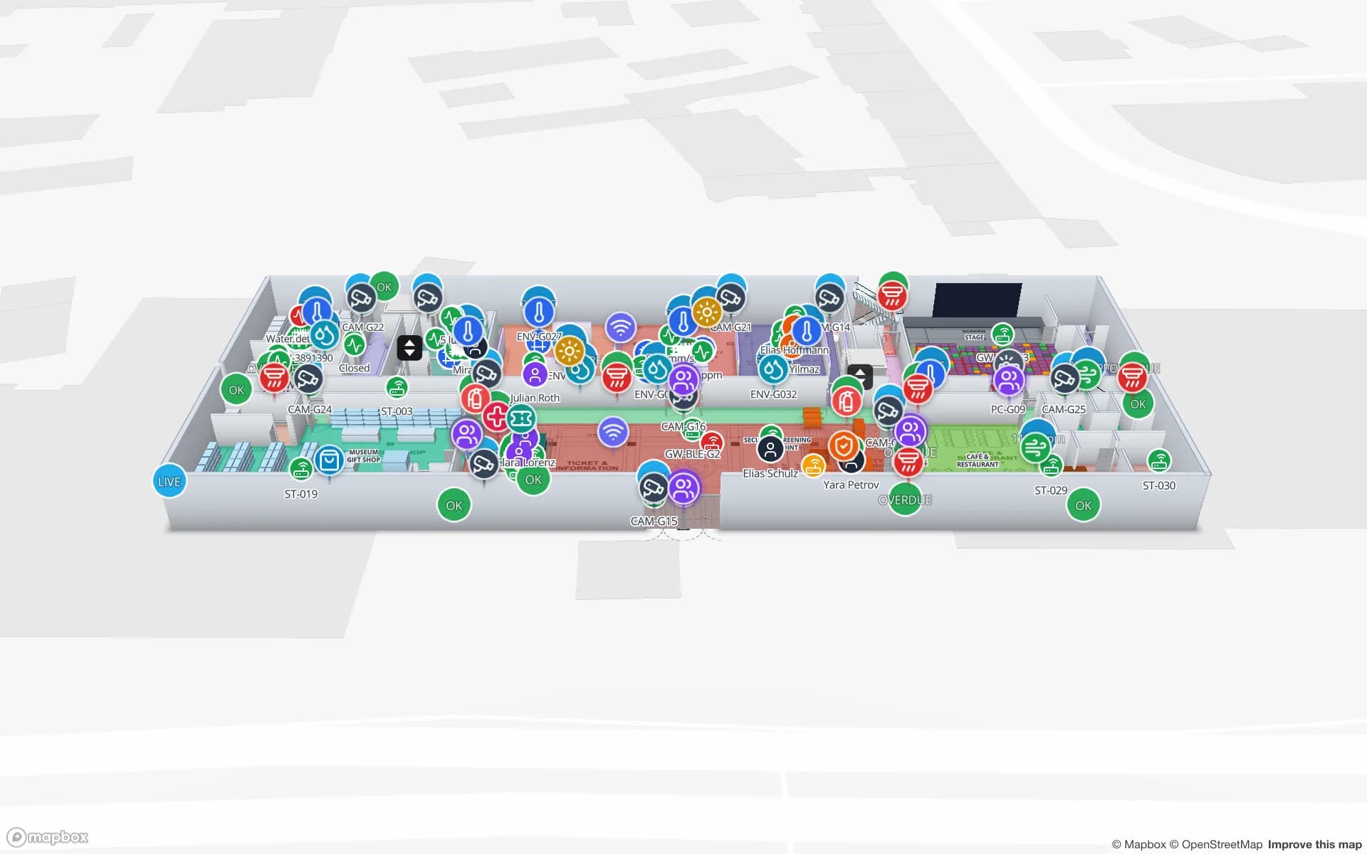
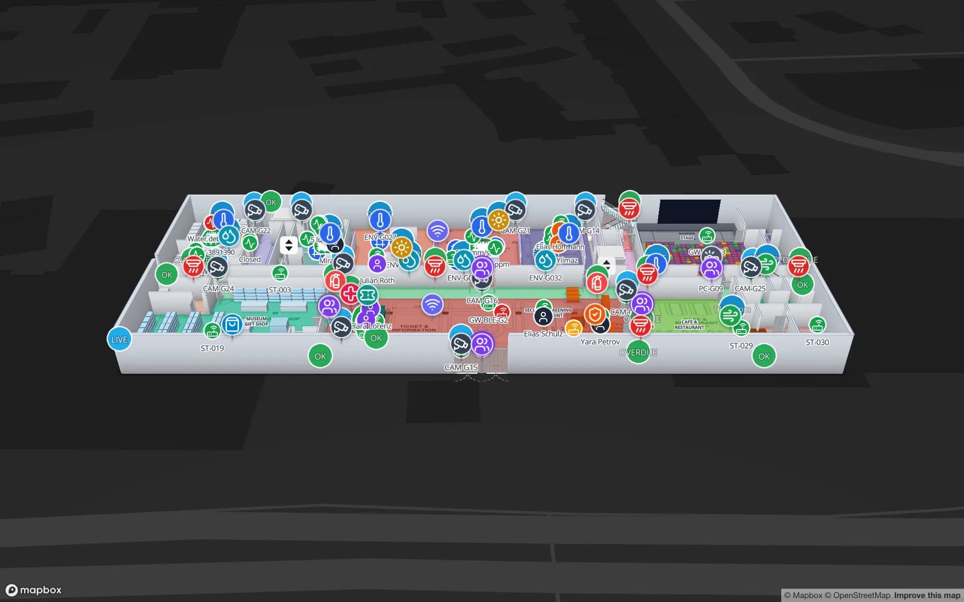
Silverbay International Airport — Terminal 2, a airport terminal demo, in the Spatial Map 3D viewer with live device markers
Silverbay International Airport — Terminal 2
Silverbay Airport, a demo two-floor terminal: check-in islands, security lanes, gates with jet-bridges, lifts, escalators and baggage reclaim.
Year the Old Town of Tallinn joined the UNESCO World Heritage List
1997
Passengers at Tallinn Airport in 2025, per its annual report
3.49 M
Gates, security lanes and baggage reclaim in the Silverbay demo
2 floors
Free trial, up to 5 facilities, no card
7 days

The Old Town: buildings that were never drawn for a computer

UNESCO inscribed the Historic Centre (Old Town) of Tallinn in 1997 and lists a core area of 113 hectares, enlarged from about 60. It describes the upper town of Toompea, with its castle and cathedral, as the administrative centre, and the lower town as the part that kept its trading character. In practice that means merchants’ houses with cellars, courtyards and lofts, many of them now offices, hotels, restaurants and museums.

The plans of such buildings are often scans, hand drawings or a heritage survey in PDF, and floors do not line up. Upload what exists, place it at real scale and trace the rooms; AI Map can draft walls and doors from the picture and a person reviews every one. A museum or office can then mark fire equipment, tagged exhibits and staff rooms; the Production Museum demo shows three floors with galleries, climate sensors and object tags. Heritage rules about what you may fix to a wall are for your conservation adviser; Spatial Map only draws and tags.
Tallinn Airport: a terminal a few kilometres from the centre

Tallinn Airport served 3,488,973 passengers in 2025, according to its annual report, about the same as the year before. Statistics Estonia counts direct flights to over 90 destinations, with Stockholm, Riga and Helsinki the busiest routes, and notes that air freight and mail grew 33 % to about 12,400 tonnes.

A terminal is a many-floor building where staff and passengers need routes, and where operations need to see gates, queues and equipment. Spatial Map draws check-in and gates as areas, shows crowd counters and equipment on the plan, and routes people across floors by stairs, lifts and escalators with a step-free option; it does not place a visitor’s blue dot. The Silverbay demo is a two-floor terminal built the same way, and airport indoor mapping explains the data side.

Ülemiste: a tram, a railway and the airport on one patch

Tallinn’s city government has approved a plan turning 11.47 hectares at Ülemiste into a transport node, with the Rail Baltica passenger terminal meant to link the Baltic countries with Western and Southern Europe, and trade-press reports mention a tram extension to the airport. Plans change and sources differ on timing, so we give no dates.

For anyone running a building in such a node — offices, retail, a station concourse, a car park — the interesting question is how people move through several levels and connect between modes. A map with floors, lifts, escalators and walking routes with minutes shows it; occupancy counters coloured on the plan show where it jams. Heatmaps stop at walls and closed doors, which keeps them honest indoors.

The Song Festival Grounds and the event calendar

The Tallinn Song Festival Grounds are an open-air stage and field with indoor event spaces in the same complex; the operator’s own guide says the concert area can be set up for anything from 5,000 to 15,000 people by moving the stage. Headline capacities for the big festivals differ between sources, so none is quoted. What is certain is that an event of this kind needs entrances, first aid, catering points and crowd counts in one place.

Draw gates, stages and service points once, then switch layers per event. The Lakeside convention demo shows halls with live occupancy and freight docks, and the Crown Park stadium demo shows gates, turnstiles and crowd flow. Read-only share links with an expiry date give contractors and stewards the plan without an account; tags move live on shared links.

Services for teams in Tallinn

Where Tallinn teams usually start depends on the building:

Language and working with us from Tallinn

The interface is not available in Estonian or Russian, which matters in a city where both are spoken every day. Staff can use English, German, French, Spanish, Arabic or Chinese, and the content you write — room names, notices, report titles — can be in Estonian or Russian. Spatial Map is sold online in US dollars and our team works with customers in Estonia remotely.

Also served nearby

The same approach covers Maardu, Viimsi, Saue and Harku, and the industrial areas around Muuga. Nothing needs to be installed on site: the map opens in a browser.

How Spatial Map does it

From scanned plan to Tallinn map

  1. 01

    Pick one building

    A heritage building, a terminal wing or a venue where equipment or crowds are a problem.

  2. 02

    Import and trace

    Upload the PDF, DWG (AutoCAD R2004–R2018, placed as a picture) or photo, align it, and let AI Map draft the floor for review.

  3. 03

    Add tags and counters

    Equipment tags, room sensors and visitor counters post rows through the table write API, REST polling or CSV uploads.

  4. 04

    Share the plan

    Read-only links with expiry give stewards, tenants and contractors the map without an account.

What Tallinn teams map

Heritage offices and museums

Rooms, exhibits, climate and fire equipment across several uneven floors.

Airport and station areas

Gates, queues, lifts and step-free routes across floors.

Event grounds and halls

Entrances, crowd counts, catering and service points per event.

Office buildings

Tagged equipment, meeting rooms and work orders by floor.

See it on real demo facilities

Fictional names, real floor plans, live sensors, RFID, BLE tags and gateways — open any of them in the browser.

All 13 demo facilities

Indoor mapping in Tallinn — questions we get

Yes. Upload the scan or a photo and align it at real size. AI Map can draft walls and doors from the picture and you correct what it gets wrong. Floors that differ in outline are handled as separate floors.

No. Spatial Map does not position visitors. It shows routes across floors with walking minutes and a step-free option, and live markers for equipment you tag or counters you install.

Yes. Read-only share links can lock a floor, choose layers and expire after a date or a number of views, and can be revoked. Facilities and reports can also be grouped per client.

Not yet. The app is available in English, German, French, Spanish, Arabic and Chinese. Names and notices you write yourself can be in Estonian or Russian.

No. Spatial Map is sold online and our team works with customers in Estonia remotely, by video call and through the contact form. There are no local resellers or partners.

In US dollars, the same worldwide: a 7-day free trial for up to 5 facilities with no card, then Pro at $60 a month or $600 a year for up to 4 facilities. Tags and gateways, if you ask us to source them, are quoted per project.

Map one Tallinn building before the next event.

Start the free trial and open the airport demo, or send us a scanned plan of a building and a list of what you need to find in it.





