Helsinki · Vuosaari, Helsinki Airport City and Ring III

Warehouse tracking in Helsinki, from the Vuosaari ramp to the last bin

Spatial Map shows warehouse stock, dock doors, yard slots and RFID reads on a live 3D map of the building, coloured from your own WMS, RFID middleware and sensors. Warehouse tracking in Helsinki is shaped by a freight harbour on the east side of the city, a direct ro-pax link to Estonia, an airport with a big cargo building and a climate where the loading dock is the coldest room in the plant. Each warehouse is its own facility, and all of them can sit in one workspace.

No credit card. Runs in the browser. Pro is $60/month for up to 4 facilities. Book a demo

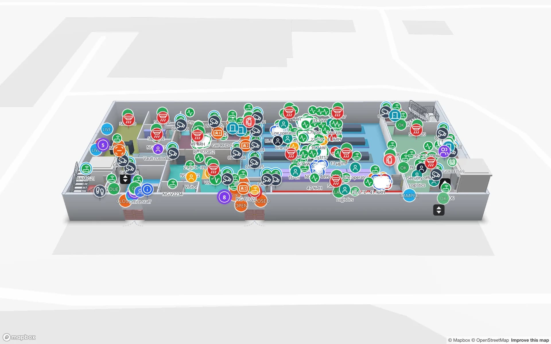
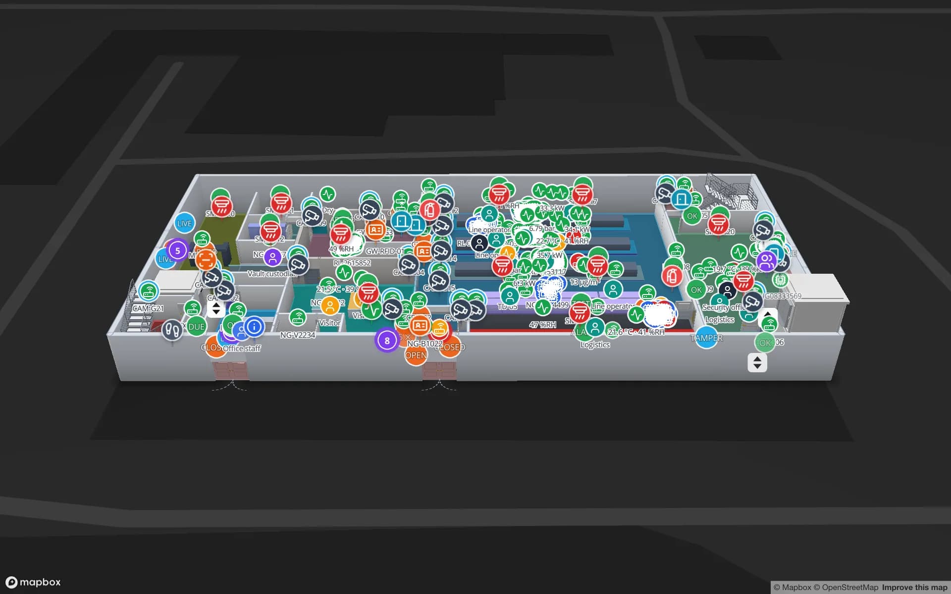
Eastport Cross-Dock Freight Hub, a cross-dock & trailer yard demo, in the Spatial Map 3D viewer with live device markers
Eastport Cross-Dock Freight Hub
Eastport Cross-Dock, a demo freight hub: 50 dock doors, 44 yard slots and 1,180 RFID pallets, with the gate and weighbridge.
Dock doors in the Eastport cross-dock demo
50
Rack locations in the Crestline fulfilment demo
2,204
RFID pallets moving through Eastport
1,180
Free trial, up to 5 facilities, no card
7 days

Vuosaari: a freight harbour with its own rail line

The Port of Helsinki calls itself Finland’s leading general port for foreign trade, and says that in 2025 13.4 million tonnes of freight passed through it. Vuosaari Harbour, in its words, is a cargo harbour that mainly handles freight. It opened on 24 November 2008, covers about 240 hectares and has a dedicated rail line to the Finnish Main Line at Kerava, and sits at the eastern end of Ring III. The port calls the Vuosaari–Muuga route a direct connection between the capitals of Finland and Estonia, and says the berth can receive up to three ro-pax vessels per day.

The warehouses that serve a harbour like that work to ship times. Tag pallets at receiving, read them at the dock door, and the map shows which are staged for the sailing and which are still on the floor. The Eastport demo shows 50 dock doors, 44 yard slots and 1,180 RFID pallets on one map, with the gate and weighbridge. Spatial Map does not connect to port or customs systems; it shows what your own WMS and readers say.


Helsinki Airport City: cargo that changes hands at the apron

The airport operator describes its cargo building in Helsinki Airport City as a large logistics, cargo-terminal and office property of about 30,000 square metres, its largest individual logistics property, with one side directly connected to the apron for direct access to air transport. Buildings like that have two faces: an airside door where freight is handed over and a landside door where trucks arrive.

Mapping both is the trick. Draw the shed with its airside and landside doors, staging lanes by departure and any chilled rooms, and let your handling or warehouse system post rows for each consignment: arrived, built up, handed over. A lane colours by age, and an alert rule “matches for N minutes” raises an in-app alert when a consignment waits past its cut-off. Spatial Map is independent of the airport operator and its systems, and RFID warehouse management shows how reads at the doors fit.

Cold climate: the dock door is the coldest room

The Finnish Meteorological Institute gives a 1991–2020 mean temperature of 6.5 °C for Helsinki and 0.3 °C for Sodankylä in the north. A Helsinki warehouse often ships to places that are colder still, and in winter the weak spots are the dock doors, unheated annexes and trailers waiting in the yard. Goods that must stay above freezing — beverages, paints, adhesives — are exposed exactly where a door is open.

Put a temperature sensor and a door sensor at each dock, send them to a table, and the map colours each dock by reading and shows which doors are open. An alert rule “matches for N minutes” raises an in-app alert when a door stays open too long. Cold also affects handheld batteries and printers, so test your own devices at the dock; that is a question for the device vendor, not something Spatial Map can verify. The Finland page covers winter storage in general, and warehouse temperature mapping shows how a heatmap finds the cold corner.

Bin-level stock: what warehouse tracking means in practice

Warehouse tracking in a plain sense means knowing where each pallet, carton or tote is, and what the system says should be there. Draw racks with their bins from the architect’s plan, bring stock by location in from your WMS, and the map colours each bin by status: full, low, empty, on hold. RFID reads add the physical truth at doors and on handheld walk-throughs, and stock counting shows how a count is taken and compared.

The Crestline demo shows 20 racks with 2,204 locations coloured by stock status, pick modules, packing stations and the staging lanes in front of the docks. Spatial Map is not a WMS: it does not decide putaway or picking. The warehouse digital twin vs WMS post explains where the line is.

Services for teams in Helsinki

Where Helsinki teams usually start depends on the building:

  • Port-side warehouses and forwarders begin with inventory tracking at dock doors and yard slots.
  • Distribution centres begin with the bin map and a door-by-door temperature view in winter.
  • Airport-area handlers add asset tracking for unit load devices and returnable equipment.
  • RTLS and UWB is for large plants and yards where vehicles and people must be located continuously; a BlueIOT server connects directly and other engines through the write API.
  • If you have no readers, tags or sensors yet, our team can source them on request, quoted per project, with warranty from the manufacturer: see hardware and demo kits on request. WMS and ERP integrations, Android RFID handheld apps and other custom software are built as client projects; the product runs as cloud or on-premises.

Also served nearby

The same page covers Vantaa and Espoo, Kerava along the rail line from Vuosaari, Sipoo, Tuusula and Porvoo. Nothing needs installing at any of them: the map opens in a browser, and the interface is in English — lane names and rack codes stay in Finnish, ä and ö included, exactly as you type them.

How Spatial Map does it

From a warehouse plan to a live bin map

  1. 01

    Pick one warehouse

    A port-side shed, an airport cargo building or a distribution centre — wherever a lost pallet costs most.

  2. 02

    Map racks, bins and docks

    Upload the plan, align it, let AI Map draft the floor, and name read points the way your WMS names them.

  3. 03

    Connect stock, reads and sensors

    Your WMS, RFID middleware and dock sensors post rows through the table write API, a polled REST endpoint or CSV and Excel uploads.

  4. 04

    Add door and cut-off rules

    In-app alerts for open doors, pallets staged past a cut-off and readers that stopped reporting.

What Helsinki teams track

Port and ro-ro warehouses

Dock doors, yard slots and pallets staged for the right sailing.

Distribution and fulfilment centres

Rack-level stock by bin, pick modules and staging lanes.

Chilled and frost-free rooms

Probe readings and open doors by room and dock.

Electronics and secure stores

RFID-tagged units through security zones and a secure store.

See it on real demo facilities

Fictional names, real floor plans, live sensors, RFID, BLE tags and gateways — open any of them in the browser.

All 13 demo facilities

Warehouse tracking in Helsinki — questions we get

No. A WMS decides putaway and picking; Spatial Map shows its stock, doors and reads on a map. It cannot write back to your WMS or ERP, so changes still happen in the WMS.

No. It has no link to port, terminal or customs systems. It shows what happens inside your own warehouse, from your own WMS, RFID reads and sensors.

That depends on the hardware and how you mount it, so ask the vendor for its operating range and test at your dock. Spatial Map does not make hardware; what it adds is visibility — an in-app alert when a reader stops reporting, and dock temperatures coloured on the plan.

No. The interface is available in English, German, French, Spanish, Arabic and Chinese, so Finnish teams use it in English. Rack codes, lane names and report titles are yours and can be in Finnish or Swedish.

No. Spatial Map is sold online and our team works with customers in Finland remotely, by video call and through the contact form. There are no local resellers or partners.

In US dollars, the same worldwide: a 7-day free trial for up to 5 facilities with no card, then Pro at $60 a month or $600 a year for up to 4 facilities. RFID hardware, if you ask us to source it, is quoted per project and is not part of the subscription.

Map one Helsinki dock before the next sailing.

Start the free trial and open the Eastport demo, or send us the plan of a warehouse and a sample of your stock export through the contact form.