Dublin · The port, the airport and the data-centre belt

RFID tracking in Dublin, from the port trailer to the data-hall crate

Spatial Map puts RFID reads on a live 3D map of the building where they happen, so a tag at a dock door becomes a pallet in a lane, a crate in a laydown area or a cage on an apron-side shed floor. RFID tracking in Dublin is shaped by an island economy with one very busy front door: freight that arrives through Dublin Port and Dublin Airport spreads across the capital region to distribution sheds, manufacturing sites and the data-centre halls being built, fitted out and extended in and around the city. Your readers and middleware do the reading; Spatial Map shows each read in place.

No credit card. Runs in the browser. Pro is $60/month for up to 4 facilities. Book a demo

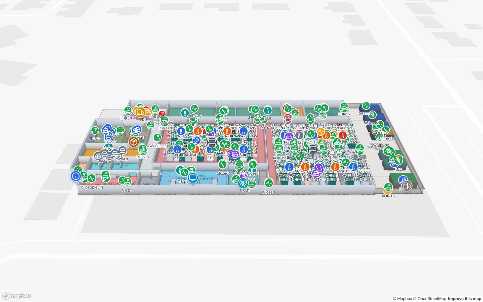
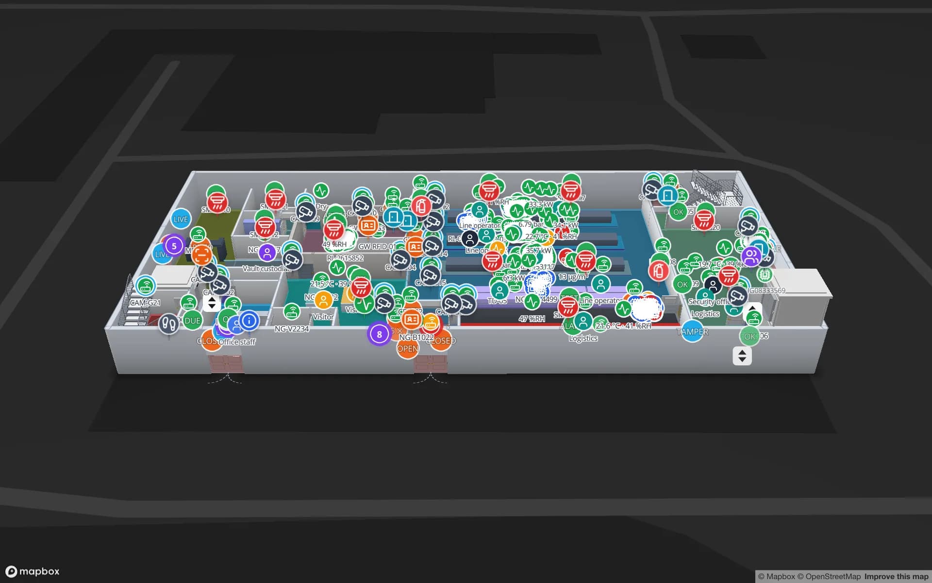
Eastport Cross-Dock Freight Hub, a cross-dock & trailer yard demo, in the Spatial Map 3D viewer with live device markers
Eastport Cross-Dock Freight Hub
Eastport Cross-Dock, a demo freight hub: 50 dock doors, 44 yard slots and 1,180 RFID pallets, with the gate and weighbridge.
Dock doors in the Eastport cross-dock demo
50
RFID pallets moving through Eastport
1,180
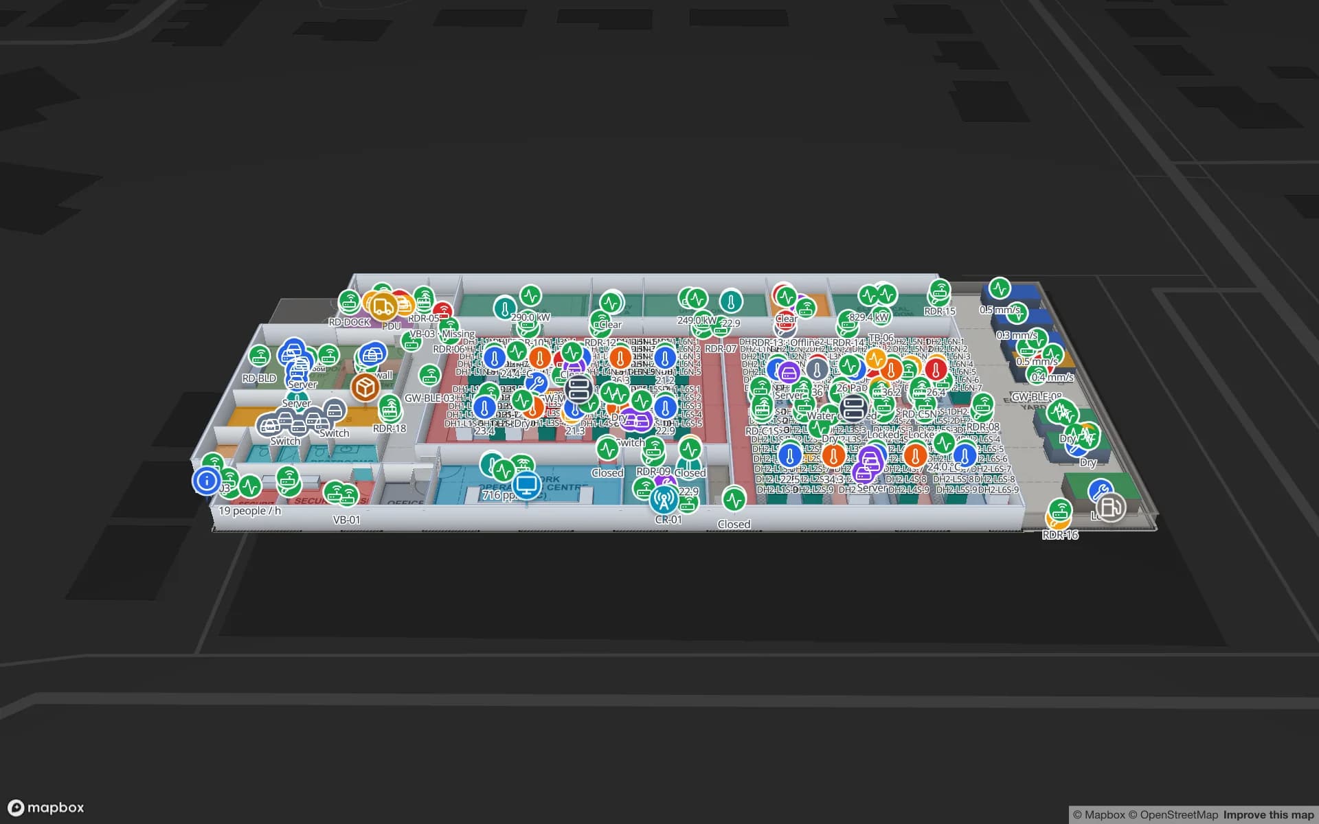
Cabinet rows in the Ridgeline data-hall demo
24
Free trial, up to 5 facilities, no card
7 days

Dublin Port: the trailer is the unit

Dublin Port is owned and run by a State-owned commercial company that describes it as the largest freight and passenger port in Ireland. A dedicated twin-bore tunnel, 4.5 km long and opened in 2006 according to Dublin City Council, carries heavy goods vehicles between the port and the M50. Most freight arrives on wheels or in boxes, as roll-on roll-off trailers and lift-on lift-off containers, and leaves through that tunnel within hours.

For a distribution shed in the capital region the question is what the trailer contains and where it sits. Tag pallets at the point they are loaded, read them at your dock doors, and the map shows which pallets are staged against which trailer, which trailer is in which yard slot and which lane is still waiting. The Eastport demo shows 50 dock doors, 44 yard slots and 1,180 RFID pallets, with the gate and weighbridge. Spatial Map does not connect to port, customs or terminal systems, and it does not predict ferry arrivals; it shows what your own reads and WMS say. For the wider picture of dairy cold stores and pharma, the Ireland page covers it.
Dublin Airport: parcels, perishables and night freight

A 2020 economic-impact study published by the airport says it is the busiest cargo airport in Ireland and handles around 90 % of the country’s air freight, that bellyhold freight and the main express carriers together make up around 94 % of the volume, and that freight flown at night accounts for 38 % of the total. A shed serving that traffic works to a clock, with consolidated cages, express parcels and temperature-sensitive consignments all needing to be somewhere specific by a specific hour.

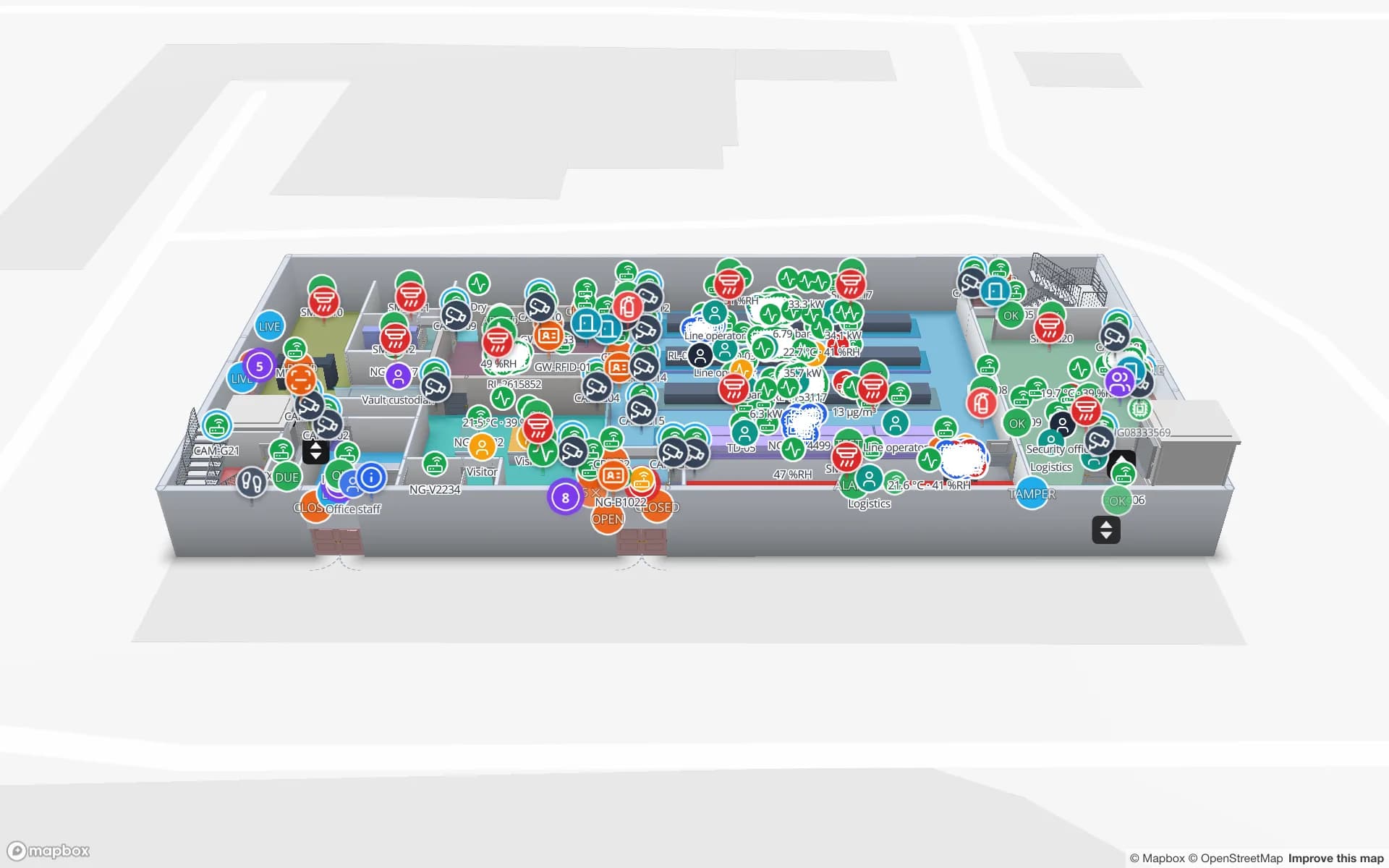
Draw the shed with its cage lines, cold room and secure area, tag cages and high-value consignments, and read them at the shed door. The map shows what is staged, what has left and what is late. The Northgate demo follows 863 tagged units through a secure store, and the History player replays a unit’s path for an investigation. Spatial Map is not a handling or airline system, does not read air waybills and does not connect to the airport’s systems.

Data-centre build-outs: tracking the equipment before it is live

The Central Statistics Office reports that data centres used 22 % of Ireland’s metered electricity in 2024, up from 5 % in 2015, and the grid operator’s May 2026 overview expects the greater Dublin area and surrounding areas to be constrained for large new data-centre developments. The Ireland page covers data halls in operation. Whether a project is a new hall or an expansion of an existing one, a different problem comes first: the build-out. Crated cabinets, power and cooling kit, cable drums and spares arrive on trucks, wait in laydown areas, go through goods-in and are installed by contractors who each have their own area.

Tag the high-value items when they are received, read them at the loading bay and at the hall door, and the map shows what has arrived, what is in laydown, what is installed in which cabinet and what is missing. When the hall goes live, the same tags stay on the cabinet as the asset record. The Ridgeline demo shows a hall mapped cabinet by cabinet, with 24 rows. Spatial Map does not control power or cooling plant and does not manage contractors’ permits; it shows where tagged items are.

Pharma and medtech distribution

IDA Ireland says medtech accounts for 8 % of Ireland’s exports, and biopharma is one of the other sectors it promotes. Behind the plants sit warehouses where finished goods, samples, components and returns are staged by lot, in cartons and on pallets that must leave on the right truck. Tags on cartons or pallets, read at the packing station and the dock door, show which lot is staged and which trailer it is bound for.

The Polar Pharma demo shows quarantine areas, cold rooms and 1,140 rack locations. Spatial Map makes no compliance claim: your quality system remains the record for any regulated product, and the map shows where it physically sits and what your sensors report. See the post on pharma cold storage temperature monitoring for how the readings fit.

Services for teams in Dublin

Where Dublin teams usually start depends on the building:

  • Port-side distribution sheds and cross-docks usually begin with inventory tracking at the dock doors, then add yard slots and trailers.
  • Data-centre contractors and operators often start with asset tracking for crated equipment and spares, then use the same tags for the cabinet record.
  • RTLS and UWB matters mainly for big yards and plants where vehicles and people must be located continuously; most buildings will not need it first.
  • If you have no readers or tags yet, our team can source RFID readers, antennas and tags on request, quoted per project, with warranty and device support from the manufacturer: see hardware and demo kits on request.
  • WMS integrations and handheld stock-take apps are built as client projects, including an RFID inventory system; the product runs as cloud or on-premises.

Also served nearby

The same page covers the industrial areas of Fingal, South Dublin, Dún Laoghaire-Rathdown and the neighbouring counties of Meath, Kildare and Wicklow, and sites along the M50 and the M1. Nothing needs to be installed at any of them: the map opens in a browser. The interface is in English and is not available in Irish.

How Spatial Map does it

From the port gate to the data hall

  1. 01

    Pick one building

    A distribution shed, an airport-side cargo unit or a data-centre site under construction — wherever a missing item costs most.

  2. 02

    Map doors, lanes and laydown

    Upload the plan, photo or sketch, let AI Map draft the floor, and name read points the way your middleware names them.

  3. 03

    Connect reads and stock

    RFID middleware and your WMS post rows through the table write API, a polled REST endpoint or CSV and Excel uploads.

  4. 04

    Add door and silence rules

    In-app alerts for pallets staged too long, cages not read and readers that stopped reporting.

What Dublin teams track

Port-side distribution and trailers

Dock doors, yard slots and pallets staged against each trailer.

Airport cargo cages

Consolidations and high-value consignments through the shed with a read trail.

Data-centre equipment

Crated kit from goods-in to laydown to cabinet, then the asset record.

Medtech and pharma stock

Cartons and pallets by lot, quarantine areas and cold rooms in place.

See it on real demo facilities

Fictional names, real floor plans, live sensors, RFID, BLE tags and gateways — open any of them in the browser.

All 13 demo facilities

RFID tracking in Dublin — questions we get

No. It has no link to port, customs or ferry-operator systems, and it does not predict arrivals. It shows what happens inside your own building, from your own RFID reads and WMS, so it complements port-level systems rather than replacing them.

Yes. Draw the loading bay, laydown areas and hall on the plan, tag items on receipt, and read them at the bay and the hall door. The map shows what has arrived, where it sits and what is installed. It does not manage permits or contractors’ schedules, and it does not control plant.

It shows where tagged stock physically is and what your sensors report, with row history and exportable reports. It makes no compliance claim, and your quality system and procedures remain the record for any regulated product.

No. It is available in English, Spanish, French, German, Arabic and Chinese. Your own room names, labels and report titles can be in any language.

No. Spatial Map is sold online and our team works with customers in Ireland remotely, by video call and through the contact form. There are no local resellers or partners.

No. Pricing is the same worldwide and in US dollars: a 7-day free trial for up to 5 facilities with no card, then Pro at $60 a month or $600 a year for up to 4 facilities. RFID hardware, if you ask us to source it, is quoted per project and is not part of the subscription.

Map one Dublin dock before the next sailing.

Start the free trial and open the Eastport demo, or send us the plan of a shed or hall and a sample of your reads through the contact form.