

Stuttgart · Engineering plants, suppliers, trade-fair centre by the airport

RTLS software in Stuttgart, for plants where tools and vehicles must be found

Spatial Map is the map layer for a real-time location system: it shows the positions your RTLS engine computes, with rooms, shifts and alerts, on a live 3D plan of the plant. RTLS software in Stuttgart is bought by people who run engineering and supplier plants, where a forklift, a tool trolley or a work-in-progress carrier has to be found within seconds. Spatial Map does not calculate positions itself; it takes them from your anchors, your engine or its one built-in RTLS driver and puts them where they belong.

No credit card. Runs in the browser. Pro is $60/month for up to 4 facilities. Book a demo

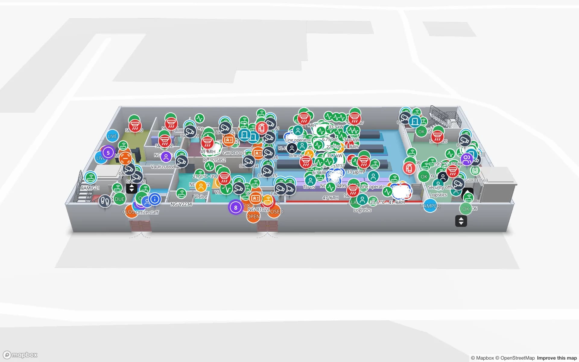
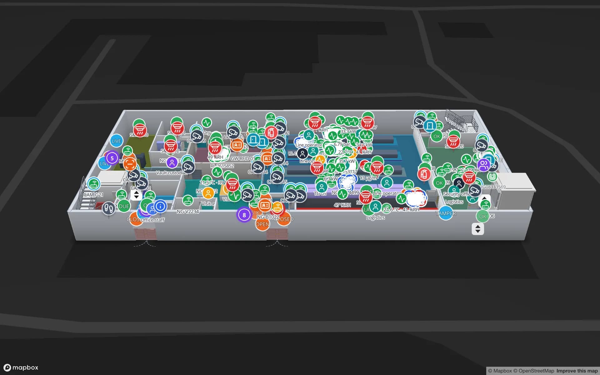
Summit Assembly Plant, a assembly plant demo, in the Spatial Map 3D viewer with live device markers
Summit Assembly Plant
Summit Assembly Plant, a demo plant: assembly lines, WIP carriers read between stations, tools and crews located on the shop floor, and 867 rack locations.
Rack locations in the Summit Assembly demo
867
RTLS vendor with a built-in driver: BlueIOT
1
German interface, one of six languages
Deutsch
Free trial, up to 5 facilities, no card
7 days

A region built on engineering

Region Stuttgart promotes automotive and engineering, mechanical and manufacturing engineering, energy and environmental engineering, IT and aerospace as its focus areas, and reports that companies in the region account for more than 10 percent of German companies’ R&D investment, according to regional summaries. The Port of Stuttgart on the Neckar connects the region to the inner German and western European waterway network, and Messe Stuttgart moved in 2007 from Killesberg to grounds directly next to the airport, beside the A8 motorway.

For location data that means plants with many small moving parts: tool trolleys, fixtures, test equipment, work-in-progress carriers and vehicles, often in older halls extended over decades. The Summit Assembly demo shows the pattern with WIP carriers read between stations and tools and crews located on the shop floor.
What Spatial Map does, and what the RTLS engine does

An RTLS has two halves. The first measures: anchors or gateways, tags, and an engine that turns signals into positions. The second makes the positions useful: which room, how long, what next to it, who has to know. Spatial Map is the second half.

Only one RTLS vendor, BlueIOT, has a built-in driver: connect its server from Integrations and tags move live on the map with the room they are in, room visits and dwell, and the vendor’s alarms mirrored as alerts. It runs in the cloud or through the sgv-edge agent, a small program on a PC in your network that only makes outbound HTTPS connections and buffers to disk when the line is down. Other engines, such as Sewio or Quuppa, connect through the table write API or REST polling. There is no MQTT input yet, and Spatial Map never computes positions from BLE signal strength itself. See device connections, RTLS and UWB and UWB anchors and tags.

Tools, carriers and AGVs on one plan

Start with the thing that must be found. Tool and fixture trolleys, small load carriers, AGVs and tuggers move on routes, and a map with the routes drawn shows where they queue. Draw the navigation graph as aisles; read the post on AMR and AGV navigation graphs. A heatmap of positions shows where vehicles and people cross; heat stops at walls and closed doors, so the picture follows the building.

If people carry tags, the works council has a say: introducing a system that could be used to monitor employees’ behaviour or performance typically triggers co-determination under BetrVG §87(1) no. 6, as described on our Germany page. This is not legal advice. Many plants tag assets only, and a map that shows rooms and dwell rather than named people is easier to agree on.

Services for teams in Stuttgart

Where Stuttgart teams usually start depends on the plant:

Also served nearby

The same approach covers Sindelfingen and Böblingen, Esslingen and Ludwigsburg, Reutlingen and Heilbronn, and the supplier plants of the Neckar valley. Nothing needs to be installed at any of them: the map opens in a browser.

How Spatial Map does it

From anchors to a plan people use

  1. 01

    Choose the question

    Where is the tool, the carrier or the vehicle? Where do routes queue? Start with one hall.

  2. 02

    Map the hall

    Upload the layout as PDF or DWG, let AI Map draft walls, doors and racks for review, and draw aisles and rooms.

  3. 03

    Connect the positions

    Use the BlueIOT driver, or post your engine’s positions to a table with the write API or a polled REST endpoint.

  4. 04

    Add rules and history

    In-app alerts for dwell, rooms and silent tags; the history player replays a shift on the map.

What Stuttgart teams locate

Tools and crews on the shop floor

Room-by-room location for tools, with dwell and last-seen times.

WIP carriers between stations

Carriers read at each station and shown by line.

Forklifts and yard vehicles

Vehicles on the dock and yard, with routes and queues.

Pickers and carts

Zone-level location of carts and crews in a warehouse.

See it on real demo facilities

Fictional names, real floor plans, live sensors, RFID, BLE tags and gateways — open any of them in the browser.

All 13 demo facilities

RTLS software in Stuttgart: questions we get

No. It does not measure or calculate positions. Anchors, tags and an engine do that. Spatial Map shows the positions on a 3D plan with rooms, dwell, alerts and history. It never computes positions from BLE signal strength itself.

One has a built-in driver: BlueIOT. Other engines, such as Sewio, Quuppa, Pozyx or Kontakt.io, connect through the table write API or REST polling, with your integrator or our team building the bridge as a client project. There is no MQTT input yet.

Not yet. Alerts appear in the app (the bell, a toast and the Alerts page) and can notify chosen roles or members there. There is no email, SMS or push.

Yes. The app has a German interface alongside English, French, Spanish, Arabic and Chinese, and each person picks their own. Names you type stay as written, umlauts included.

No. Spatial Map is sold online and our team works with customers in Germany remotely, by video call and through the contact form. There are no local resellers or partners.

In US dollars, the same worldwide: a 7-day free trial for up to 5 facilities with no card, then Pro at $60 a month or $600 a year for up to 4 facilities. Anchors and tags, if you ask us to source them, are quoted per project and are not part of the subscription.

See your RTLS positions on a plan people use.

Start the free trial and open the Summit Assembly demo, or send us the layout of one hall and tell us which RTLS engine you run through the contact form.






