
What is IMDF? The indoor mapping data format explained
The IMDF format explained: Apple’s GeoJSON indoor data model and OGC standard, its feature types, how indoor maps reach Apple Maps, and when you need it.

What is the IMDF format?
The IMDF format — Indoor Mapping Data Format — is a data model for describing the inside of a building: its levels, rooms, doors, amenities and the businesses in it. Apple created it for indoor maps in Apple Maps and its developer frameworks. It is built on GeoJSON, and in February 2021 the Open Geospatial Consortium (OGC) approved it as an OGC Community Standard (version 1.0.0, document 20-094), which means it was adopted as a mature format developed outside OGC’s own process.
Spatial Map is a browser-based indoor mapping platform for operations — warehouses, stores, venues, campuses — with live data on multi-floor 3D maps. Spatial Map does not export or import IMDF. We explain the format here because it comes up in almost every indoor mapping project, and because it helps to know when you need it and when you don’t.
How an IMDF dataset is structured
IMDF data is an archive of GeoJSON files (RFC 7946), each holding one feature type, plus a manifest that names the version and language. Features refer to each other by ID: a unit belongs to a level, a level to a building, an opening sits on a unit’s edge. Coordinates are plain longitude and latitude, so the data is georeferenced by definition.
| Feature type | What it describes |
|---|---|
| Venue | The whole place: an airport, a shopping centre, a campus, with its category and address |
| Building and Footprint | Each building in the venue, and its outline on the ground |
| Level | One floor of a building, with an ordinal that puts the floors in vertical order |
| Unit | A space on a level: a room, a walkway, a lift, a staircase, a restroom |
| Opening | A door or entrance, drawn as a line on a unit’s boundary |
| Fixture | Something fixed that blocks or fills space, such as a counter or a shelf block |
| Section and Geofence | Named sub-areas of a level, and virtual areas used for things like notifications |
| Kiosk | A stand or booth in a common area |
| Amenity | A point of interest: toilets, ATMs, information desks |
| Occupant and Anchor | A business in the venue, and the point that ties it to a unit |
| Address | Postal addresses referenced by venues, buildings and anchors |
| Detail | Extra linework for drawing, such as floor markings |
| Relationship | Links between features, for example how a staircase connects two levels |
Each type has a fixed list of categories (a unit can be a “room”, “restroom”, “elevator” and so on), which is what lets an app show the right icon and route through the right spaces without knowing the building in advance.
How indoor maps reach Apple Maps
Indoor maps get into Apple Maps through Apple’s indoor maps programme, run through Apple Business Register (register.apple.com). Apple’s own pages describe the process like this:
- 1Register the organisation
The organisation that owns or operates the venue sets up an account. Apple says the published maps are always based on data it receives from that account.
- 2Convert the floor plans to IMDF
Produce an IMDF dataset of the venue, correctly georeferenced, and upload it. Many teams use a mapping vendor or GIS tools for this step.
- 3Survey the building
For Apple’s indoor positioning, walk the venue with Apple’s Indoor Survey app on an iPhone to record its radio-frequency patterns.
- 4Authorise display
For an eligible location, the organisation can authorise Apple to show the floor plans in Apple Maps. Only publicly accessible areas are shown.
When IMDF matters — and when it doesn’t
IMDF was designed for one job: helping members of the public find their way around a public venue on a phone. It is very good at that. It is the wrong shape for most operational work, because the things operations teams care about — rack locations, bins, tagged assets, sensors, staff-only areas — are either missing from the model or deliberately left out of Apple Maps.
| Situation | Do you need IMDF? |
|---|---|
| You run an airport or a large shopping centre and want it in Apple Maps | Yes — it is the format Apple accepts |
| You build an iOS app that shows a venue’s indoor map with Apple’s frameworks | Very likely |
| A tender asks for indoor data in an open, documented format | Possibly; IMDF is one option, alongside plain GeoJSON or OGC IndoorGML |
| You want live stock by rack, sensor readings by room or tag positions | No — you need an operations map |
| Warehouses, factories, data centres, back-of-house | No — private spaces are not eligible for Apple Maps anyway |
| Staff wayfinding inside your own buildings | Not necessarily; any indoor map with routing does the job |
Many venues end up with both: an IMDF dataset maintained for the public-facing map, and an operations map for the people running the building. They can share the same source floor plans and room numbers. The wider picture — floor plans, BIM, IMDF and indoor maps — is in indoor map vs floor plan vs BIM.
Spatial Map and IMDF
To be plain about it: Spatial Map has no IMDF export and no IMDF import today, and it does not publish maps to Apple Maps. If Apple Maps is your goal, you need an IMDF-capable tool or service.
What Spatial Map does is the operations side. You import PDF or DWG floor plans, AI Map drafts walls, doors, racks, areas, stairs and lifts for you to review, and the result is a multi-floor 3D map — levels, rooms, doors and vertical connectors, conceptually close to IMDF’s levels, units, openings and relationships — with live data, alerts, reports and multi-floor wayfinding on top. Visitors can open read-only share links in any browser; there is no app to install.
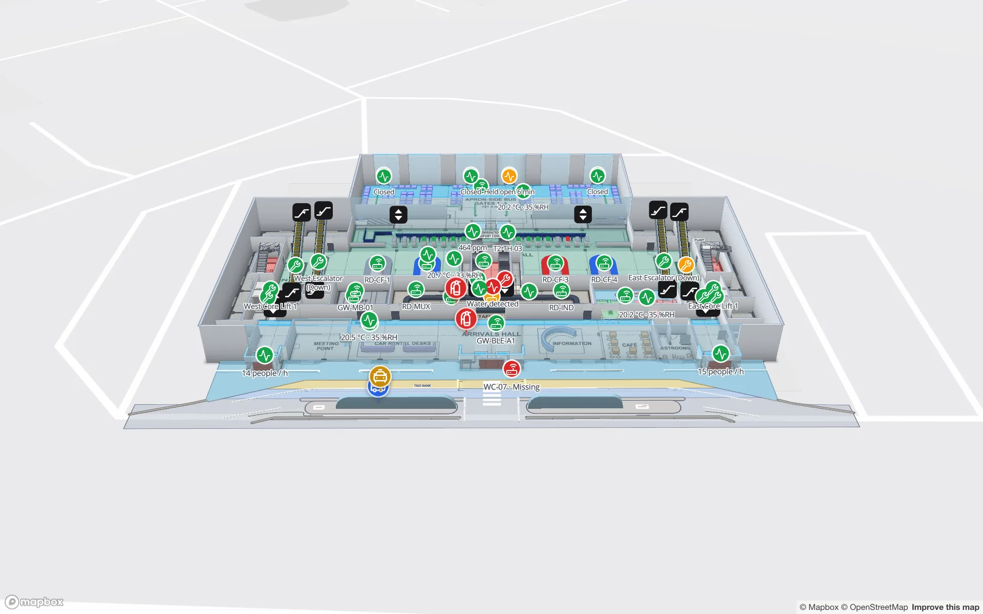

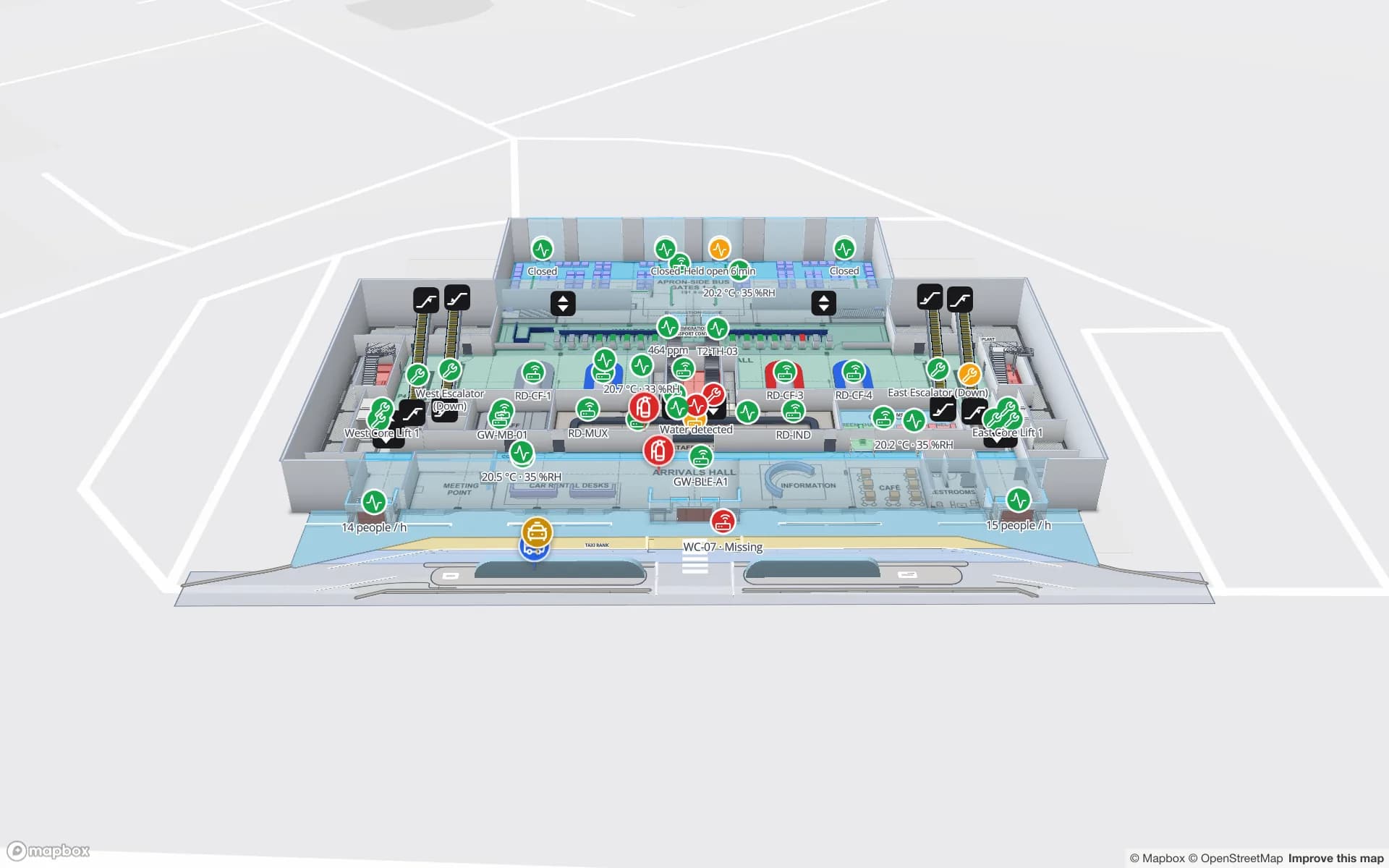
The Silverbay airport demo shows what that looks like for a terminal: throughput at security, departures by gate and crowding by zone — the operational picture that sits behind the public map. For the airport and mall wayfinding question specifically, see wayfinding for airports and malls, and for the basics, what is indoor mapping.
Try the platform your data belongs on.
Spatial Map turns spreadsheets, sensor streams, and CAD drawings into one live 3D facility view — nothing to install, seven-day free trial.
Keep reading
- Deep-diveAzure Maps Creator is retired: what it means and your optionsMicrosoft retired Azure Maps Creator on 30 September 2025 and deleted its indoor data. What Creator did, what you can still rebuild from, and how to choose where to move.
- Deep-diveHow accurate are BLE beacons? Four methods, and why results varyFrom room-level to sub-metre: BLE accuracy depends on the method, the building and the update rate. The four methods, what affects them and seven questions for vendors.
- Deep-diveDoes GPS work indoors? Why it fails and what works insteadGPS barely works inside buildings: the signals are too weak and bounce off everything. Here is why, how indoor positioning options compare, and why each one still needs an indoor map.