
How to convert a PDF floor plan to a 3D map of a commercial building
Convert a PDF floor plan to 3D for a warehouse, office or venue: scale from the sheet size, clean the plan, align it, extrude walls and racks, stack the floors.


Convert a PDF floor plan to 3D — for real buildings
This guide shows how to convert a PDF floor plan to 3D for a commercial building — a warehouse, an office, a store, a venue — so the result is a working map at true scale, not a rendering. Spatial Map is a browser-based indoor mapping platform that does this: it places the PDF sheet at real-world size on a map, drafts walls, doors and racks with AI for you to review, and stacks the floors in 3D. The principles apply whatever tool you use.
One honest line first: if you are furnishing a flat or planning a kitchen, a home 3D floor-plan app is the better tool. This guide is for buildings where the 3D model has to carry rooms, racks, routes and live data.
Step 1: get the scale from the sheet size
A PDF page has an exact size, measured in points (1/72 inch), so software can tell an A1 sheet from an ARCH D sheet. What it does not record is the drawing scale. Multiply the paper size by the scale denominator and you get the ground area the sheet covers:
| Sheet | Paper size | At 1:100 | At 1:200 |
|---|---|---|---|
| A3 | 420 × 297 mm | 42.0 × 29.7 m | 84.0 × 59.4 m |
| A1 | 841 × 594 mm | 84.1 × 59.4 m | 168.2 × 118.8 m |
| A0 | 1189 × 841 mm | 118.9 × 84.1 m | 237.8 × 168.2 m |
| ARCH D | 36 × 24 in | 91.4 × 61.0 m | 182.9 × 121.9 m |
| ANSI D | 34 × 22 in | 86.4 × 55.9 m | 172.7 × 111.8 m |
Always check one dimension you trust: a column grid spacing, a dock door width, the length of the building from a site plan or a laser measure on site. A plan marked NTS (not to scale) has to be scaled this way.
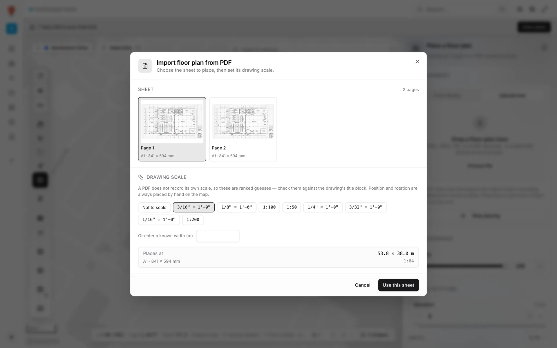
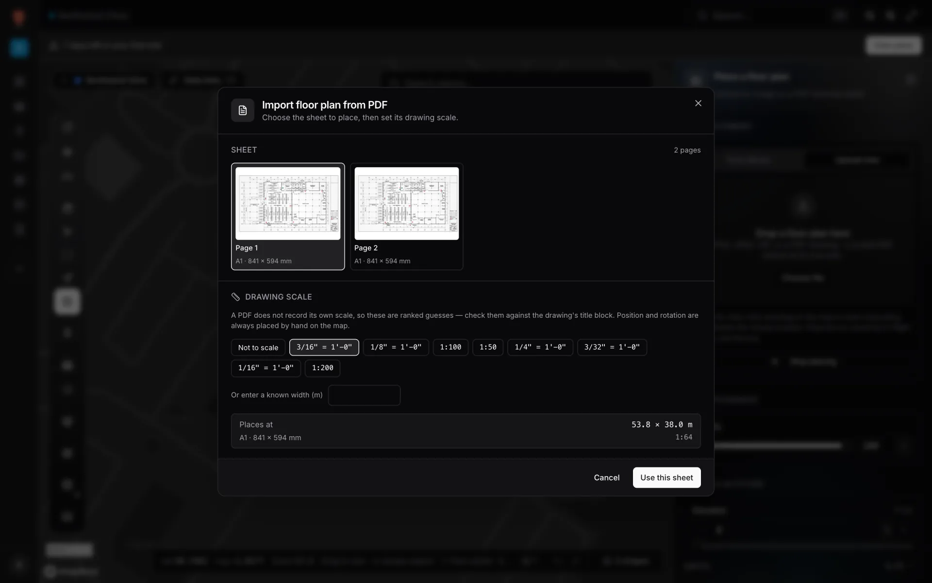
In Spatial Map the PDF import dialog does the arithmetic: it shows a thumbnail per page with its recognised paper size (17 ISO, ANSI and ARCH sizes), offers ranked scale chips such as 1:100 or 1/8" = 1', and shows the real-world size the sheet will be placed at. If the scale is unknown, type the real width the whole sheet covers in metres. Details are in the PDF and DWG import guide.
Step 2: clean the plan before and after import
Architectural PDFs carry far more than a 3D map needs: title blocks, dimension strings, hatching, furniture, grid bubbles, revision clouds. They make the plan harder to read and harder to trace, by a person or by AI.
- Pick the right sheet. You want the general arrangement plan of each level, not the reflected ceiling plan, the fire strategy or the furniture layout.
- Prefer vector PDFs. A PDF exported from CAD stays sharp at any zoom; a scanned PDF is just a photo inside a PDF and needs the treatment for paper plans.
- Turn off what you can upstream. Some PDFs keep CAD layers you can hide in a PDF viewer before re-exporting. If you have the DWG, import that instead and untick furniture and annotation layers.
- Trim the margin on the map. Spatial Map’s non-destructive Crop removes title blocks, and Hide outside walls hides everything beyond the outer walls once you have drawn them.
Step 3: align the sheet to the site
With the scale fixed, the plan has the right size but not the right place. Fly the map to the address, drag to drop the sheet, lower its Opacity until the street map shows through, and rotate it (slider, or [ and ], Shift for 15° steps) until the outer walls sit on the building outline. Nudge with the arrow keys, 0.5 m at a time. Don’t trust the north arrow on the sheet: align to the building itself.
Step 4: turn lines into 3D — walls, rooms and racks
A placed PDF is still a flat picture. It becomes 3D when shapes are drawn on it and given heights. Start with an AI draft: Spatial Map’s AI Map reads the aligned sheet and drafts walls, doors, racks, labels, areas, stairs, lifts and escalators, for the whole floor or one part of it. You review the drafts on the map and add them all or kind by kind. It drafts; you check. More in AI floor plan mapping.
| What | How it becomes 3D |
|---|---|
| Walls | Aisle tool lines with a Wall height and thickness; or Magic walls around rooms you have drawn |
| Rooms and zones | Areas with a Height become prisms; with 0 they stay flat fills |
| Doors | The Door tool snaps to a wall and cuts the opening that routes walk through |
| Racks | Rows × columns of bins, with Levels, Level height (1.5 m by default) and Level gap for pallet racking |
| Stairs, lifts, escalators | Their own tools, so routes can change floor |
| Equipment | GLB 3D models placed where they help, such as a conveyor or a forklift |
Step 5: stack the floors
- 1Import one sheet per level
Same scale check every time: drawing sets often mix 1:100 and 1:200 sheets.
- 2Place them at the same spot
Use a fixed element as the reference — a stair core, a lift shaft or a column grid line — rather than the outer wall, which often changes between floors.
- 3Set each elevation
Ground floor at 0, the next at its storey height, under 3D & Altitude → Elevation (PgUp and PgDn move 0.5 m).
- 4Connect them
Draw stairs, lifts and escalators on every floor they serve, then test a route between floors to prove they connect.
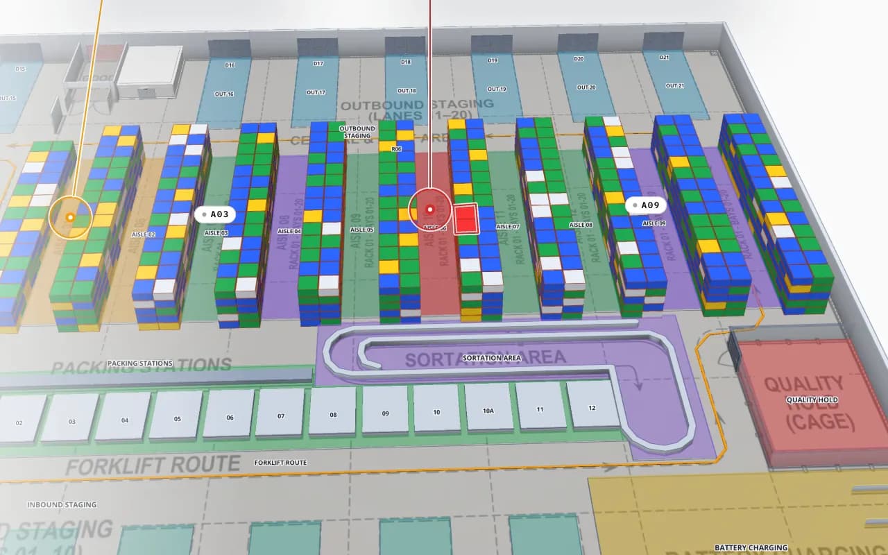
The result is one building in 3D that you can tilt, orbit and read one floor at a time, with the same scale and alignment on every level. See 3D indoor map for what the finished viewer does.
From 3D to a working map
A 3D building earns its keep when data lands on it: stock by rack, sensors by room, tag positions, alerts. Name rooms and racks with the codes your systems already use, then link a table or REST source to them. The full path from any floor plan file is on floor plan to indoor map; if you start from a DWG rather than a PDF, read CAD floor plan to 3D map. Spatial Map’s free trial runs 7 days, up to 5 facilities, no card.
Try the platform your data belongs on.
Spatial Map turns spreadsheets, sensor streams, and CAD drawings into one live 3D facility view — nothing to install, seven-day free trial.
Keep reading
- TutorialBLE gateway for asset tracking: placement, backhaul, MQTT and the mapGateways are where BLE tracking succeeds or fails. How to place them, connect them, turn their MQTT or HTTP messages into zones, and write the result to a live floor plan.
- TutorialHow to digitize a paper floor plan: scan, scale, traceFrom an old blueprint or a photo of an evacuation plan to a usable digital plan: capture, perspective correction, scale, the CAD question, and the step to an indoor map.
- TutorialHow to georeference a floor plan: control points, rotation and scalePinning a floor plan to real-world coordinates takes four numbers: position, rotation and scale. How to choose control points, what not to trust, and how to spot the usual errors.